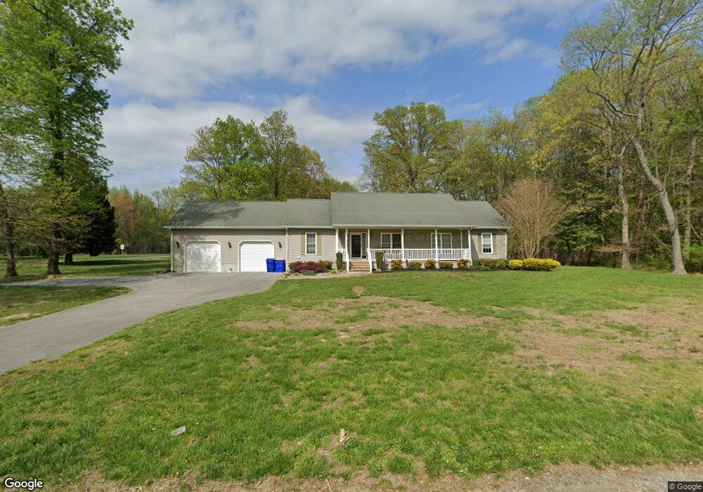
29 Brockam Bridge Rd Milford, DE 19963
Estimated Value: $397,812 - $429,000
3
Beds
2
Baths
1,712
Sq Ft
$244/Sq Ft
Est. Value
About This Home
This home is located at 29 Brockam Bridge Rd, Milford, DE 19963 and is currently estimated at $417,203, approximately $243 per square foot. 29 Brockam Bridge Rd is a home with nearby schools including Benjamin Banneker Elementary School, Milford Central Academy, and Milford Senior High School.
Ownership History
Date
Name
Owned For
Owner Type
Purchase Details
Closed on
Mar 31, 2011
Sold by
Pepka Brenda A
Bought by
Pepka Gerald A and Pepka Brenda A
Current Estimated Value
Home Financials for this Owner
Home Financials are based on the most recent Mortgage that was taken out on this home.
Original Mortgage
$224,375
Interest Rate
5.04%
Mortgage Type
Construction
Purchase Details
Closed on
Apr 28, 2009
Sold by
Sullivan Laura M
Bought by
Sullivan Laura M and Sullivan John H
Create a Home Valuation Report for This Property
The Home Valuation Report is an in-depth analysis detailing your home's value as well as a comparison with similar homes in the area
Home Values in the Area
Average Home Value in this Area
Purchase History
| Date | Buyer | Sale Price | Title Company |
|---|---|---|---|
| Pepka Gerald A | -- | None Available | |
| Sullivan Laura M | -- | None Available |
Source: Public Records
Mortgage History
| Date | Status | Borrower | Loan Amount |
|---|---|---|---|
| Closed | Pepka Gerald A | $224,375 |
Source: Public Records
Tax History Compared to Growth
Tax History
| Year | Tax Paid | Tax Assessment Tax Assessment Total Assessment is a certain percentage of the fair market value that is determined by local assessors to be the total taxable value of land and additions on the property. | Land | Improvement |
|---|---|---|---|---|
| 2025 | $818 | $346,000 | $101,000 | $245,000 |
| 2024 | $818 | $346,000 | $101,000 | $245,000 |
| 2023 | $752 | $52,900 | $9,700 | $43,200 |
| 2022 | $722 | $52,900 | $9,700 | $43,200 |
| 2021 | $782 | $52,900 | $9,700 | $43,200 |
| 2020 | $791 | $52,900 | $9,700 | $43,200 |
| 2019 | $797 | $52,900 | $9,700 | $43,200 |
| 2018 | $1,201 | $52,900 | $9,700 | $43,200 |
| 2017 | $1,213 | $52,900 | $0 | $0 |
| 2016 | $1,287 | $52,900 | $0 | $0 |
| 2015 | $942 | $52,900 | $0 | $0 |
| 2014 | $923 | $52,900 | $0 | $0 |
Source: Public Records
Map
Nearby Homes
- Lot Whitwell Delight Rd
- 4404 & 4398 S Bowers Rd
- 4404 S Bowers Rd
- 4398 S Bowers Rd
- 4376 S Bowers Rd
- 74 Murderkill Ave
- 66 Wyatt St
- 440 Log Cabin Rd
- 45 Wyatt St
- 46 Hubbard Ave
- 237 Thompsonville Rd
- 218 Williams Ave
- 200 Williams Ave
- 3520 Main St
- 17 N Flack Ave
- 626 Milford Neck Rd
- 65 N Bayshore Dr
- 607 Milford Neck Rd
- Lot 17B N Flack Ave
- Lot 4A N Flack Ave
- 1234 S Bowers Rd
- 1426 S Bowers Rd
- 1235 S Bowers Rd
- 1215 S Bowers Rd
- 1322 S Bowers Rd
- 1167 S Bowers Rd
- 1184 S Bowers Rd
- 220 Brockam Bridge Rd
- 1742 Mosley Rd
- 1032 S Bowers Rd
- 1652 Mosley Rd
- 973 S Bowers Rd
- 973 S Bowers Rd
- 1744 S Bowers Rd
- 779 Mosley Rd
- 853 S Bowers Rd
- 800 S Bowers Rd
- 797 S Bowers Rd
- 716 S Bowers Rd
- 2 S Bowers Rd