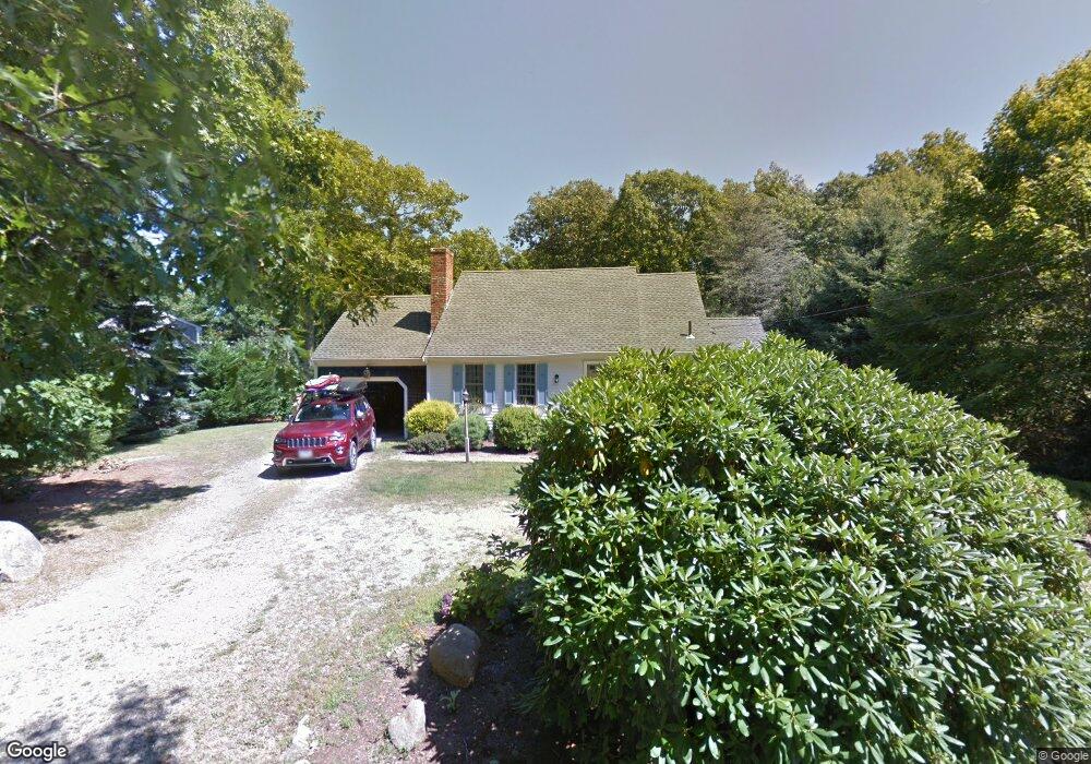
29 Captain Curtis Way Orleans, MA 02653
Estimated Value: $1,077,000 - $1,388,510
3
Beds
2
Baths
2,660
Sq Ft
$464/Sq Ft
Est. Value
About This Home
This home is located at 29 Captain Curtis Way, Orleans, MA 02653 and is currently estimated at $1,233,378, approximately $463 per square foot. 29 Captain Curtis Way is a home located in Barnstable County with nearby schools including Orleans Elementary School, Nauset Regional Middle School, and Nauset Regional High School.
Ownership History
Date
Name
Owned For
Owner Type
Purchase Details
Closed on
Jul 2, 2018
Sold by
Truesdale William H and Truesdale Marcie M
Bought by
Sweeney Timothy J and Sweeney Laurel A
Current Estimated Value
Home Financials for this Owner
Home Financials are based on the most recent Mortgage that was taken out on this home.
Original Mortgage
$480,000
Outstanding Balance
$416,911
Interest Rate
4.6%
Mortgage Type
Unknown
Estimated Equity
$816,467
Purchase Details
Closed on
Oct 30, 2008
Sold by
Ellen M Hamlin T
Bought by
Truesdale Marcie M and Truesdale William Hardie
Create a Home Valuation Report for This Property
The Home Valuation Report is an in-depth analysis detailing your home's value as well as a comparison with similar homes in the area
Home Values in the Area
Average Home Value in this Area
Purchase History
| Date | Buyer | Sale Price | Title Company |
|---|---|---|---|
| Sweeney Timothy J | $600,000 | -- | |
| Truesdale Marcie M | $431,500 | -- |
Source: Public Records
Mortgage History
| Date | Status | Borrower | Loan Amount |
|---|---|---|---|
| Open | Sweeney Timothy J | $480,000 |
Source: Public Records
Tax History Compared to Growth
Tax History
| Year | Tax Paid | Tax Assessment Tax Assessment Total Assessment is a certain percentage of the fair market value that is determined by local assessors to be the total taxable value of land and additions on the property. | Land | Improvement |
|---|---|---|---|---|
| 2025 | $7,207 | $1,154,900 | $289,700 | $865,200 |
| 2024 | $6,748 | $1,052,800 | $283,900 | $768,900 |
| 2023 | $4,768 | $765,400 | $262,900 | $502,500 |
| 2022 | $4,468 | $620,500 | $239,000 | $381,500 |
| 2021 | $4,307 | $549,300 | $231,000 | $318,300 |
| 2020 | $4,246 | $561,700 | $241,500 | $320,200 |
| 2019 | $3,819 | $516,100 | $214,300 | $301,800 |
| 2018 | $3,239 | $488,600 | $210,200 | $278,400 |
| 2017 | $3,033 | $479,100 | $210,200 | $268,900 |
| 2016 | $3,049 | $472,000 | $208,500 | $263,500 |
| 2015 | $2,914 | $453,900 | $194,600 | $259,300 |
Source: Public Records
Map
Nearby Homes
- 3 Bramblewood Ln
- 2 Little Cove Ln
- 53 Great Oak Rd
- 2 Seaview Rd
- 18 Cole Place
- 216 Main St
- 6 Snow Way
- 320 State Hwy
- 3 Country Crossing
- 150 Old State Hwy Unit Compound
- 20 Kittiwake Ln
- 46 Freeman Ln
- 110 Beach Rd
- 7 Brick Hill Ext Rd
- 7 Brick Hill Rd
- 785 State Hwy Unit 9
- 25 Twin Rocks Dr
- 993 Intonti Way
- 995 Intonti Way
- 30 Cove Rd
- 35 Captain Curtis Way
- 25 Captain Curtis Way
- 30 Captain Curtis Way
- 77 Captain Curtis Way
- 39 Captain Curtis Way
- 26 Captain Curtis Way
- 34 Capt Curtis Way
- 34 Captain Curtis Way
- 75 Captain Curtis Way
- 36 Captain Curtis Way
- 24 Captain Curtis Way
- 23 Captain Curtis Way
- 80 Capt Curtis Way
- 41 Captain Curtis Way
- 49 Pine Needle Way
- 85 Capt Curtis Way
- 85 Pineneedle Way
- 79 Capt Curtis Way
- 71 Captain Curtis Way
- 10 Sand Hill Ln