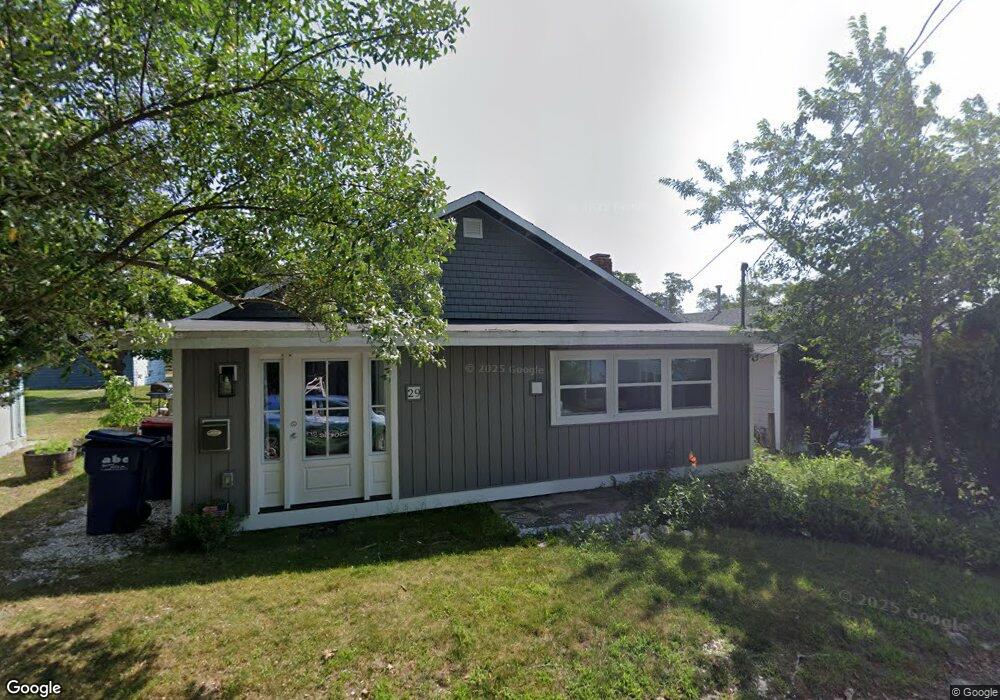
29 Circuit Ave Wareham, MA 02571
Wareham Center NeighborhoodEstimated Value: $368,000 - $498,000
2
Beds
1
Bath
1,086
Sq Ft
$383/Sq Ft
Est. Value
About This Home
This home is located at 29 Circuit Ave, Wareham, MA 02571 and is currently estimated at $415,977, approximately $383 per square foot. 29 Circuit Ave is a home located in Plymouth County.
Ownership History
Date
Name
Owned For
Owner Type
Purchase Details
Closed on
May 13, 2022
Sold by
Murphy Roland and Murphy Kathy
Bought by
Skymaster Lt and Murphy
Current Estimated Value
Purchase Details
Closed on
Jan 29, 2016
Sold by
Offen Kathleen K and Gately Carol A
Bought by
Offen 3Rd R Lansing and Offen Kathleen K
Purchase Details
Closed on
Jan 6, 2016
Sold by
Offen Kathleen K and Gately Carol A
Bought by
Offen 3Rd R Lansing and Gately Carol A
Purchase Details
Closed on
Sep 16, 2005
Sold by
Murphy Roland and Drews Judith L
Bought by
Murphy Roland and Murphy Kathy
Create a Home Valuation Report for This Property
The Home Valuation Report is an in-depth analysis detailing your home's value as well as a comparison with similar homes in the area
Home Values in the Area
Average Home Value in this Area
Purchase History
| Date | Buyer | Sale Price | Title Company |
|---|---|---|---|
| Skymaster Lt | -- | None Available | |
| Skymaster Lt | -- | None Available | |
| Offen 3Rd R Lansing | -- | -- | |
| Offen 3Rd R Lansing | -- | -- | |
| Offen 3Rd R Lansing | -- | -- | |
| Offen 3Rd R Lansing | -- | -- | |
| Murphy Roland | $146,600 | -- | |
| Murphy Roland | $146,600 | -- |
Source: Public Records
Tax History
| Year | Tax Paid | Tax Assessment Tax Assessment Total Assessment is a certain percentage of the fair market value that is determined by local assessors to be the total taxable value of land and additions on the property. | Land | Improvement |
|---|---|---|---|---|
| 2025 | $3,657 | $351,000 | $134,300 | $216,700 |
| 2024 | $3,553 | $316,400 | $103,600 | $212,800 |
| 2023 | $3,252 | $283,800 | $94,100 | $189,700 |
| 2022 | $3,252 | $246,700 | $94,100 | $152,600 |
| 2021 | $3,225 | $239,800 | $94,100 | $145,700 |
| 2020 | $3,026 | $228,200 | $94,100 | $134,100 |
| 2019 | $2,724 | $205,000 | $78,800 | $126,200 |
| 2018 | $2,582 | $189,400 | $78,800 | $110,600 |
| 2017 | $2,262 | $168,200 | $78,800 | $89,400 |
| 2016 | $2,063 | $152,500 | $75,100 | $77,400 |
| 2015 | $1,993 | $152,500 | $75,100 | $77,400 |
| 2014 | $1,917 | $149,200 | $71,300 | $77,900 |
Source: Public Records
Map
Nearby Homes
- 15 Broadmarsh Ave
- 6 Allen Ave
- 20 Grant St
- 43 Shore Ave
- 4 Mather Dr
- 6 Wildwood Ave
- 21 Bayview St
- 10 Oak St
- 10 Barnes St
- 12 Oakdale St
- 10 Longmeadow Dr
- 6 Bourne Terrace
- 58 Shady Ln
- 233 Marion Rd
- 437 Main St
- 110 Mayflower Ridge Dr
- 9 Woodville Way
- 0 Cromesett Rd (Off) Unit 73385395
- 15 14th Ave
- 2645 Cranberry Hwy Unit A
- 27 Circuit Ave
- 31 Circuit Ave
- 25 Circuit Ave
- 61 Circuit Ave
- 23 Circuit Ave
- 23 Circuit Ave
- 23 Circuit Ave Unit 23
- 33 Circuit Ave
- 33 Circuit Ave Unit 1
- 30 Circuit Ave
- 82 Circuit Ave
- 28 Circuit Ave
- 21 Circuit Ave
- 32 Circuit Ave
- 65 Circuit Ave
- 24 Circuit Ave
- 35 Circuit Ave
- 20 Circuit Ave
- 88 Circuit Ave
- 88 Circuit Ave Unit A
Your Personal Tour Guide
Ask me questions while you tour the home.