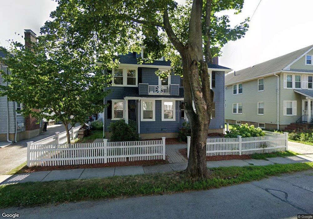
29 Dalton Rd Unit 31 Belmont, MA 02478
Cushing Square NeighborhoodEstimated Value: $950,000 - $2,053,979
8
Beds
3
Baths
3,497
Sq Ft
$453/Sq Ft
Est. Value
About This Home
This home is located at 29 Dalton Rd Unit 31, Belmont, MA 02478 and is currently estimated at $1,585,495, approximately $453 per square foot. 29 Dalton Rd Unit 31 is a home located in Middlesex County with nearby schools including Roger Wellington Elementary School, Winthrop L Chenery Middle School, and Belmont High School.
Ownership History
Date
Name
Owned For
Owner Type
Purchase Details
Closed on
Jul 10, 2020
Sold by
Carifio Susan N and Green Elizabeth C
Bought by
Carifio Susan N and Green Elizabeth C
Current Estimated Value
Purchase Details
Closed on
May 3, 2018
Sold by
Susan N Carifio Ret 20
Bought by
Carifio Susan N and Green Elizabeth C
Purchase Details
Closed on
Mar 30, 2018
Sold by
Susan N Carifio Ret 20
Bought by
Green Elizabeth C
Purchase Details
Closed on
Jun 3, 2013
Sold by
Carifio Susan N
Bought by
Susan N Carifio Ret and Carifio Susan N
Purchase Details
Closed on
Jun 22, 2010
Sold by
Clair Dennis B and Clair Karen K
Bought by
Carifio Susan N
Home Financials for this Owner
Home Financials are based on the most recent Mortgage that was taken out on this home.
Original Mortgage
$400,000
Interest Rate
5.03%
Mortgage Type
Purchase Money Mortgage
Purchase Details
Closed on
Dec 23, 2005
Sold by
King David C
Bought by
Clair Dennis B and Clair Karen K
Home Financials for this Owner
Home Financials are based on the most recent Mortgage that was taken out on this home.
Original Mortgage
$310,000
Interest Rate
6.36%
Mortgage Type
Purchase Money Mortgage
Purchase Details
Closed on
Aug 13, 1999
Sold by
Mclaughlin Genevieve C
Bought by
King David C
Create a Home Valuation Report for This Property
The Home Valuation Report is an in-depth analysis detailing your home's value as well as a comparison with similar homes in the area
Home Values in the Area
Average Home Value in this Area
Purchase History
| Date | Buyer | Sale Price | Title Company |
|---|---|---|---|
| Carifio Susan N | -- | None Available | |
| Carifio Susan N | -- | -- | |
| Green Elizabeth C | -- | -- | |
| Susan N Carifio Ret | -- | -- | |
| Carifio Susan N | $696,667 | -- | |
| Clair Dennis B | $729,000 | -- | |
| King David C | $413,300 | -- |
Source: Public Records
Mortgage History
| Date | Status | Borrower | Loan Amount |
|---|---|---|---|
| Previous Owner | King David C | $75,000 | |
| Previous Owner | King David C | $50,000 | |
| Previous Owner | Carifio Susan N | $400,000 | |
| Previous Owner | Clair Dennis B | $310,000 | |
| Previous Owner | King David C | $384,400 |
Source: Public Records
Tax History Compared to Growth
Tax History
| Year | Tax Paid | Tax Assessment Tax Assessment Total Assessment is a certain percentage of the fair market value that is determined by local assessors to be the total taxable value of land and additions on the property. | Land | Improvement |
|---|---|---|---|---|
| 2025 | $21,447 | $1,883,000 | $808,000 | $1,075,000 |
| 2024 | $17,561 | $1,663,000 | $936,000 | $727,000 |
| 2023 | $17,703 | $1,575,000 | $884,000 | $691,000 |
| 2022 | $15,083 | $1,484,000 | $808,000 | $676,000 |
| 2021 | $15,083 | $1,307,000 | $800,000 | $507,000 |
| 2020 | $15,928 | $1,448,000 | $822,000 | $626,000 |
| 2019 | $11,250 | $964,000 | $570,000 | $394,000 |
| 2018 | $11,008 | $906,000 | $518,000 | $388,000 |
| 2017 | $10,951 | $863,000 | $475,000 | $388,000 |
| 2016 | $10,802 | $860,000 | $475,000 | $385,000 |
| 2015 | $9,107 | $706,000 | $373,000 | $333,000 |
Source: Public Records
Map
Nearby Homes
- 73 Foster Rd Unit 2
- 276 Belmont St Unit 1
- 147 Langdon Ave Unit 149
- 30 Unity Ave Unit 30
- 10 Marlboro St Unit 1
- 133 Hillside Rd
- 163 Belmont St
- 56-58 Edgecliff Rd
- 87 Templeton Pkwy Unit 3
- 16 Ericsson St
- 81 Winsor Ave
- 172 Maplewood St
- 161 Cushing St
- 43 Irma Ave Unit 43
- 95 Cushing St
- 1 Clayton St
- 25 Francis St Unit 2
- 25 Francis St Unit 1
- 66 Holworthy St
- 36 Madison St
- 31 Dalton Rd Unit 2
- 29-31 Dalton Rd
- 35 Dalton Rd Unit 1
- 35 Dalton Rd Unit 37
- 27 Dalton Rd Unit 27
- 25 Dalton Rd Unit 27
- 25 Dalton Rd Unit 25
- 19 Dalton Rd Unit 21
- 41 Dalton Rd Unit 43
- 30 Dalton Rd Unit 32
- 32 Dalton Rd Unit 32
- 34 Dalton Rd Unit 36
- 34 Dalton Rd Unit 1
- 38 Dalton Rd Unit 40
- 17 Dalton Rd Unit 2
- 17 Dalton Rd
- 51 Foster Rd Unit 53
- 51 Foster Rd Unit 51
- 59 Foster Rd Unit 61
- 59 Foster Rd Unit 61