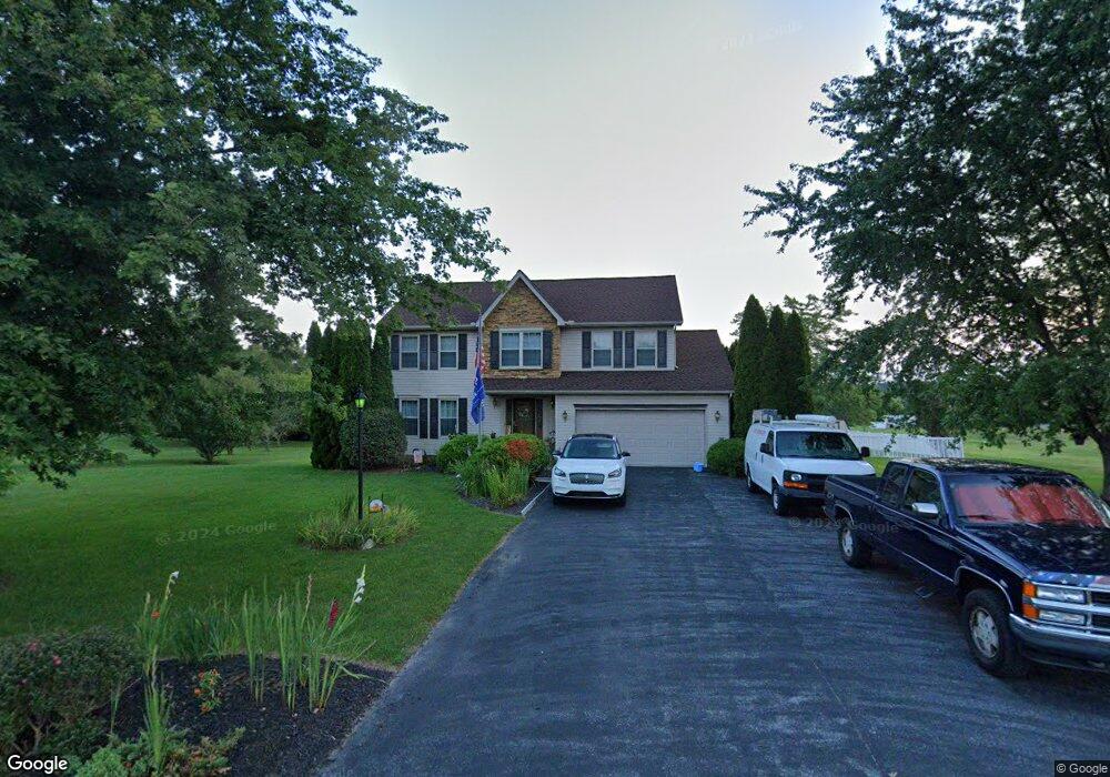
29 E Summit Dr Unit 4 Littlestown, PA 17340
Estimated Value: $438,187 - $517,000
4
Beds
3
Baths
2,134
Sq Ft
$226/Sq Ft
Est. Value
About This Home
This home is located at 29 E Summit Dr Unit 4, Littlestown, PA 17340 and is currently estimated at $482,297, approximately $226 per square foot. 29 E Summit Dr Unit 4 is a home located in Adams County with nearby schools including Rolling Acres El School, Maple Avenue Middle School, and Littlestown Senior High School.
Ownership History
Date
Name
Owned For
Owner Type
Purchase Details
Closed on
Sep 26, 2011
Sold by
Cashman Mark E and Cashman Bobbie J
Bought by
Cashman Mark E and Cashman Bobbie J
Current Estimated Value
Home Financials for this Owner
Home Financials are based on the most recent Mortgage that was taken out on this home.
Original Mortgage
$164,000
Outstanding Balance
$14,878
Interest Rate
3.44%
Mortgage Type
New Conventional
Estimated Equity
$467,419
Create a Home Valuation Report for This Property
The Home Valuation Report is an in-depth analysis detailing your home's value as well as a comparison with similar homes in the area
Home Values in the Area
Average Home Value in this Area
Purchase History
| Date | Buyer | Sale Price | Title Company |
|---|---|---|---|
| Cashman Mark E | -- | None Available |
Source: Public Records
Mortgage History
| Date | Status | Borrower | Loan Amount |
|---|---|---|---|
| Open | Cashman Mark E | $164,000 |
Source: Public Records
Tax History
| Year | Tax Paid | Tax Assessment Tax Assessment Total Assessment is a certain percentage of the fair market value that is determined by local assessors to be the total taxable value of land and additions on the property. | Land | Improvement |
|---|---|---|---|---|
| 2025 | $5,330 | $281,600 | $78,600 | $203,000 |
| 2024 | $5,123 | $281,600 | $78,600 | $203,000 |
| 2023 | $4,994 | $281,600 | $78,600 | $203,000 |
| 2022 | $4,958 | $281,600 | $78,600 | $203,000 |
| 2021 | $4,776 | $281,300 | $78,600 | $202,700 |
| 2020 | $4,707 | $281,300 | $78,600 | $202,700 |
| 2019 | $4,607 | $281,300 | $78,600 | $202,700 |
| 2018 | $4,469 | $281,300 | $78,600 | $202,700 |
| 2017 | $4,330 | $281,300 | $78,600 | $202,700 |
| 2016 | -- | $281,300 | $78,600 | $202,700 |
| 2015 | -- | $281,300 | $78,600 | $202,700 |
| 2014 | -- | $281,300 | $78,600 | $202,700 |
Source: Public Records
Map
Nearby Homes
- 484 S Columbus Ave Unit 19
- 17 Mason Dixon Dr Unit 84
- 5130 Littlestown Pike
- 230 M St
- 316 Mathias Rd Unit 4
- LOT 9 Mehring Rd
- 311 S Columbus Ave Unit 128
- 2100 Blacks School House Rd
- 535 Lumber St
- 559 Lumber St
- 567 Lumber St
- 15 Yorktowne Ct Unit 97
- 161 Cemetery St
- 11 Yorktowne Ct Unit 96
- 117 Charles St
- 115 Charles St
- 144 W King St
- 141 W King St
- 50 Mummert Dr
- 13 Fieldcrest Dr Unit 154
- 37 E Summit Dr Unit 5
- 19 E Summit Dr Unit 3
- 32 E Summit Dr Unit 47
- 22 E Summit Dr Unit 46
- 45 E Summit Dr Unit 6
- 48 E Summit Dr Unit 48
- 7 E Summit Dr Unit 2
- 53 E Summit Dr Unit 7
- 11 Mayers Blvd Unit 1
- 6350 Baltimore Pike
- 5 W Summit Dr Unit 44
- 6320 Baltimore Pike
- 64 E Summit Dr Unit 49
- 10 W Summit Dr Unit 40
- 12 Mayers Blvd Unit 41
- 57 E Summit Dr Unit 8
- 80 E Summit Dr Unit 50
- 15 W Summit Dr Unit 43
- 20 W Summit Dr Unit 39
Your Personal Tour Guide
Ask me questions while you tour the home.