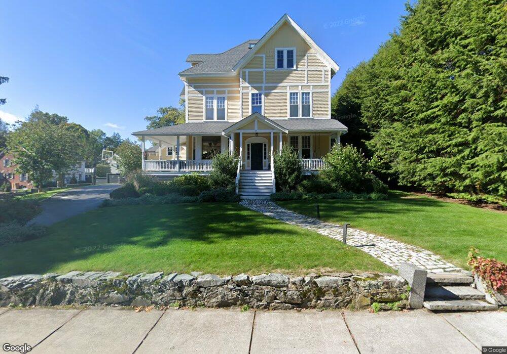
29 Forest Ave Auburndale, MA 02466
West Newton NeighborhoodEstimated Value: $4,165,000 - $6,209,000
5
Beds
7
Baths
6,305
Sq Ft
$818/Sq Ft
Est. Value
About This Home
This home is located at 29 Forest Ave, Auburndale, MA 02466 and is currently estimated at $5,155,716, approximately $817 per square foot. 29 Forest Ave is a home located in Middlesex County with nearby schools including Peirce Elementary School, F.A. Day Middle School, and Newton North High School.
Ownership History
Date
Name
Owned For
Owner Type
Purchase Details
Closed on
Dec 1, 2010
Sold by
Goldsmith Arthur H and Goldsmith Linda J
Bought by
Black Jonathan Seth and Rivkin-Black Jesswica
Current Estimated Value
Home Financials for this Owner
Home Financials are based on the most recent Mortgage that was taken out on this home.
Original Mortgage
$750,000
Outstanding Balance
$483,805
Interest Rate
4.22%
Mortgage Type
Purchase Money Mortgage
Estimated Equity
$4,671,911
Create a Home Valuation Report for This Property
The Home Valuation Report is an in-depth analysis detailing your home's value as well as a comparison with similar homes in the area
Home Values in the Area
Average Home Value in this Area
Purchase History
| Date | Buyer | Sale Price | Title Company |
|---|---|---|---|
| Black Jonathan Seth | $2,275,000 | -- |
Source: Public Records
Mortgage History
| Date | Status | Borrower | Loan Amount |
|---|---|---|---|
| Open | Black Jonathan Seth | $750,000 |
Source: Public Records
Tax History
| Year | Tax Paid | Tax Assessment Tax Assessment Total Assessment is a certain percentage of the fair market value that is determined by local assessors to be the total taxable value of land and additions on the property. | Land | Improvement |
|---|---|---|---|---|
| 2025 | $52,622 | $5,369,600 | $1,801,700 | $3,567,900 |
| 2024 | $50,881 | $5,213,200 | $1,749,200 | $3,464,000 |
| 2023 | $49,727 | $4,884,800 | $1,390,800 | $3,494,000 |
| 2022 | $47,582 | $4,523,000 | $1,287,800 | $3,235,200 |
| 2021 | $45,913 | $4,267,000 | $1,214,900 | $3,052,100 |
| 2020 | $44,547 | $4,267,000 | $1,214,900 | $3,052,100 |
| 2019 | $43,291 | $4,142,700 | $1,179,500 | $2,963,200 |
| 2018 | $38,133 | $3,524,300 | $1,052,900 | $2,471,400 |
| 2017 | $33,634 | $3,024,600 | $993,300 | $2,031,300 |
| 2016 | $32,168 | $2,826,700 | $928,300 | $1,898,400 |
| 2015 | $30,671 | $2,641,800 | $867,600 | $1,774,200 |
Source: Public Records
Map
Nearby Homes
- 40 Greenwood Ave
- 326 Austin St
- 125 Mount Vernon St Unit 2
- 123 Mount Vernon St Unit 125
- 123 Mount Vernon St Unit 1
- 1045 Washington St Unit 2
- 29 Parsons St
- 68 Chestnut St Unit 3
- 56 Bigelow Rd
- 94 Highland St
- 97 Valentine St
- 975 Washington St Unit 107
- 14 Wedgewood Rd
- 70 Walker St Unit 1
- 462 Waltham St
- 44 Putnam St
- 401 Albemarle Rd Unit 2
- 54 Temple St
- 710 Watertown St Unit 710
- 712 Watertown St
- 29 Forest Ave
- 23 Forest Ave
- 23 Forest Ave
- 266 Highland Ave
- 283 Highland Ave
- 280 Highland Ave
- 11 Forest Ave
- 245 Highland Ave
- 254 Highland Ave
- 289 Highland Ave
- 11 Forest Ave
- 286 Highland Ave
- 230 Mount Vernon St
- 245 Otis St
- 14 Forest Ave
- 233 Otis St
- 55 Forest Ave
- 55 Forest Ave
- 251 Otis St
- 295 Highland Ave
Your Personal Tour Guide
Ask me questions while you tour the home.