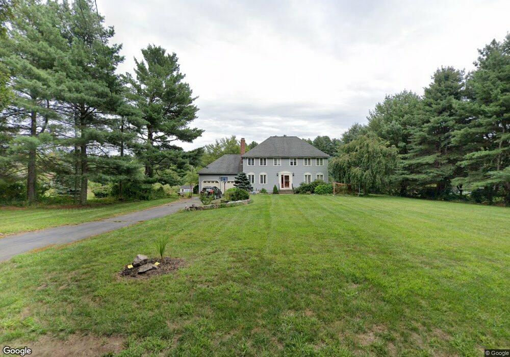
29 Grove St Millis, MA 02054
Estimated Value: $829,295 - $958,000
4
Beds
3
Baths
2,352
Sq Ft
$382/Sq Ft
Est. Value
About This Home
This home is located at 29 Grove St, Millis, MA 02054 and is currently estimated at $897,574, approximately $381 per square foot. 29 Grove St is a home located in Norfolk County with nearby schools including Clyde F Brown, Millis Middle School, and Millis High School.
Ownership History
Date
Name
Owned For
Owner Type
Purchase Details
Closed on
Aug 28, 2003
Sold by
Gonsalves Jeremy S and Shea Jill S
Bought by
Ciampolillo Timm E and Ciampolillo Lisa
Current Estimated Value
Home Financials for this Owner
Home Financials are based on the most recent Mortgage that was taken out on this home.
Original Mortgage
$445,500
Interest Rate
5.69%
Mortgage Type
Purchase Money Mortgage
Purchase Details
Closed on
Jul 30, 1999
Sold by
Krofaczek David J and Krofaczek Lori A
Bought by
Shea Jill S and Gonsalves Jeremy S
Purchase Details
Closed on
Jul 28, 1998
Sold by
Murray Michael
Bought by
Kropaczek David J and Kropaczek Lori A
Purchase Details
Closed on
Aug 6, 1993
Sold by
Donahue Richard K
Bought by
Murray Michael
Purchase Details
Closed on
Sep 13, 1990
Sold by
Dedham Inst For Svgs
Bought by
Donahue Richard K
Create a Home Valuation Report for This Property
The Home Valuation Report is an in-depth analysis detailing your home's value as well as a comparison with similar homes in the area
Home Values in the Area
Average Home Value in this Area
Purchase History
| Date | Buyer | Sale Price | Title Company |
|---|---|---|---|
| Ciampolillo Timm E | $495,000 | -- | |
| Shea Jill S | $320,000 | -- | |
| Kropaczek David J | $292,900 | -- | |
| Murray Michael | $210,000 | -- | |
| Donahue Richard K | $140,000 | -- |
Source: Public Records
Mortgage History
| Date | Status | Borrower | Loan Amount |
|---|---|---|---|
| Open | Donahue Richard K | $350,000 | |
| Closed | Donahue Richard K | $445,500 |
Source: Public Records
Tax History
| Year | Tax Paid | Tax Assessment Tax Assessment Total Assessment is a certain percentage of the fair market value that is determined by local assessors to be the total taxable value of land and additions on the property. | Land | Improvement |
|---|---|---|---|---|
| 2025 | $11,375 | $693,600 | $223,400 | $470,200 |
| 2024 | $10,931 | $665,700 | $223,400 | $442,300 |
| 2023 | $10,450 | $597,500 | $169,100 | $428,400 |
| 2022 | $10,093 | $534,600 | $170,400 | $364,200 |
| 2021 | $10,085 | $514,000 | $170,400 | $343,600 |
| 2020 | $9,873 | $490,200 | $159,200 | $331,000 |
| 2019 | $8,295 | $443,600 | $118,000 | $325,600 |
| 2018 | $7,994 | $443,600 | $118,000 | $325,600 |
| 2017 | $7,873 | $427,400 | $137,500 | $289,900 |
| 2016 | $7,152 | $410,100 | $137,500 | $272,600 |
| 2015 | $6,972 | $410,100 | $137,500 | $272,600 |
Source: Public Records
Map
Nearby Homes
- 6 Jameson Dr Unit 6
- 8 Glen Ellen Blvd Unit 8
- 3 Jameson Dr Unit 3
- 124 Glen Ellen Blvd Unit 124
- 13 Hattie Ln Unit 13
- 99 Goulding St
- 86 Glen Ellen Blvd Unit 86
- 9 Bogastow Cir
- 731 Norfolk St
- 50 Walnut St
- 4 Brookview Rd
- 11 Fairway Ln
- 0 Hill St
- 204 Ridge St
- 2 Towne Lyne Rd
- 17 Fairway Ln
- 66 Lakeshore Dr
- 119 Middlesex St
- 25 Howe St
- 14 April Way
Your Personal Tour Guide
Ask me questions while you tour the home.