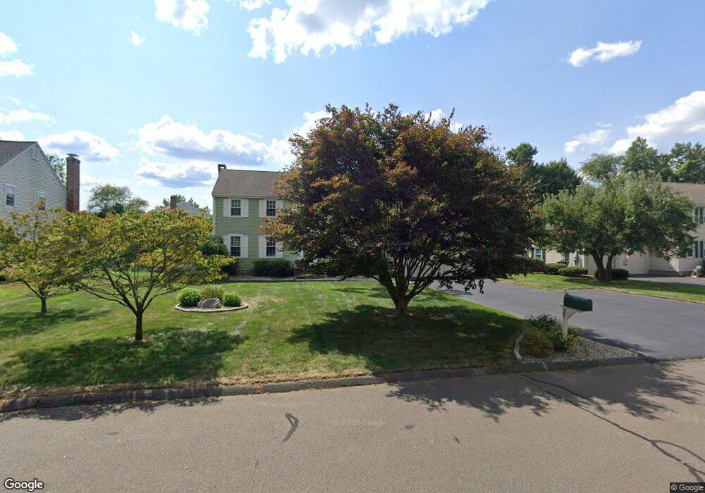
29 Harvest Hill Wethersfield, CT 06109
Estimated Value: $634,048 - $691,000
4
Beds
3
Baths
2,656
Sq Ft
$246/Sq Ft
Est. Value
About This Home
This home is located at 29 Harvest Hill, Wethersfield, CT 06109 and is currently estimated at $652,762, approximately $245 per square foot. 29 Harvest Hill is a home located in Hartford County with nearby schools including Samuel B. Webb Elementary School, Silas Deane Middle School, and Wethersfield High School.
Ownership History
Date
Name
Owned For
Owner Type
Purchase Details
Closed on
Aug 6, 2010
Sold by
Philip F Peterson Ret and Peterson Philip F
Bought by
Peterson Philip F
Current Estimated Value
Purchase Details
Closed on
Feb 28, 2005
Sold by
Mcpadden Todd J and Mcpadden Leslie G
Bought by
Peterson Philip F and Peterson Dorothy L
Home Financials for this Owner
Home Financials are based on the most recent Mortgage that was taken out on this home.
Original Mortgage
$190,000
Interest Rate
5.73%
Purchase Details
Closed on
Dec 4, 2003
Sold by
Boyle James D and Boyle Elizabeth B
Bought by
Mcpadden Todd J and Mcpadden Leslie G
Create a Home Valuation Report for This Property
The Home Valuation Report is an in-depth analysis detailing your home's value as well as a comparison with similar homes in the area
Home Values in the Area
Average Home Value in this Area
Purchase History
| Date | Buyer | Sale Price | Title Company |
|---|---|---|---|
| Peterson Philip F | -- | -- | |
| Peterson Philip F | $405,000 | -- | |
| Mcpadden Todd J | $328,000 | -- |
Source: Public Records
Mortgage History
| Date | Status | Borrower | Loan Amount |
|---|---|---|---|
| Open | Mcpadden Todd J | $137,200 | |
| Previous Owner | Mcpadden Todd J | $190,000 |
Source: Public Records
Tax History Compared to Growth
Tax History
| Year | Tax Paid | Tax Assessment Tax Assessment Total Assessment is a certain percentage of the fair market value that is determined by local assessors to be the total taxable value of land and additions on the property. | Land | Improvement |
|---|---|---|---|---|
| 2025 | $15,922 | $386,270 | $110,670 | $275,600 |
| 2024 | $10,763 | $249,020 | $79,100 | $169,920 |
| 2023 | $10,404 | $249,020 | $79,100 | $169,920 |
| 2022 | $10,230 | $249,020 | $79,100 | $169,920 |
| 2021 | $10,128 | $249,020 | $79,100 | $169,920 |
| 2020 | $10,133 | $249,020 | $79,100 | $169,920 |
| 2019 | $10,145 | $249,020 | $79,100 | $169,920 |
| 2018 | $9,840 | $241,300 | $77,100 | $164,200 |
| 2017 | $9,597 | $241,300 | $77,100 | $164,200 |
| 2016 | $9,300 | $241,300 | $77,100 | $164,200 |
| 2015 | $9,215 | $241,300 | $77,100 | $164,200 |
| 2014 | $8,865 | $241,300 | $77,100 | $164,200 |
Source: Public Records
Map
Nearby Homes
- 6 Barrington Dr Unit B
- 7 Barrington Dr Unit C
- 5 Barrington Dr Unit D
- 15 Grass Bonnet Ln
- 104 Willow St
- 274 Cedarwood Ln
- 0 Collier Rd
- 268 Goff Rd
- 76 Luca Lane Homesite 8
- 61 Luca Ln
- 8 Stella Dr
- 5 Robeth Ln
- 841 Ridge Rd
- 67 Luca (Homesite 6) Ln
- 53 Luca (Homesite 4) Ln
- 876 Ridge Rd
- 6 Vinnie Dr
- 122 Cottonwood Rd Unit 122
- 47 Forest Dr
- 39 Cottonwood Rd Unit 39
- 37 Harvest Hill
- 19 Harvest Hill
- 19 Harvest Hill Unit RD
- 52 Swing Ln
- 51 Swing Ln
- 32 Harvest Hill
- 46 Swing Ln
- 24 Harvest Hill
- 11 Harvest Hill
- 43 Harvest Hill
- 38 Harvest Hill
- 16 Harvest Hill
- 45 Swing Ln
- 46 Harvest Hill
- 32 Swing Ln
- 33 Orchard Hill Dr
- 43 Orchard Hill Dr
- 22 Swing Ln
- 49 Harvest Hill
- 6 Harvest Hill