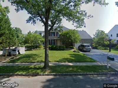
29 Hawthorne Dr Princeton Junction, NJ 08550
Princeton Junction NeighborhoodEstimated Value: $1,116,000 - $1,281,000
--
Bed
--
Bath
2,578
Sq Ft
$466/Sq Ft
Est. Value
About This Home
This home is located at 29 Hawthorne Dr, Princeton Junction, NJ 08550 and is currently estimated at $1,201,190, approximately $465 per square foot. 29 Hawthorne Dr is a home located in Mercer County with nearby schools including Dutch Neck Elementary School, Village Elementary School, and Community Middle School.
Ownership History
Date
Name
Owned For
Owner Type
Purchase Details
Closed on
May 14, 2001
Sold by
Sastry Radhika
Bought by
Foley Timothy and Foley Catherine
Current Estimated Value
Home Financials for this Owner
Home Financials are based on the most recent Mortgage that was taken out on this home.
Original Mortgage
$120,000
Interest Rate
7.03%
Purchase Details
Closed on
Aug 1, 1995
Sold by
Calotn Homes Inc
Bought by
Sastry Radhika and Sastry Vadali
Home Financials for this Owner
Home Financials are based on the most recent Mortgage that was taken out on this home.
Original Mortgage
$203,000
Interest Rate
7.48%
Create a Home Valuation Report for This Property
The Home Valuation Report is an in-depth analysis detailing your home's value as well as a comparison with similar homes in the area
Home Values in the Area
Average Home Value in this Area
Purchase History
| Date | Buyer | Sale Price | Title Company |
|---|---|---|---|
| Foley Timothy | $520,000 | -- | |
| Sastry Radhika | $318,925 | -- |
Source: Public Records
Mortgage History
| Date | Status | Borrower | Loan Amount |
|---|---|---|---|
| Open | Foley Timothy J | $200,000 | |
| Open | Foley Timothy J | $325,000 | |
| Closed | Foley Timothy J | $330,000 | |
| Closed | Foley Timothy J | $300,000 | |
| Closed | Foley Timothy | $120,000 | |
| Previous Owner | Sastry Radhika | $203,000 |
Source: Public Records
Tax History Compared to Growth
Tax History
| Year | Tax Paid | Tax Assessment Tax Assessment Total Assessment is a certain percentage of the fair market value that is determined by local assessors to be the total taxable value of land and additions on the property. | Land | Improvement |
|---|---|---|---|---|
| 2024 | $19,390 | $660,200 | $301,000 | $359,200 |
| 2023 | $19,390 | $660,200 | $301,000 | $359,200 |
| 2022 | $19,014 | $660,200 | $301,000 | $359,200 |
| 2021 | $18,855 | $660,200 | $301,000 | $359,200 |
| 2020 | $18,512 | $660,200 | $301,000 | $359,200 |
| 2019 | $18,301 | $660,200 | $301,000 | $359,200 |
| 2018 | $18,129 | $660,200 | $301,000 | $359,200 |
| 2017 | $17,753 | $660,200 | $301,000 | $359,200 |
| 2016 | $17,370 | $660,200 | $301,000 | $359,200 |
| 2015 | $16,967 | $660,200 | $301,000 | $359,200 |
| 2014 | $16,769 | $660,200 | $301,000 | $359,200 |
Source: Public Records
Map
Nearby Homes
- 19 Shadow Dr
- 11 Bridgewater Dr
- 2 Becket Ct
- 2 Foxboro Ct
- 27 Revere Ct
- 30 Revere Ct
- 58 Slayback Dr
- 13 Wellesley Ct
- 7 Briarwood Dr
- 10 Manor Ridge Dr
- 59 Cambridge Way
- 2 Cartwright Dr
- 11 Manor Ridge Dr
- 11 Westminster Dr
- 19 Taunton Ct
- 55 Cambridge Way
- 7 Braemar Dr
- 3 Manor Ridge Dr
- 5 Pinewood Ct
- 12 Woodland Ct