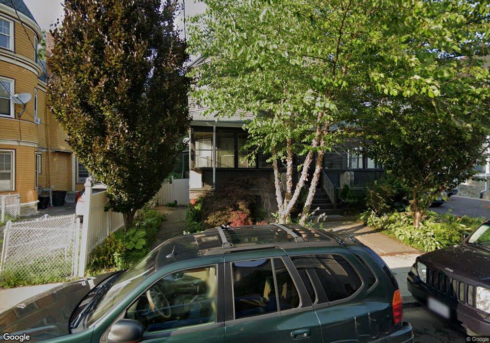
29 Howland St Dorchester, MA 02121
Washington Park NeighborhoodEstimated Value: $681,292 - $857,000
3
Beds
2
Baths
3,040
Sq Ft
$248/Sq Ft
Est. Value
About This Home
This home is located at 29 Howland St, Dorchester, MA 02121 and is currently estimated at $752,573, approximately $247 per square foot. 29 Howland St is a home located in Suffolk County with nearby schools including Bridge Boston Charter School and Mother Caroline Academy & Education Center.
Ownership History
Date
Name
Owned For
Owner Type
Purchase Details
Closed on
Dec 31, 1999
Sold by
Scott John S Est
Bought by
White Paul A
Current Estimated Value
Create a Home Valuation Report for This Property
The Home Valuation Report is an in-depth analysis detailing your home's value as well as a comparison with similar homes in the area
Home Values in the Area
Average Home Value in this Area
Purchase History
| Date | Buyer | Sale Price | Title Company |
|---|---|---|---|
| White Paul A | $225,000 | -- |
Source: Public Records
Mortgage History
| Date | Status | Borrower | Loan Amount |
|---|---|---|---|
| Open | White Paul A | $336,450 | |
| Closed | White Paul A | $333,700 | |
| Closed | White Paul A | $270,000 | |
| Closed | White Paul A | $205,000 |
Source: Public Records
Tax History Compared to Growth
Tax History
| Year | Tax Paid | Tax Assessment Tax Assessment Total Assessment is a certain percentage of the fair market value that is determined by local assessors to be the total taxable value of land and additions on the property. | Land | Improvement |
|---|---|---|---|---|
| 2025 | $5,843 | $504,600 | $176,800 | $327,800 |
| 2024 | $5,539 | $508,200 | $179,100 | $329,100 |
| 2023 | $5,458 | $508,200 | $179,100 | $329,100 |
| 2022 | $5,170 | $475,200 | $167,500 | $307,700 |
| 2021 | $4,868 | $456,200 | $164,200 | $292,000 |
| 2020 | $3,972 | $376,100 | $152,500 | $223,600 |
| 2019 | $3,704 | $351,400 | $126,800 | $224,600 |
| 2018 | $3,441 | $328,300 | $126,800 | $201,500 |
| 2017 | $3,477 | $328,300 | $126,800 | $201,500 |
| 2016 | $3,518 | $319,800 | $126,800 | $193,000 |
| 2015 | $2,887 | $238,400 | $84,500 | $153,900 |
| 2014 | $2,911 | $231,400 | $84,500 | $146,900 |
Source: Public Records
Map
Nearby Homes
- 164 Ruthven St Unit 1
- 7 Waumbeck St Unit 3
- 28 Wabon St
- 4 Wyoming St Unit 2
- 495 Warren St
- 214 Humboldt Ave
- 476 Warren St
- 2 Otisfield St
- 5 Glenburne St
- 78 Hutchings St Unit 1
- 32 Hartwell St
- 75 Ruthven St
- 8 Weldon St
- 40 Devon St Unit 3
- 12 Weldon St
- 352 Blue Hill Ave Unit 8
- 340 Blue Hill Ave
- 99 Harrishof St
- 151 Townsend St
- 9 Abbotsford St Unit 1
- 31 Howland St
- 27 Howland St Unit 1
- 27 Howland St Unit 2
- 27 Howland St
- 27 Howland St Unit B
- 34 Wenonah St
- 36 Wenonah St
- 33 Howland St
- 32 Wenonah St
- 38 Wenonah St
- 27 Elm Hill Ave
- 30 Wenonah St
- 30 Wenonah St Unit 1
- 30 Wenonah St Unit 3
- 30 Wenonah St Unit 2
- 30 Howland St
- 30 Howaland Unit 2
- 30 Howland St Unit 3
- 30 Howland St Unit 2
- 35 Howland St