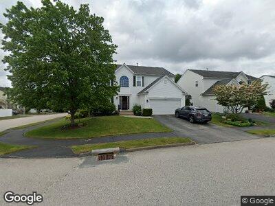
29 Jasmine Dr Worcester, MA 01605
Forest Grove NeighborhoodEstimated Value: $582,000 - $705,000
4
Beds
3
Baths
2,390
Sq Ft
$271/Sq Ft
Est. Value
About This Home
This home is located at 29 Jasmine Dr, Worcester, MA 01605 and is currently estimated at $648,323, approximately $271 per square foot. 29 Jasmine Dr is a home located in Worcester County with nearby schools including Nelson Place Elementary School, Jacob Hiatt Magnet School, and Chandler Magnet.
Ownership History
Date
Name
Owned For
Owner Type
Purchase Details
Closed on
Dec 6, 2002
Sold by
Pulte Home Corp Of New and Mccabe James R
Bought by
Thyous Ronnie M and Thyous Colleen P
Current Estimated Value
Home Financials for this Owner
Home Financials are based on the most recent Mortgage that was taken out on this home.
Original Mortgage
$46,000
Interest Rate
6.34%
Create a Home Valuation Report for This Property
The Home Valuation Report is an in-depth analysis detailing your home's value as well as a comparison with similar homes in the area
Home Values in the Area
Average Home Value in this Area
Purchase History
| Date | Buyer | Sale Price | Title Company |
|---|---|---|---|
| Thyous Ronnie M | $232,000 | -- |
Source: Public Records
Mortgage History
| Date | Status | Borrower | Loan Amount |
|---|---|---|---|
| Open | Thyous Ronnie M | $100,000 | |
| Closed | Thyus Ronne M | $20,000 | |
| Open | Thyous Ronnie M | $240,547 | |
| Closed | Thyous Colleen P | $33,000 | |
| Closed | Thyous Ronnie M | $46,000 | |
| Closed | Thyous Ronnie M | $258,400 |
Source: Public Records
Tax History Compared to Growth
Tax History
| Year | Tax Paid | Tax Assessment Tax Assessment Total Assessment is a certain percentage of the fair market value that is determined by local assessors to be the total taxable value of land and additions on the property. | Land | Improvement |
|---|---|---|---|---|
| 2025 | $7,568 | $573,800 | $117,600 | $456,200 |
| 2024 | $7,367 | $535,800 | $117,600 | $418,200 |
| 2023 | $7,124 | $496,800 | $102,300 | $394,500 |
| 2022 | $6,691 | $439,900 | $81,800 | $358,100 |
| 2021 | $6,716 | $412,500 | $65,400 | $347,100 |
| 2020 | $6,467 | $380,400 | $65,500 | $314,900 |
| 2019 | $6,487 | $360,400 | $58,900 | $301,500 |
| 2018 | $6,388 | $337,800 | $58,900 | $278,900 |
| 2017 | $6,083 | $316,500 | $58,900 | $257,600 |
| 2016 | $6,179 | $299,800 | $42,800 | $257,000 |
| 2015 | $6,017 | $299,800 | $42,800 | $257,000 |
| 2014 | $5,858 | $299,800 | $42,800 | $257,000 |
Source: Public Records
Map
Nearby Homes
- 24 Laurelwood Dr
- 3606 Knightsbridge Close
- 505 Browning Ln
- 83 Jordan Rd
- 20 Jordan Rd
- 1 Dubiel Dr
- 770 Salisbury St Unit 533
- 5 Birchwood Rd
- 694 Salisbury St
- 19 Steppingstone Dr
- 90 Fisher Rd Unit 30
- 4 Winter Hill Dr
- 12 Fisher Rd
- 14 Fisher Rd
- 5 Fisher Rd
- 1 Fisher Rd
- 9 Fisher Rd
- 68 Fisher Rd
- 13 Fisher Rd
- 300 Fisher Rd