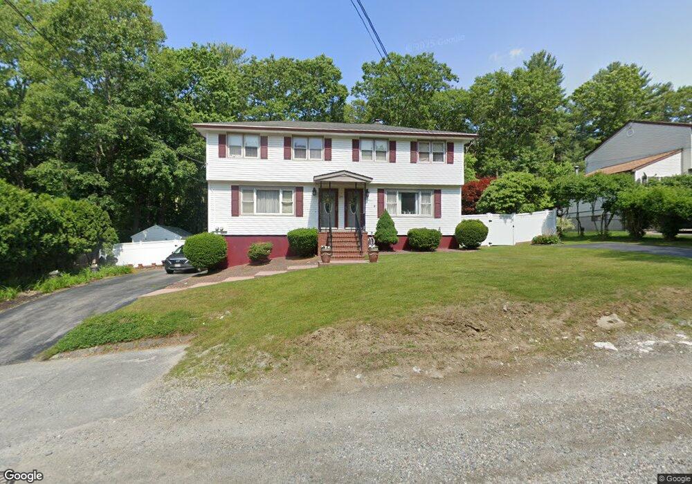
29 Joppa Rd Worcester, MA 01602
West Tatnuck NeighborhoodEstimated Value: $549,000 - $706,000
4
Beds
4
Baths
2,058
Sq Ft
$295/Sq Ft
Est. Value
About This Home
This home is located at 29 Joppa Rd, Worcester, MA 01602 and is currently estimated at $608,044, approximately $295 per square foot. 29 Joppa Rd is a home located in Worcester County with nearby schools including West Tatnuck School, Chandler Magnet, and Jacob Hiatt Magnet School.
Create a Home Valuation Report for This Property
The Home Valuation Report is an in-depth analysis detailing your home's value as well as a comparison with similar homes in the area
Home Values in the Area
Average Home Value in this Area
Tax History
| Year | Tax Paid | Tax Assessment Tax Assessment Total Assessment is a certain percentage of the fair market value that is determined by local assessors to be the total taxable value of land and additions on the property. | Land | Improvement |
|---|---|---|---|---|
| 2025 | $6,338 | $480,500 | $118,700 | $361,800 |
| 2024 | $6,359 | $462,500 | $118,700 | $343,800 |
| 2023 | $5,789 | $403,700 | $103,200 | $300,500 |
| 2022 | $5,827 | $383,100 | $82,600 | $300,500 |
| 2021 | $5,045 | $309,900 | $66,100 | $243,800 |
| 2020 | $4,517 | $265,700 | $66,100 | $199,600 |
| 2019 | $4,507 | $250,400 | $59,500 | $190,900 |
| 2018 | $4,637 | $245,200 | $59,500 | $185,700 |
| 2017 | $4,661 | $242,500 | $59,500 | $183,000 |
| 2016 | $4,518 | $219,200 | $43,700 | $175,500 |
| 2015 | $4,399 | $219,200 | $43,700 | $175,500 |
| 2014 | $4,283 | $219,200 | $43,700 | $175,500 |
Source: Public Records
Map
Nearby Homes
- 21 Baxter St
- 9 Newburn Rd
- 20 Wedgewood Rd
- 432 Mower St
- 8 Sussex Ln
- 58 Wedgewood Rd
- 15 Sunny Hill Dr
- 23 Tiverton Pkwy
- 29 Scenic Dr
- 3 Mower St
- 148A Tory Fort Ln
- 122 Copperfield Rd
- 47R Yarnie Unit 3A
- 47R Yarnie Unit 1B
- 47R Yarnie Unit 2B
- 47R Yarnie Unit 4B
- 47R Yarnie Unit 8B
- 47R Yarnie Unit 5A
- 47R Yarnie Unit 6B
- 47R Yarnie Unit 4A
Your Personal Tour Guide
Ask me questions while you tour the home.