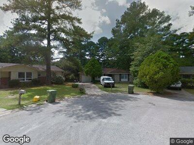
29 King Arthur Ct Columbia, SC 29223
Spring Valley NeighborhoodEstimated Value: $111,000 - $152,000
3
Beds
1
Bath
1,125
Sq Ft
$116/Sq Ft
Est. Value
About This Home
This home is located at 29 King Arthur Ct, Columbia, SC 29223 and is currently estimated at $130,295, approximately $115 per square foot. 29 King Arthur Ct is a home located in Richland County with nearby schools including L. B. Nelson Elementary School, E. L. Wright Middle School, and Westwood High School.
Ownership History
Date
Name
Owned For
Owner Type
Purchase Details
Closed on
Sep 2, 2022
Sold by
Obenour Jeffrey M
Bought by
Deberry Property Management Llc
Current Estimated Value
Purchase Details
Closed on
Apr 26, 2018
Sold by
Norris Elaine and Norris Mulligan Elaine
Bought by
Obenour Jeffrey M
Home Financials for this Owner
Home Financials are based on the most recent Mortgage that was taken out on this home.
Original Mortgage
$71,677
Interest Rate
4.5%
Mortgage Type
FHA
Create a Home Valuation Report for This Property
The Home Valuation Report is an in-depth analysis detailing your home's value as well as a comparison with similar homes in the area
Home Values in the Area
Average Home Value in this Area
Purchase History
| Date | Buyer | Sale Price | Title Company |
|---|---|---|---|
| Deberry Property Management Llc | $88,000 | -- | |
| Obenour Jeffrey M | $73,000 | None Available |
Source: Public Records
Mortgage History
| Date | Status | Borrower | Loan Amount |
|---|---|---|---|
| Previous Owner | Obenour Jeffrey M | $71,677 | |
| Previous Owner | Obenour Jeffrey M | $6,000 |
Source: Public Records
Tax History Compared to Growth
Tax History
| Year | Tax Paid | Tax Assessment Tax Assessment Total Assessment is a certain percentage of the fair market value that is determined by local assessors to be the total taxable value of land and additions on the property. | Land | Improvement |
|---|---|---|---|---|
| 2024 | $3,589 | $101,200 | $0 | $0 |
| 2023 | $3,589 | $2,920 | $0 | $0 |
| 2022 | $959 | $73,000 | $8,800 | $64,200 |
| 2021 | $947 | $2,920 | $0 | $0 |
| 2020 | $958 | $2,920 | $0 | $0 |
| 2019 | $927 | $2,920 | $0 | $0 |
| 2018 | $1,495 | $1,450 | $0 | $0 |
| 2017 | $1,462 | $2,180 | $0 | $0 |
| 2016 | $1,455 | $2,180 | $0 | $0 |
| 2015 | $1,419 | $2,180 | $0 | $0 |
| 2014 | $1,404 | $36,300 | $0 | $0 |
| 2013 | -- | $2,180 | $0 | $0 |
Source: Public Records
Map
Nearby Homes
- 141 Westbridge Rd
- 97 Charmont Dr
- 94 Winterberry Ln
- 627 Folkstone Rd
- 358 Rabon Rd
- 120 Gale River Rd
- 308 Great Rd N
- W/S Rabon Rd
- 353 Hardwick Dr
- 380 Hardwick Dr
- 365 Hardwick Dr
- 340 Hardwick Dr
- 295 Brando Way
- 277 Brando Way
- 346 Hardwick Dr
- 320 Hardwick Dr
- 297 Brando Way
- 357 Hardwick Dr
- 172 Rabon Springs Rd
- 373 Hardwick Dr
- 29 King Arthur Ct
- 33 King Arthur Ct
- 25 King Arthur Ct
- 208 Foxhunt Rd
- 151 Charmont Dr
- 212 Foxhunt Rd
- 21 King Arthur Ct
- 149 Charmont Dr
- 28 King Arthur Ct
- 145 Charmont Dr
- 24 King Arthur Ct
- 220 Foxhunt Rd
- 20 King Arthur Ct
- 141 Charmont Dr
- 17 King Arthur Ct
- 13 King Arthur Ct
- 224 Foxhunt Rd
- 137 Charmont Dr
- 16 King Arthur Ct
- 133 Westbridge Rd
