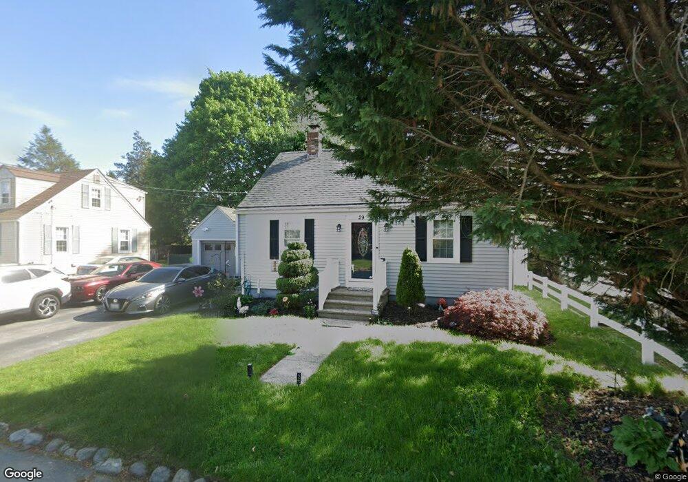
29 Laconia Rd Cranston, RI 02920
Meshanticut NeighborhoodEstimated Value: $388,783 - $459,000
3
Beds
1
Bath
1,152
Sq Ft
$358/Sq Ft
Est. Value
About This Home
This home is located at 29 Laconia Rd, Cranston, RI 02920 and is currently estimated at $412,196, approximately $357 per square foot. 29 Laconia Rd is a home located in Providence County with nearby schools including George J. Peters School, Western Hills Middle School, and Cranston High School West.
Ownership History
Date
Name
Owned For
Owner Type
Purchase Details
Closed on
Jul 23, 2008
Sold by
Dandeneau Diane
Bought by
Scavitti Karen M
Current Estimated Value
Home Financials for this Owner
Home Financials are based on the most recent Mortgage that was taken out on this home.
Original Mortgage
$203,700
Outstanding Balance
$133,266
Interest Rate
6.35%
Mortgage Type
Purchase Money Mortgage
Estimated Equity
$278,930
Purchase Details
Closed on
Jul 1, 1998
Sold by
Mcginley Eleanor R
Bought by
Dandeneau Diane
Home Financials for this Owner
Home Financials are based on the most recent Mortgage that was taken out on this home.
Original Mortgage
$88,000
Interest Rate
7.04%
Create a Home Valuation Report for This Property
The Home Valuation Report is an in-depth analysis detailing your home's value as well as a comparison with similar homes in the area
Home Values in the Area
Average Home Value in this Area
Purchase History
| Date | Buyer | Sale Price | Title Company |
|---|---|---|---|
| Scavitti Karen M | $210,000 | -- | |
| Dandeneau Diane | $110,000 | -- |
Source: Public Records
Mortgage History
| Date | Status | Borrower | Loan Amount |
|---|---|---|---|
| Open | Dandeneau Diane | $203,700 | |
| Previous Owner | Dandeneau Diane | $88,000 |
Source: Public Records
Tax History Compared to Growth
Tax History
| Year | Tax Paid | Tax Assessment Tax Assessment Total Assessment is a certain percentage of the fair market value that is determined by local assessors to be the total taxable value of land and additions on the property. | Land | Improvement |
|---|---|---|---|---|
| 2025 | $4,238 | $305,300 | $103,900 | $201,400 |
| 2024 | $4,155 | $305,300 | $103,900 | $201,400 |
| 2023 | $4,060 | $214,800 | $71,700 | $143,100 |
| 2022 | $3,976 | $214,800 | $71,700 | $143,100 |
| 2021 | $3,866 | $214,800 | $71,700 | $143,100 |
| 2020 | $3,820 | $183,900 | $75,100 | $108,800 |
| 2019 | $3,820 | $183,900 | $75,100 | $108,800 |
| 2018 | $3,731 | $183,900 | $75,100 | $108,800 |
| 2017 | $3,402 | $148,300 | $61,400 | $86,900 |
| 2016 | $3,329 | $148,300 | $61,400 | $86,900 |
| 2015 | $3,329 | $148,300 | $61,400 | $86,900 |
| 2014 | $3,412 | $149,400 | $61,400 | $88,000 |
Source: Public Records
Map
Nearby Homes