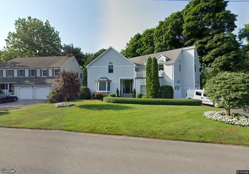
29 Lake Dr Darien, CT 06820
Estimated Value: $1,256,000 - $2,726,850
4
Beds
5
Baths
3,910
Sq Ft
$593/Sq Ft
Est. Value
About This Home
This home is located at 29 Lake Dr, Darien, CT 06820 and is currently estimated at $2,319,463, approximately $593 per square foot. 29 Lake Dr is a home located in Fairfield County with nearby schools including Holmes Elementary School, Middlesex Middle School, and Darien High School.
Ownership History
Date
Name
Owned For
Owner Type
Purchase Details
Closed on
Dec 15, 2004
Sold by
Karl Ronald A B and Kelly Joan K
Bought by
Mickels Carl B and Mickels Anita S
Current Estimated Value
Create a Home Valuation Report for This Property
The Home Valuation Report is an in-depth analysis detailing your home's value as well as a comparison with similar homes in the area
Home Values in the Area
Average Home Value in this Area
Purchase History
| Date | Buyer | Sale Price | Title Company |
|---|---|---|---|
| Mickels Carl B | $768,000 | -- |
Source: Public Records
Mortgage History
| Date | Status | Borrower | Loan Amount |
|---|---|---|---|
| Open | Mickels Carl B | $300,000 | |
| Previous Owner | Mickels Carl B | $441,000 | |
| Previous Owner | Mickels Carl B | $450,000 |
Source: Public Records
Tax History Compared to Growth
Tax History
| Year | Tax Paid | Tax Assessment Tax Assessment Total Assessment is a certain percentage of the fair market value that is determined by local assessors to be the total taxable value of land and additions on the property. | Land | Improvement |
|---|---|---|---|---|
| 2025 | $21,568 | $1,393,280 | $722,680 | $670,600 |
| 2024 | $20,467 | $1,393,280 | $722,680 | $670,600 |
| 2023 | $18,905 | $1,073,520 | $516,180 | $557,340 |
| 2022 | $18,497 | $1,073,520 | $516,180 | $557,340 |
| 2021 | $18,078 | $1,073,520 | $516,180 | $557,340 |
| 2020 | $17,563 | $1,073,520 | $516,180 | $557,340 |
| 2019 | $17,598 | $1,068,480 | $511,140 | $557,340 |
| 2018 | $16,796 | $1,044,540 | $474,880 | $569,660 |
| 2017 | $16,880 | $1,044,540 | $474,880 | $569,660 |
| 2016 | $16,472 | $1,044,540 | $474,880 | $569,660 |
| 2015 | $16,034 | $1,044,540 | $474,880 | $569,660 |
| 2014 | $15,679 | $1,044,540 | $474,880 | $569,660 |
Source: Public Records
Map
Nearby Homes
- 19 Georgian Ln
- 7 Barnstable Ln
- 42 Union St
- 100 Maple Tree Ave Unit 7
- 71 Deleo Dr
- 76 Deepwood Rd
- 69 Maple Tree Ave Unit 2
- 22 Radio Place Unit 10
- 34 Crescent St Unit 2D
- 172 Joffre Ave
- 27 Glendale Cir
- 910 Hope St Unit 5B
- 24 Haig Ave
- 15 Rose St
- 98 Scofield Ave
- 20 Norman Rd
- 970 Hope St Unit 4J
- 114 Pine Hill Ave
- 543 Newfield Ave
- 22 Hastings Ln