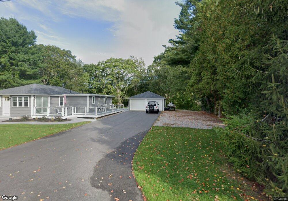
29 Maple St Stonington, CT 06378
Estimated Value: $778,000 - $1,271,000
3
Beds
3
Baths
1,982
Sq Ft
$502/Sq Ft
Est. Value
About This Home
This home is located at 29 Maple St, Stonington, CT 06378 and is currently estimated at $994,849, approximately $501 per square foot. 29 Maple St is a home with nearby schools including Stonington Middle School and Stonington High School.
Ownership History
Date
Name
Owned For
Owner Type
Purchase Details
Closed on
Aug 8, 2016
Sold by
Riverbend Builders
Bought by
Jones Alison E and Jones Howard W
Current Estimated Value
Home Financials for this Owner
Home Financials are based on the most recent Mortgage that was taken out on this home.
Original Mortgage
$454,750
Outstanding Balance
$363,772
Interest Rate
3.56%
Mortgage Type
Purchase Money Mortgage
Estimated Equity
$631,077
Purchase Details
Closed on
Jul 30, 2015
Sold by
Jarvis Roy W
Bought by
Riverbend Bldrs Stonin
Home Financials for this Owner
Home Financials are based on the most recent Mortgage that was taken out on this home.
Original Mortgage
$310,000
Interest Rate
3.97%
Mortgage Type
New Conventional
Create a Home Valuation Report for This Property
The Home Valuation Report is an in-depth analysis detailing your home's value as well as a comparison with similar homes in the area
Home Values in the Area
Average Home Value in this Area
Purchase History
| Date | Buyer | Sale Price | Title Company |
|---|---|---|---|
| Jones Alison E | $549,000 | -- | |
| Jones Alison E | $549,000 | -- | |
| Riverbend Bldrs Stonin | $100,000 | -- | |
| Riverbend Bldrs Stonin | $100,000 | -- |
Source: Public Records
Mortgage History
| Date | Status | Borrower | Loan Amount |
|---|---|---|---|
| Open | Jones Alison E | $454,750 | |
| Closed | Jones Alison E | $454,750 | |
| Previous Owner | Riverbend Bldrs Stonin | $310,000 |
Source: Public Records
Tax History
| Year | Tax Paid | Tax Assessment Tax Assessment Total Assessment is a certain percentage of the fair market value that is determined by local assessors to be the total taxable value of land and additions on the property. | Land | Improvement |
|---|---|---|---|---|
| 2025 | $10,047 | $497,400 | $212,200 | $285,200 |
| 2024 | $9,650 | $497,400 | $212,200 | $285,200 |
| 2023 | $9,590 | $497,400 | $212,200 | $285,200 |
| 2022 | $9,875 | $376,900 | $168,300 | $208,600 |
| 2021 | $9,920 | $376,900 | $168,300 | $208,600 |
| 2020 | $9,668 | $374,600 | $168,300 | $206,300 |
| 2019 | $9,668 | $374,600 | $168,300 | $206,300 |
| 2018 | $9,359 | $374,600 | $168,300 | $206,300 |
| 2017 | $8,269 | $328,000 | $140,300 | $187,700 |
| 2016 | $3,902 | $160,300 | $140,300 | $20,000 |
| 2015 | $437 | $18,700 | $18,700 | $0 |
| 2014 | -- | $18,700 | $18,700 | $0 |
Source: Public Records
Map
Nearby Homes
- 50 Ashworth Ave
- 4 E Neck Rd
- 20 Lambs Way
- 75 Montauk Ave
- 17 Old Stonington Rd
- 66 Collins Rd
- 3 Lamberts Ln
- 12 Elizabeth Ct Unit 12
- 4 Northwest St Unit B-2
- 4 Northwest St Unit B-12
- 32 Broadway Ave
- 117 Water St
- 103 Main St Unit 1103
- 92 Water St
- 59 Montauk Ave
- 45 Quanaduck Rd
- 14 Temple St
- 174 Montauk Ave
- 12 Water St
- 0 Smail St Unit 24066473
- 0 Ashworth Ave
- 33 Maple St
- 16 Ashworth Ave
- 37 Maple St
- 37 Meadowbrook Ln
- 20 Ashworth Ave
- 1 Maple St
- 3 Maple St
- 21 Langworthy Ave
- 18 Langworthy Ave
- 41 Maple St
- 41 Maple St (Lords Point
- 00 Maple St
- 6 Maple St
- 4 Maple St
- 8 Boulder Ave
- 17 Wolcott Ave
- 22 Langworthy Ave
- 4 Boulder Avenue Extension
- 19 Wolcott Ave