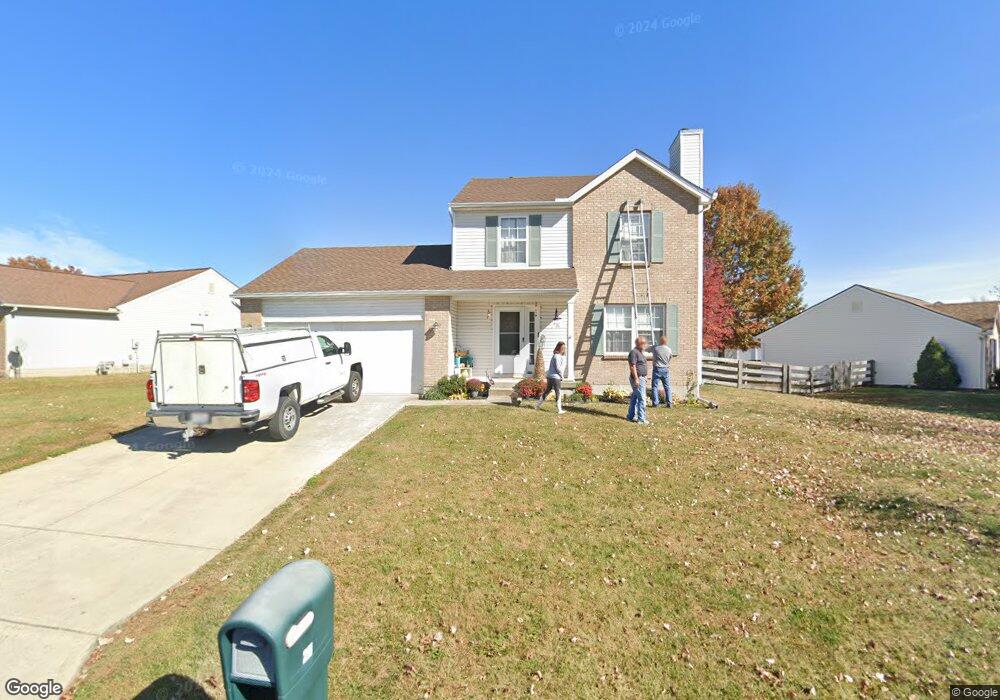
29 Mynah Dr Amelia, OH 45102
Estimated Value: $273,000 - $302,000
3
Beds
3
Baths
1,392
Sq Ft
$209/Sq Ft
Est. Value
About This Home
This home is located at 29 Mynah Dr, Amelia, OH 45102 and is currently estimated at $290,389, approximately $208 per square foot. 29 Mynah Dr is a home located in Clermont County with nearby schools including Amelia Elementary School, West Clermont Middle School, and West Clermont High School.
Ownership History
Date
Name
Owned For
Owner Type
Purchase Details
Closed on
Jun 25, 2007
Sold by
Wilson Jesse R
Bought by
Loehner Jason M
Current Estimated Value
Home Financials for this Owner
Home Financials are based on the most recent Mortgage that was taken out on this home.
Original Mortgage
$118,000
Outstanding Balance
$70,979
Interest Rate
6.42%
Mortgage Type
Purchase Money Mortgage
Estimated Equity
$219,410
Purchase Details
Closed on
May 27, 2004
Sold by
Ziegler Derek and Ziegler Bobbie
Bought by
Essig Jeffrey M and Essig Tina R
Purchase Details
Closed on
Feb 25, 2002
Sold by
Crossmann Communities Oh
Bought by
Mulligan Bobbie and Ziegler Derek
Home Financials for this Owner
Home Financials are based on the most recent Mortgage that was taken out on this home.
Original Mortgage
$145,436
Interest Rate
7.14%
Mortgage Type
FHA
Create a Home Valuation Report for This Property
The Home Valuation Report is an in-depth analysis detailing your home's value as well as a comparison with similar homes in the area
Home Values in the Area
Average Home Value in this Area
Purchase History
We collect this data history from publicly available records. To have your information removed, we recommend requesting removal directly through your county’s website.
| Date | Buyer | Sale Price | Title Company |
|---|---|---|---|
| Loehner Jason M | $118,000 | Lawyers Title Cincinnati Inc | |
| Essig Jeffrey M | $144,000 | -- | |
| Mulligan Bobbie | $147,719 | -- |
Source: Public Records
Mortgage History
We collect this data history from publicly available records. To have your information removed, we recommend requesting removal directly through your county’s website.
| Date | Status | Borrower | Loan Amount |
|---|---|---|---|
| Open | Loehner Jason M | $118,000 | |
| Previous Owner | Mulligan Bobbie | $145,436 |
Source: Public Records
Tax History
| Year | Tax Paid | Tax Assessment Tax Assessment Total Assessment is a certain percentage of the fair market value that is determined by local assessors to be the total taxable value of land and additions on the property. | Land | Improvement |
|---|---|---|---|---|
| 2025 | $4,242 | $78,890 | $14,910 | $63,980 |
| 2024 | $4,029 | $78,890 | $14,910 | $63,980 |
| 2023 | $4,035 | $78,890 | $14,910 | $63,980 |
| 2022 | $3,270 | $55,580 | $10,500 | $45,080 |
| 2021 | $3,233 | $55,580 | $10,500 | $45,080 |
| 2020 | $3,234 | $55,580 | $10,500 | $45,080 |
| 2019 | $2,866 | $53,870 | $10,290 | $43,580 |
| 2018 | $2,894 | $53,870 | $10,290 | $43,580 |
| 2017 | $2,836 | $53,870 | $10,290 | $43,580 |
| 2016 | $2,836 | $47,670 | $9,100 | $38,570 |
| 2015 | $2,652 | $47,670 | $9,100 | $38,570 |
| 2014 | $2,649 | $47,670 | $9,100 | $38,570 |
| 2013 | $2,423 | $43,190 | $10,500 | $32,690 |
Source: Public Records
Map
Nearby Homes
Your Personal Tour Guide
Ask me questions while you tour the home.