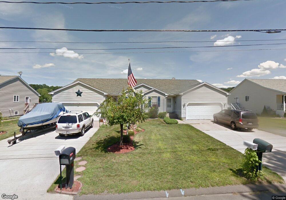
29 Notre Dame St Unit B Westfield, MA 01085
Estimated Value: $230,000 - $258,520
2
Beds
2
Baths
990
Sq Ft
$249/Sq Ft
Est. Value
About This Home
This home is located at 29 Notre Dame St Unit B, Westfield, MA 01085 and is currently estimated at $246,380, approximately $248 per square foot. 29 Notre Dame St Unit B is a home located in Hampden County with nearby schools including Westfield High School and Saint Mary High School.
Ownership History
Date
Name
Owned For
Owner Type
Purchase Details
Closed on
Nov 22, 1999
Sold by
Jn Duquette & Son Cons
Bought by
Early Daniel J
Current Estimated Value
Home Financials for this Owner
Home Financials are based on the most recent Mortgage that was taken out on this home.
Original Mortgage
$89,600
Outstanding Balance
$27,375
Interest Rate
7.76%
Mortgage Type
Purchase Money Mortgage
Estimated Equity
$219,005
Create a Home Valuation Report for This Property
The Home Valuation Report is an in-depth analysis detailing your home's value as well as a comparison with similar homes in the area
Home Values in the Area
Average Home Value in this Area
Purchase History
| Date | Buyer | Sale Price | Title Company |
|---|---|---|---|
| Early Daniel J | $115,000 | -- |
Source: Public Records
Mortgage History
| Date | Status | Borrower | Loan Amount |
|---|---|---|---|
| Open | Early Daniel J | $89,600 |
Source: Public Records
Tax History Compared to Growth
Tax History
| Year | Tax Paid | Tax Assessment Tax Assessment Total Assessment is a certain percentage of the fair market value that is determined by local assessors to be the total taxable value of land and additions on the property. | Land | Improvement |
|---|---|---|---|---|
| 2025 | $3,288 | $216,600 | $0 | $216,600 |
| 2024 | $3,654 | $228,800 | $0 | $228,800 |
| 2023 | $3,241 | $195,000 | $0 | $195,000 |
| 2022 | $3,241 | $175,300 | $0 | $175,300 |
| 2021 | $3,436 | $182,000 | $0 | $182,000 |
| 2020 | $3,267 | $169,700 | $0 | $169,700 |
| 2019 | $3,206 | $163,000 | $0 | $163,000 |
| 2018 | $3,156 | $163,000 | $0 | $163,000 |
| 2017 | $3,165 | $163,000 | $0 | $163,000 |
| 2016 | $3,169 | $163,000 | $0 | $163,000 |
| 2015 | $3,163 | $170,600 | $0 | $170,600 |
| 2014 | $3,102 | $170,600 | $0 | $170,600 |
Source: Public Records
Map
Nearby Homes
- 29 Notre Dame St Unit A
- 29 Notre Dame St Unit 29 A
- 29B Notre Dame St Unit 29B
- 21B Notre Dame St
- 21 Notre Dame St Unit B
- 21 Notre Dame St Unit A
- 21 Notre Dame St
- 37A Notre Dame St Unit A
- 37A Notre Dame St Unit 29A
- 37A Notre Dame St
- 37 Notre Dame St Unit B
- 37 Notre Dame St Unit A
- 103 Woodmont St
- 131 Dartmouth St
- 135 Dartmouth St
- 11 Notre Dame St Unit B
- 11 Notre Dame St Unit A
- 11 Notre Dame St
- 11 Notre Dame St Unit 11 B
- 11A Notre Dame St Unit 11 A