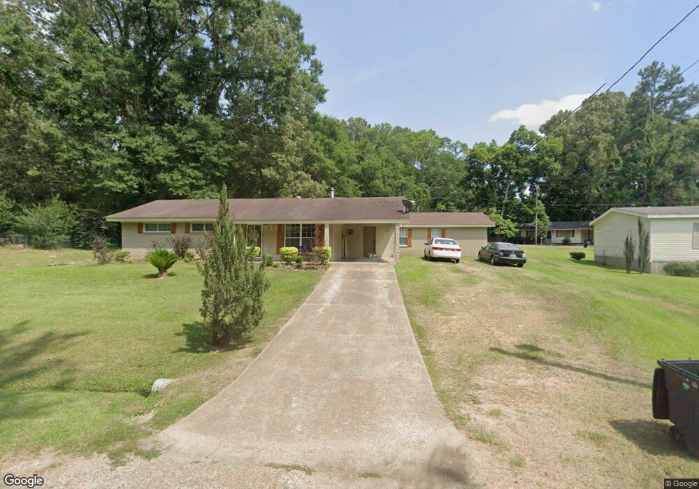
29 Parsons Rd Natchez, MS 39120
Estimated Value: $103,000 - $126,000
Studio
1
Bath
1,134
Sq Ft
$101/Sq Ft
Est. Value
About This Home
This home is located at 29 Parsons Rd, Natchez, MS 39120 and is currently estimated at $114,332, approximately $100 per square foot. 29 Parsons Rd is a home located in Adams County with nearby schools including McLaurin Elementary School, Susie B. West Primary School, and Joseph L. Frazier Primary School.
Ownership History
Date
Name
Owned For
Owner Type
Purchase Details
Closed on
Nov 20, 2007
Sold by
Johnson Marjorie
Bought by
Sullivan Marcus L and Sullivan Tangela H
Current Estimated Value
Purchase Details
Closed on
Mar 28, 2006
Sold by
Green Duncan E and Green Ursula
Bought by
Sullivan Marcus L and Sullivan Tangela R
Home Financials for this Owner
Home Financials are based on the most recent Mortgage that was taken out on this home.
Original Mortgage
$58,000
Interest Rate
6.2%
Mortgage Type
Purchase Money Mortgage
Create a Home Valuation Report for This Property
The Home Valuation Report is an in-depth analysis detailing your home's value as well as a comparison with similar homes in the area
Purchase History
| Date | Buyer | Sale Price | Title Company |
|---|---|---|---|
| Sullivan Marcus L | -- | -- | |
| Sullivan Marcus L | -- | -- | |
| Sullivan Marcus L | -- | -- |
Source: Public Records
Mortgage History
| Date | Status | Borrower | Loan Amount |
|---|---|---|---|
| Closed | Sullivan Marcus L | $0 | |
| Previous Owner | Sullivan Marcus L | $58,000 |
Source: Public Records
Tax History
| Year | Tax Paid | Tax Assessment Tax Assessment Total Assessment is a certain percentage of the fair market value that is determined by local assessors to be the total taxable value of land and additions on the property. | Land | Improvement |
|---|---|---|---|---|
| 2024 | $950 | $7,914 | $0 | $0 |
| 2023 | $704 | $7,914 | $1,100 | $6,814 |
| 2022 | $625 | $7,914 | $0 | $0 |
| 2021 | $621 | $7,914 | $0 | $0 |
| 2019 | $414 | $5,447 | $0 | $0 |
| 2018 | $411 | $5,447 | $0 | $0 |
| 2017 | $417 | $5,447 | $0 | $0 |
| 2016 | $408 | $5,262 | $0 | $0 |
| 2015 | $397 | $5,262 | $0 | $0 |
| 2014 | $397 | $5,262 | $0 | $0 |
Source: Public Records
Map
Nearby Homes
- 113 Mimosa Dr
- 20 Myrtle Dr
- 305 Cottage Dr
- 0 Ruby Dr Unit 4138245
- 0 Ruby Dr Unit 4138291
- 2152 Second St
- 401 Brooklyn Dr
- 1235 Magnolia Ave
- 405 Oakland Dr
- 802 Morgan Ave
- 61 South St
- 114 Mount Carmel Dr
- 8 Newman Rd
- 0 Cottonwood Dr Unit 4126881
- 121 Hensley Rd
- 0 Enterprise Dr
- 26 Cleothia Henyard Heights
- 95 W Wilderness Rd
- 0 Triplett Dr
- 29 Melanie Rd
Your Personal Tour Guide
Ask me questions while you tour the home.