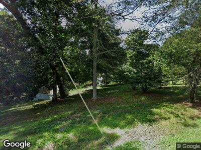
29 Plum Tree Ln Easton, CT 06612
Easton NeighborhoodEstimated Value: $809,000 - $1,184,000
5
Beds
3
Baths
4,106
Sq Ft
$258/Sq Ft
Est. Value
About This Home
This home is located at 29 Plum Tree Ln, Easton, CT 06612 and is currently estimated at $1,058,563, approximately $257 per square foot. 29 Plum Tree Ln is a home located in Fairfield County with nearby schools including Samuel Staples Elementary School, Helen Keller Middle School, and Joel Barlow High School.
Ownership History
Date
Name
Owned For
Owner Type
Purchase Details
Closed on
Sep 25, 1992
Sold by
Brew Jonathan and Brew Susan
Bought by
Reath Robert and Reath Patricia
Current Estimated Value
Purchase Details
Closed on
May 11, 1990
Sold by
Bishop John M
Bought by
Brew Johnathan C
Create a Home Valuation Report for This Property
The Home Valuation Report is an in-depth analysis detailing your home's value as well as a comparison with similar homes in the area
Home Values in the Area
Average Home Value in this Area
Purchase History
| Date | Buyer | Sale Price | Title Company |
|---|---|---|---|
| Reath Robert | $250,000 | -- | |
| Reath Robert | $250,000 | -- | |
| Reath Robert | $250,000 | -- | |
| Brew Johnathan C | $275,000 | -- |
Source: Public Records
Mortgage History
| Date | Status | Borrower | Loan Amount |
|---|---|---|---|
| Open | Miljkovic Goran | $200,000 | |
| Open | Miljkovic Goran | $570,400 | |
| Closed | Brew Johnathan C | $25,000 | |
| Closed | Brew Johnathan C | $957,000 | |
| Closed | Brew Johnathan C | $950,000 |
Source: Public Records
Tax History Compared to Growth
Tax History
| Year | Tax Paid | Tax Assessment Tax Assessment Total Assessment is a certain percentage of the fair market value that is determined by local assessors to be the total taxable value of land and additions on the property. | Land | Improvement |
|---|---|---|---|---|
| 2024 | $16,048 | $543,270 | $207,900 | $335,370 |
| 2023 | $15,733 | $543,270 | $207,900 | $335,370 |
| 2022 | $15,451 | $543,270 | $207,900 | $335,370 |
| 2021 | $15,038 | $464,860 | $190,570 | $274,290 |
| 2020 | $14,411 | $464,860 | $190,570 | $274,290 |
| 2019 | $14,564 | $464,860 | $190,570 | $274,290 |
| 2018 | $14,587 | $464,860 | $190,570 | $274,290 |
| 2017 | $15,517 | $464,860 | $190,570 | $274,290 |
| 2016 | $15,529 | $504,040 | $237,650 | $266,390 |
| 2015 | $15,313 | $504,040 | $237,650 | $266,390 |
| 2014 | $14,856 | $496,860 | $237,640 | $259,220 |
Source: Public Records
Map
Nearby Homes
- 45 Riverside Ln
- 57 Stevenson Rd
- 32 Adirondack Trail
- Lot 12 Adirondack Trail
- 5 Lawn Cir
- 11 Prospect Ave
- 142 Richfield Rd
- 107 Richfield Rd
- 6 Soundview Ave
- 376 Folino Dr
- 31 Ferndale Dr
- 65 Lance Cir
- 44 Lance Cir Unit 44
- 25 Palmer Place
- 4070 Madison Ave
- 28 Wakeley St
- 33 Frank St
- 32 Chatfield Dr
- 22 Mohawk Dr
- 47 Morningside Dr
