Estimated Value: $402,000 - $432,000
--
Bed
3
Baths
2,912
Sq Ft
$143/Sq Ft
Est. Value
About This Home
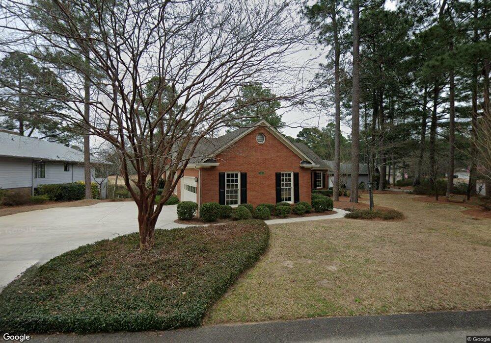
This home is located at 29 Saint Andrews Way, Aiken, SC 29803 and is currently estimated at $417,382, approximately $143 per square foot. 29 Saint Andrews Way is a home located in Aiken County with nearby schools including Aiken Elementary School, Schofield Middle School, and Aiken Intermediate School.
Ownership History
Date
Name
Owned For
Owner Type
Purchase Details
Closed on
Jul 22, 2024
Sold by
Marine Gail H and Marine Evelyn S
Bought by
Marine Family Residence Trust and Marine
Current Estimated Value
Purchase Details
Closed on
May 29, 2012
Sold by
St Johns United Methodist Ch Urch Of Aik
Bought by
Marine Gail H
Purchase Details
Closed on
Mar 26, 2012
Sold by
Estate Of Margaret C Baker
Bought by
St Johns United Methodist Church Of Aike
Purchase Details
Closed on
Dec 12, 2001
Sold by
Davis Owen G and Davis Carole Jane
Bought by
Langford Jeffrey A
Purchase Details
Closed on
Apr 14, 2000
Sold by
Baker Wayne E and Baker Margaret C
Bought by
Davis Owen G
Create a Home Valuation Report for This Property
The Home Valuation Report is an in-depth analysis detailing your home's value as well as a comparison with similar homes in the area
Home Values in the Area
Average Home Value in this Area
Purchase History
| Date | Buyer | Sale Price | Title Company |
|---|---|---|---|
| Marine Family Residence Trust | -- | None Listed On Document | |
| Marine Gail H | $240,000 | -- | |
| St Johns United Methodist Church Of Aike | -- | -- | |
| Langford Jeffrey A | $55,950 | -- | |
| Davis Owen G | $50,000 | -- |
Source: Public Records
Tax History Compared to Growth
Tax History
| Year | Tax Paid | Tax Assessment Tax Assessment Total Assessment is a certain percentage of the fair market value that is determined by local assessors to be the total taxable value of land and additions on the property. | Land | Improvement |
|---|---|---|---|---|
| 2023 | $951 | $11,480 | $1,361 | $260,150 |
| 2022 | $925 | $11,810 | $0 | $0 |
| 2021 | $927 | $11,810 | $0 | $0 |
| 2020 | $792 | $9,980 | $0 | $0 |
| 2019 | $792 | $9,980 | $0 | $0 |
| 2018 | $495 | $9,980 | $1,280 | $8,700 |
| 2017 | $753 | $0 | $0 | $0 |
| 2016 | $821 | $0 | $0 | $0 |
| 2015 | -- | $0 | $0 | $0 |
| 2014 | $722 | $0 | $0 | $0 |
| 2013 | -- | $0 | $0 | $0 |
Source: Public Records
Map
Nearby Homes
- 3 Perth Ct S
- 21 Troon Way
- 0 Troon Way Unit 216310
- 116 Cherry Hills Dr
- 153 Cherry Hills Dr
- 4 Birkdale Ct E
- 44 Troon Way
- 1713 Pine Log Rd
- 1721 Pine Log Rd
- 20 Deerwood Dr
- 1 Whitemarsh Dr
- Tbd Varden Dr
- 84 Troon Way
- 9 Whitemarsh Dr
- 11 Parkway S Unit E2
- 107 Riviera Rd
- 69 Cherry Hills Dr
- 105 Interlachen Ct SW
- 1005 Bellreive Dr
- 1749 Huntsman Dr
- 29 St Andrews Way
- 27 Saint Andrews Way
- 31 Carnoustie Ct
- 25 Saint Andrews Way
- 33 Carnoustie Ct
- 30 Carnoustie Ct
- 28 Carnoustie Ct
- 32 Carnoustie Ct
- 26 Carnoustie Ct
- 22 Saint Andrews Way
- 23 Saint Andrews Way
- 23 St Andrews Way
- 34 Carnoustie Ct
- 35 Carnoustie Ct
- 24 Carnoustie Ct
- 17 Perth Ct N
- 21 St Andrews Way
- 21 Saint Andrews Way
- 22 Carnoustie Ct
- 36 Carnoustie Ct