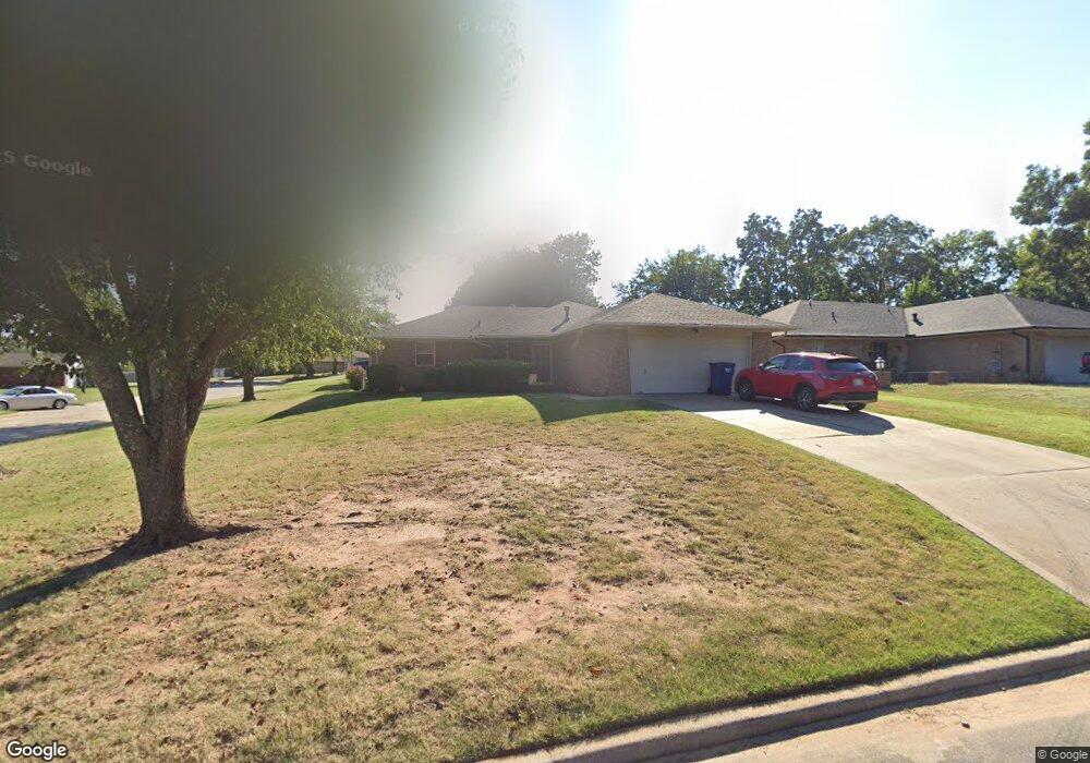
29 Sequoyah Blvd Shawnee, OK 74801
Estimated Value: $165,000 - $188,244
3
Beds
2
Baths
1,269
Sq Ft
$137/Sq Ft
Est. Value
About This Home
This home is located at 29 Sequoyah Blvd, Shawnee, OK 74801 and is currently estimated at $174,311, approximately $137 per square foot. 29 Sequoyah Blvd is a home located in Pottawatomie County with nearby schools including Sequoyah Elementary School, Shawnee Middle School, and Shawnee High School.
Ownership History
Date
Name
Owned For
Owner Type
Purchase Details
Closed on
Feb 21, 2012
Sold by
Gordon Darcie
Bought by
Gordon Marilyn
Current Estimated Value
Purchase Details
Closed on
Aug 20, 2010
Sold by
Lebund Wilma Jean and Lebund Robert Allen
Bought by
Gordon Marilyn and Gordon Darcie
Home Financials for this Owner
Home Financials are based on the most recent Mortgage that was taken out on this home.
Original Mortgage
$95,000
Outstanding Balance
$62,804
Interest Rate
4.54%
Mortgage Type
New Conventional
Estimated Equity
$111,507
Purchase Details
Closed on
Feb 3, 1995
Sold by
Rice Wilam
Bought by
Lebund Wilma
Create a Home Valuation Report for This Property
The Home Valuation Report is an in-depth analysis detailing your home's value as well as a comparison with similar homes in the area
Home Values in the Area
Average Home Value in this Area
Purchase History
| Date | Buyer | Sale Price | Title Company |
|---|---|---|---|
| Gordon Marilyn | -- | None Available | |
| Gordon Marilyn | $130,000 | None Available | |
| Lebund Wilma | -- | -- |
Source: Public Records
Mortgage History
| Date | Status | Borrower | Loan Amount |
|---|---|---|---|
| Open | Gordon Marilyn | $95,000 |
Source: Public Records
Tax History Compared to Growth
Tax History
| Year | Tax Paid | Tax Assessment Tax Assessment Total Assessment is a certain percentage of the fair market value that is determined by local assessors to be the total taxable value of land and additions on the property. | Land | Improvement |
|---|---|---|---|---|
| 2024 | $1,304 | $13,890 | $940 | $12,950 |
| 2023 | $1,304 | $13,485 | $1,200 | $12,285 |
| 2022 | $1,281 | $13,485 | $1,200 | $12,285 |
| 2021 | $1,258 | $13,485 | $1,200 | $12,285 |
| 2020 | $1,282 | $13,689 | $1,200 | $12,489 |
| 2019 | $1,370 | $14,120 | $1,200 | $12,920 |
| 2018 | $1,384 | $14,526 | $1,200 | $13,326 |
| 2017 | $1,409 | $14,958 | $1,200 | $13,758 |
| 2016 | $1,446 | $15,171 | $1,200 | $13,971 |
| 2015 | $1,373 | $14,730 | $1,200 | $13,530 |
| 2014 | $1,433 | $15,323 | $1,200 | $14,123 |
Source: Public Records
Map
Nearby Homes
- 42 Mojave Dr
- 17 Mojave Dr
- 29 Dakota Dr
- 1307 Laverne Ave
- 1410 Laverne Ave
- 2 Sequoyah Blvd
- 1301 E Independence St
- 1202 Mark St
- 1306 E Wallace St
- 711 N Cleveland Ave
- 1404 Charles Dr
- 1824 E Remington St
- 648 N Cleveland Ave
- 1210 E Independence St
- 9 Dustin Cir
- 2309 Pinehurst Ct
- 1219 E Monroe Dr
- 0 E Fay St
- 2400 Augusta
- 0 Robinwood Place