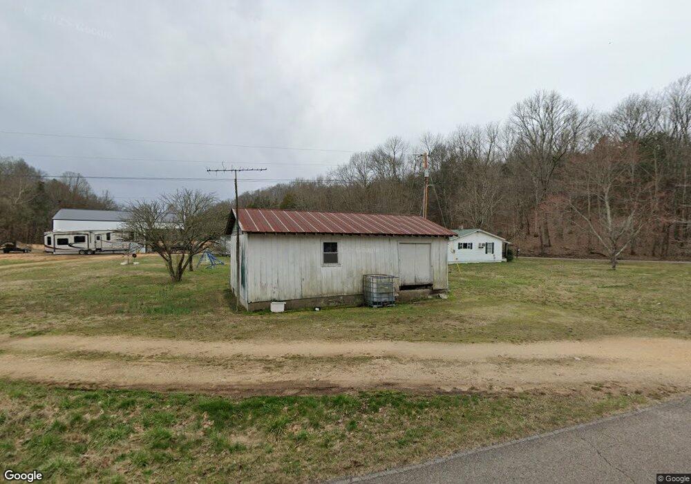
29 Smith Rd Linden, TN 37096
Estimated Value: $83,569 - $189,000
--
Bed
1
Bath
810
Sq Ft
$157/Sq Ft
Est. Value
About This Home
This home is located at 29 Smith Rd, Linden, TN 37096 and is currently estimated at $127,142, approximately $156 per square foot. 29 Smith Rd is a home located in Perry County.
Ownership History
Date
Name
Owned For
Owner Type
Purchase Details
Closed on
Apr 3, 2020
Sold by
Smith Josh Randall
Bought by
Rosson Crystal Smith
Current Estimated Value
Purchase Details
Closed on
May 28, 2010
Sold by
Smith Randall
Bought by
Smith Randall
Purchase Details
Closed on
Oct 28, 2003
Bought by
Smith Dorothy
Purchase Details
Closed on
Jul 15, 1959
Bought by
Smith Jesse W and Smith Dorothy
Create a Home Valuation Report for This Property
The Home Valuation Report is an in-depth analysis detailing your home's value as well as a comparison with similar homes in the area
Home Values in the Area
Average Home Value in this Area
Purchase History
| Date | Buyer | Sale Price | Title Company |
|---|---|---|---|
| Rosson Crystal Smith | -- | None Available | |
| Smith Randall | -- | -- | |
| Smith Josh Randall | -- | -- | |
| Smith Dorothy | $47,000 | -- | |
| Smith Jesse W | -- | -- |
Source: Public Records
Tax History Compared to Growth
Tax History
| Year | Tax Paid | Tax Assessment Tax Assessment Total Assessment is a certain percentage of the fair market value that is determined by local assessors to be the total taxable value of land and additions on the property. | Land | Improvement |
|---|---|---|---|---|
| 2025 | $320 | $23,375 | $0 | $0 |
| 2024 | $320 | $13,925 | $5,300 | $8,625 |
| 2023 | $320 | $13,925 | $5,300 | $8,625 |
| 2022 | $320 | $13,925 | $5,300 | $8,625 |
| 2021 | $320 | $13,925 | $5,300 | $8,625 |
| 2020 | $320 | $13,925 | $5,300 | $8,625 |
| 2019 | $297 | $11,975 | $5,125 | $6,850 |
| 2018 | $297 | $11,975 | $5,125 | $6,850 |
| 2017 | $293 | $11,975 | $5,125 | $6,850 |
| 2016 | $293 | $11,975 | $5,125 | $6,850 |
| 2015 | $288 | $11,975 | $5,125 | $6,850 |
| 2014 | $288 | $11,975 | $5,125 | $6,850 |
| 2013 | $277 | $11,533 | $0 | $0 |
Source: Public Records
Map
Nearby Homes
- 0 New Era Ridge Rd Unit RTC2991826
- 0 New Era Ridge Rd Unit 25219806
- 0 Sewell Branch Rd
- 3202 Lego School Rd
- 1 New Era Landing Rd
- 168 Mackin Rd
- 555 New Era Bluff Rd
- 0 New Era Landing Unit 17800450
- 0 New Era Landing Unit RTC2554791
- 351 New Era Landing Rd
- 3 Kellys Landing Rd
- 1 Kellys Landing Rd
- 2 Kellys Landing Dr
- Lot 1 Kellys Landing Rd
- Lot 3 Kellys Landing Rd
- Lot 2 Kellys Landing Rd
- 1040 Whites Creek Ln
- 0 Phillips Rd
- 91 Creekside View Ln
- 7525 Mount Carmel Rd
- 875 Mayberry Prong Rd
- 249 Cardinal Rd
- 811 Mayberry Prong Rd
- 201 Smith Rd
- 812 Mayberry Prong Rd
- 140 K B Song Ln
- 140 K B Song Ln
- 33 Cardinal Rd
- 25 Cardinal Rd
- 1115 Mayberry Prong Rd
- 0 Mayberry Prong Rd Unit 2182866
- 0 Mayberry Prong Rd Unit 2105945
- 0 Mayberry Prong Rd Unit 2011072
- 280 Mayberry Prong Rd
- 1740 Mayberry Prong Rd
- 1796 Mayberry Prong Rd
- 92 Field Dr
- 6268 Highway 128
- 1890 Mayberry Prong Rd
- 13 Mayberry Prong Rd