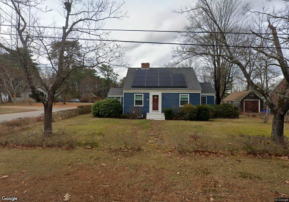
29 Sutton Ave Portsmouth, NH 03801
Estimated Value: $610,366 - $656,000
3
Beds
1
Bath
1,200
Sq Ft
$530/Sq Ft
Est. Value
About This Home
This home is located at 29 Sutton Ave, Portsmouth, NH 03801 and is currently estimated at $635,842, approximately $529 per square foot. 29 Sutton Ave is a home located in Rockingham County with nearby schools including New Franklin School, Portsmouth Middle School, and Portsmouth High School.
Ownership History
Date
Name
Owned For
Owner Type
Purchase Details
Closed on
Jun 19, 2019
Sold by
Dahlgren Carrie A
Bought by
Meade Hannah K
Current Estimated Value
Home Financials for this Owner
Home Financials are based on the most recent Mortgage that was taken out on this home.
Original Mortgage
$276,000
Outstanding Balance
$242,179
Interest Rate
4%
Mortgage Type
Adjustable Rate Mortgage/ARM
Estimated Equity
$393,663
Purchase Details
Closed on
Jan 19, 2012
Sold by
Trafton Marilyn R and Trafton Robert M
Bought by
Meade Hannah K and Dahlgren Carrie A
Create a Home Valuation Report for This Property
The Home Valuation Report is an in-depth analysis detailing your home's value as well as a comparison with similar homes in the area
Home Values in the Area
Average Home Value in this Area
Purchase History
| Date | Buyer | Sale Price | Title Company |
|---|---|---|---|
| Meade Hannah K | -- | -- | |
| Meade Hannah K | -- | -- | |
| Meade Hannah K | -- | -- | |
| Meade Hannah K | $225,000 | -- | |
| Meade Hannah K | $225,000 | -- |
Source: Public Records
Mortgage History
| Date | Status | Borrower | Loan Amount |
|---|---|---|---|
| Open | Meade Hannah K | $276,000 | |
| Closed | Meade Hannah K | $276,000 | |
| Closed | Meade Hannah K | $0 |
Source: Public Records
Tax History Compared to Growth
Tax History
| Year | Tax Paid | Tax Assessment Tax Assessment Total Assessment is a certain percentage of the fair market value that is determined by local assessors to be the total taxable value of land and additions on the property. | Land | Improvement |
|---|---|---|---|---|
| 2024 | $6,055 | $541,600 | $270,500 | $271,100 |
| 2023 | $5,229 | $324,200 | $164,000 | $160,200 |
| 2022 | $4,928 | $324,200 | $164,000 | $160,200 |
| 2021 | $4,873 | $324,200 | $164,000 | $160,200 |
| 2020 | $4,766 | $324,200 | $164,000 | $160,200 |
| 2019 | $4,818 | $324,200 | $164,000 | $160,200 |
| 2018 | $4,589 | $289,700 | $149,000 | $140,700 |
| 2017 | $4,403 | $286,300 | $149,000 | $137,300 |
| 2016 | $4,119 | $241,700 | $129,900 | $111,800 |
| 2015 | $4,058 | $241,700 | $129,900 | $111,800 |
| 2014 | $4,436 | $245,100 | $137,100 | $108,000 |
| 2013 | $4,390 | $245,100 | $137,100 | $108,000 |
| 2012 | $4,168 | $237,500 | $137,100 | $100,400 |
Source: Public Records
Map
Nearby Homes
- 7 Hall Ct
- 283 Decatur Rd
- 166 Decatur Rd
- 291 Colonial Dr
- 6 Shipwright Way
- 255 Melbourne St
- 41 Newington Rd
- 777 Middle Rd Unit 45
- 15 Woodworth Ave
- Lot 44 Sims Ave
- 1230 Islington St
- 88 Farm Ln
- 6 Boyd Rd
- 171 Echo Ave
- 224 Cate St
- 216 Woodbury Ave
- 60 Ocean Rd
- 50 Cate St Unit 4
- 150 Us Highway 1 Bypass Unit 209
- 25 Morning St
- 27 Sutton Ave
- 28 Doris Ave
- 496 Greenside Ave
- 20 Doris Ave
- 30 Sutton Ave
- 516 Greenside Ave
- 436 Sherburne Rd
- 456 Sherburne Rd
- 470 Greenside Ave
- 422 Sherburne Rd
- 21 Sutton Ave
- 460 Sherburne Rd
- 455 Greenside Ave
- 540 Greenside Ave
- 450 Greenside Ave
- 29 Doris Ave
- 445 Greenside Ave
- 24 Sutton Ave
- 19 Doris Ave
- 576 Greenside Ave