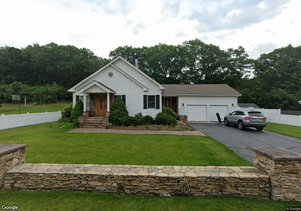
29 Svenson Rd Shrewsbury, MA 01545
Estimated Value: $458,000 - $675,000
3
Beds
1
Bath
1,811
Sq Ft
$324/Sq Ft
Est. Value
About This Home
This home is located at 29 Svenson Rd, Shrewsbury, MA 01545 and is currently estimated at $586,960, approximately $324 per square foot. 29 Svenson Rd is a home located in Worcester County with nearby schools including Calvin Coolidge Elementary School, Sherwood Middle School, and Oak Middle School.
Ownership History
Date
Name
Owned For
Owner Type
Purchase Details
Closed on
Aug 28, 1996
Sold by
Gonnella Michael A and Gonnella Elena
Bought by
Nikos Ana and Beka Dhimiter
Current Estimated Value
Home Financials for this Owner
Home Financials are based on the most recent Mortgage that was taken out on this home.
Original Mortgage
$65,500
Interest Rate
8.18%
Mortgage Type
Purchase Money Mortgage
Purchase Details
Closed on
Oct 26, 1990
Sold by
Lally Yolanda E
Bought by
Gonnella Michael A
Create a Home Valuation Report for This Property
The Home Valuation Report is an in-depth analysis detailing your home's value as well as a comparison with similar homes in the area
Home Values in the Area
Average Home Value in this Area
Purchase History
| Date | Buyer | Sale Price | Title Company |
|---|---|---|---|
| Nikos Ana | $125,500 | -- | |
| Nikos Ana | $125,500 | -- | |
| Gonnella Michael A | $120,000 | -- |
Source: Public Records
Mortgage History
| Date | Status | Borrower | Loan Amount |
|---|---|---|---|
| Open | Gonnella Michael A | $146,000 | |
| Closed | Gonnella Michael A | $65,500 | |
| Previous Owner | Gonnella Michael A | $117,000 |
Source: Public Records
Tax History Compared to Growth
Tax History
| Year | Tax Paid | Tax Assessment Tax Assessment Total Assessment is a certain percentage of the fair market value that is determined by local assessors to be the total taxable value of land and additions on the property. | Land | Improvement |
|---|---|---|---|---|
| 2025 | $74 | $612,100 | $238,800 | $373,300 |
| 2024 | $7,360 | $594,500 | $227,500 | $367,000 |
| 2023 | $6,477 | $493,700 | $227,500 | $266,200 |
| 2022 | $5,971 | $423,200 | $197,800 | $225,400 |
| 2021 | $4,995 | $378,700 | $183,900 | $194,800 |
| 2020 | $4,580 | $367,300 | $197,800 | $169,500 |
| 2019 | $4,242 | $337,500 | $170,500 | $167,000 |
| 2018 | $4,125 | $325,800 | $156,300 | $169,500 |
| 2017 | $3,921 | $305,600 | $141,500 | $164,100 |
| 2016 | $3,814 | $293,400 | $132,500 | $160,900 |
| 2015 | $3,637 | $275,500 | $114,600 | $160,900 |
Source: Public Records
Map
Nearby Homes
- 26 Browne Rd
- 40 Shrewsbury Green Dr Unit A
- 22 Shrewsbury Green Dr Unit C
- 10 Gleason Rd
- 73 S Quinsigamond Ave
- 6 Selina St
- 105 S Quinsigamond Ave
- 135 Lake Ave
- 67 N Quinsigamond Ave Unit 23
- 40 Phillips Ave
- 315 Maple Ave
- 96 Lake Ave
- 15 Eagle Dr
- 190 S Quinsigamond Ave Unit 102
- 65 Lake Ave Unit 831
- 65 Lake Ave Unit 1008
- 7 Tern Dr
- 175 Oak St
- 22 Sherbrook Ave
- 241 Lake Ave
- 31 Svenson Rd
- 25 Svenson Rd
- 12 Hancock St
- 28 Svenson Rd Unit B
- 28 Svenson Rd Unit A
- 28A Svenson Rd
- 28A Svenson Rd Unit 28 A
- 40 Svenson Rd
- 10 Hancock St
- 20 Hancock St Unit 22
- 21 Svenson Rd
- 36 Sterling St
- 42 Svenson Rd Unit 44
- 8 Hancock St
- 11 Power Ave
- 13 Hancock St Unit 17
- 7 Power Ave
- 19 Hancock St
- 24 Hancock St Unit 26
- 17 Svenson Rd