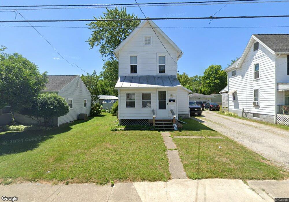
29 W 13th St Ashland, OH 44805
Estimated Value: $103,000 - $114,000
2
Beds
1
Bath
1,084
Sq Ft
$100/Sq Ft
Est. Value
About This Home
This home is located at 29 W 13th St, Ashland, OH 44805 and is currently estimated at $108,834, approximately $100 per square foot. 29 W 13th St is a home located in Ashland County with nearby schools including Ashland High School, Ashland County Community Academy, and St. Edward Elementary School.
Ownership History
Date
Name
Owned For
Owner Type
Purchase Details
Closed on
Jul 17, 2024
Sold by
Arrow Properties Limited and Arrow Properties Ltd
Bought by
Arrow First Ltd
Current Estimated Value
Purchase Details
Closed on
Jul 9, 2015
Sold by
Bank Of America Na
Bought by
Arrow Properties Ltd
Purchase Details
Closed on
Jul 1, 2009
Bought by
Conner Curt C
Purchase Details
Closed on
Apr 10, 2009
Sold by
Worstall Mark S
Purchase Details
Closed on
Jun 30, 2006
Bought by
Worstall Mark S
Purchase Details
Closed on
May 29, 2001
Sold by
Rogers Judy E
Purchase Details
Closed on
Jan 1, 1990
Bought by
Rogers Judy E
Create a Home Valuation Report for This Property
The Home Valuation Report is an in-depth analysis detailing your home's value as well as a comparison with similar homes in the area
Home Values in the Area
Average Home Value in this Area
Purchase History
| Date | Buyer | Sale Price | Title Company |
|---|---|---|---|
| Arrow First Ltd | -- | None Listed On Document | |
| Arrow Properties Ltd | -- | -- | |
| Conner Curt C | $20,000 | -- | |
| -- | $32,700 | -- | |
| Worstall Mark S | $63,000 | -- | |
| -- | $45,000 | -- | |
| Rogers Judy E | -- | -- |
Source: Public Records
Tax History Compared to Growth
Tax History
| Year | Tax Paid | Tax Assessment Tax Assessment Total Assessment is a certain percentage of the fair market value that is determined by local assessors to be the total taxable value of land and additions on the property. | Land | Improvement |
|---|---|---|---|---|
| 2024 | $702 | $19,770 | $5,680 | $14,090 |
| 2023 | $702 | $19,770 | $5,680 | $14,090 |
| 2022 | $684 | $15,210 | $4,370 | $10,840 |
| 2021 | $687 | $15,210 | $4,370 | $10,840 |
| 2020 | $652 | $15,210 | $4,370 | $10,840 |
| 2019 | $490 | $10,540 | $4,580 | $5,960 |
| 2018 | $494 | $10,540 | $4,580 | $5,960 |
| 2017 | $496 | $10,540 | $4,580 | $5,960 |
| 2016 | $451 | $9,160 | $3,980 | $5,180 |
| 2015 | $447 | $9,160 | $3,980 | $5,180 |
| 2013 | $353 | $7,000 | $4,460 | $2,540 |
Source: Public Records
Map
Nearby Homes