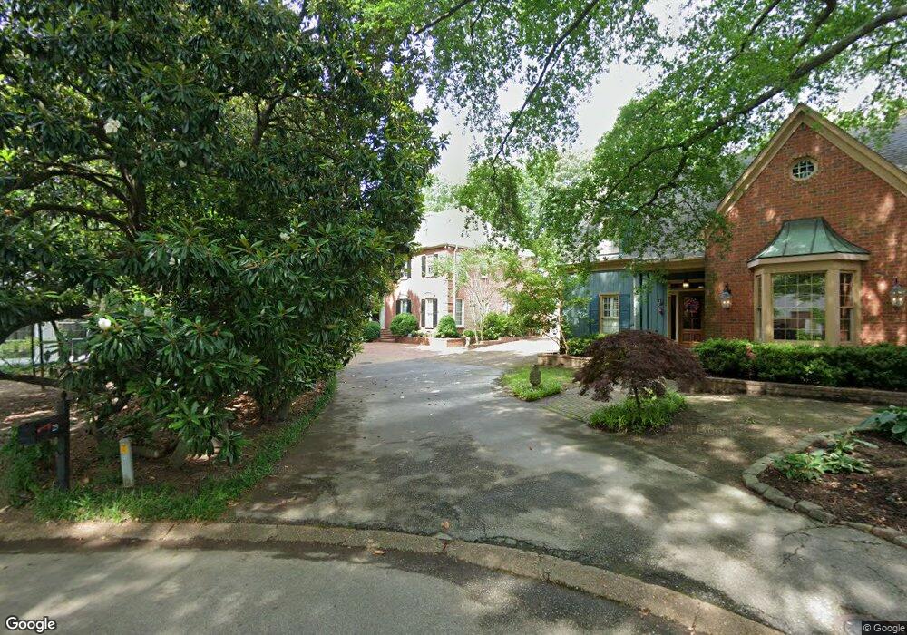
29 Walnut Grove Ct Memphis, TN 38117
Audubon Park NeighborhoodEstimated Value: $702,000 - $874,000
5
Beds
5
Baths
5,270
Sq Ft
$150/Sq Ft
Est. Value
About This Home
This home is located at 29 Walnut Grove Ct, Memphis, TN 38117 and is currently estimated at $789,738, approximately $149 per square foot. 29 Walnut Grove Ct is a home located in Shelby County with nearby schools including White Station Elementary School, White Station High, and White Station Middle.
Ownership History
Date
Name
Owned For
Owner Type
Purchase Details
Closed on
Feb 16, 2011
Sold by
Harris Michael J
Bought by
Harris Pamela D
Current Estimated Value
Purchase Details
Closed on
Dec 16, 2005
Sold by
Cumbelich Leo W
Bought by
Harris Michael D and Harris Pamela D
Home Financials for this Owner
Home Financials are based on the most recent Mortgage that was taken out on this home.
Original Mortgage
$200,000
Outstanding Balance
$111,901
Interest Rate
6.29%
Mortgage Type
Fannie Mae Freddie Mac
Estimated Equity
$677,837
Purchase Details
Closed on
Nov 30, 1998
Sold by
Cumbelich Belinda K
Bought by
Cumbelich Leo W
Create a Home Valuation Report for This Property
The Home Valuation Report is an in-depth analysis detailing your home's value as well as a comparison with similar homes in the area
Home Values in the Area
Average Home Value in this Area
Purchase History
| Date | Buyer | Sale Price | Title Company |
|---|---|---|---|
| Harris Pamela D | -- | None Available | |
| Harris Michael D | $652,000 | -- | |
| Cumbelich Leo W | -- | -- |
Source: Public Records
Mortgage History
| Date | Status | Borrower | Loan Amount |
|---|---|---|---|
| Open | Harris Michael D | $200,000 |
Source: Public Records
Tax History Compared to Growth
Tax History
| Year | Tax Paid | Tax Assessment Tax Assessment Total Assessment is a certain percentage of the fair market value that is determined by local assessors to be the total taxable value of land and additions on the property. | Land | Improvement |
|---|---|---|---|---|
| 2025 | $5,031 | $168,800 | $23,625 | $145,175 |
| 2024 | $5,031 | $148,400 | $23,625 | $124,775 |
| 2023 | $9,040 | $148,400 | $23,625 | $124,775 |
| 2022 | $9,040 | $148,400 | $23,625 | $124,775 |
| 2021 | $9,146 | $148,400 | $23,625 | $124,775 |
| 2020 | $8,574 | $118,325 | $23,625 | $94,700 |
| 2019 | $8,574 | $118,325 | $23,625 | $94,700 |
| 2018 | $8,574 | $118,325 | $23,625 | $94,700 |
| 2017 | $4,863 | $118,325 | $23,625 | $94,700 |
| 2016 | $5,116 | $117,075 | $0 | $0 |
| 2014 | $5,116 | $117,075 | $0 | $0 |
Source: Public Records
Map
Nearby Homes
- 4679 Walnut Grove Rd
- 137 Perkins Extension
- 4723 Normandy Ln
- 4798 Normandy Ln
- 154 Perkins Extension
- 105 Grove Park Cir
- 4772 Gwynne Rd
- 4501 Minden Rd
- 131 N Mendenhall Rd
- 196 E Cherry Cir
- 427 S Perkins Rd Unit 427-2
- 135 Cherry Rd
- 4859 Gwynne Rd
- 4640 Chickasaw Rd
- 150 Waring Rd
- 4348 Gwynne Rd
- 180 Waring Rd
- 271 Wakefield Dr
- 4654 Hemlock Ln
- 4975 Brookwood Cove
- 33 Walnut Grove Ct
- 21 Walnut Grove Ct
- 37 Walnut Grove Ct
- 25 Walnut Grove Ct
- 13 Walnut Grove Ct
- 17 Walnut Grove Ct
- 0 Walnut Grove Ct
- 5 Walnut Grove Ct
- 4641 Normandy Ave
- 4649 Normandy Ave
- 4631 Normandy Ave
- 4661 Normandy Ave
- 4695 Walnut Grove Rd
- 90 N Perkins Rd
- 4677 Normandy Ave
- 4691 Normandy Ave
- 4585 Walnut Grove Rd
- 46 S Perkins Rd
- 4699 Normandy Ave
- 4715 Walnut Grove Rd