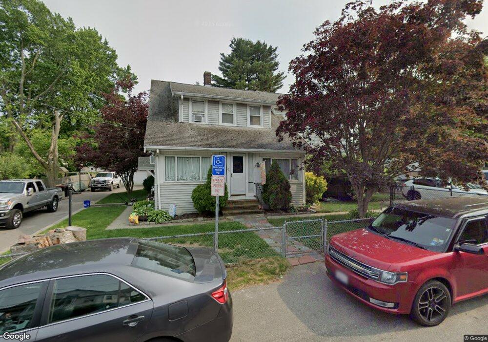
29 Watson St Brockton, MA 02301
Campello NeighborhoodEstimated Value: $514,769 - $553,000
4
Beds
2
Baths
2,372
Sq Ft
$226/Sq Ft
Est. Value
About This Home
This home is located at 29 Watson St, Brockton, MA 02301 and is currently estimated at $536,692, approximately $226 per square foot. 29 Watson St is a home located in Plymouth County with nearby schools including Gilmore Elementary School, Davis K-8 School, and John F. Kennedy Elementary School.
Ownership History
Date
Name
Owned For
Owner Type
Purchase Details
Closed on
Apr 22, 2021
Sold by
Kondroski Cheryl A and Kondroski Andrew T
Bought by
Kondroski Cheryl A and Kondroski Andrew T
Current Estimated Value
Home Financials for this Owner
Home Financials are based on the most recent Mortgage that was taken out on this home.
Original Mortgage
$240,000
Interest Rate
2.9%
Mortgage Type
New Conventional
Purchase Details
Closed on
Mar 23, 2021
Sold by
Kondroski Cheryl A and Kondroski Andrew T
Bought by
Kondroski Andrew T and Kondroski Cheryl A
Home Financials for this Owner
Home Financials are based on the most recent Mortgage that was taken out on this home.
Original Mortgage
$240,000
Interest Rate
2.9%
Mortgage Type
New Conventional
Purchase Details
Closed on
Dec 23, 2014
Sold by
Kondroski Cheryl A and Kondroski Andrew T
Bought by
Kondroski Cheryl A and Kondroski Andrew T
Purchase Details
Closed on
Apr 18, 2006
Sold by
Cheryl Rt and Kondroski
Bought by
Kondroski Andrew T
Home Financials for this Owner
Home Financials are based on the most recent Mortgage that was taken out on this home.
Original Mortgage
$210,000
Interest Rate
6.28%
Mortgage Type
Purchase Money Mortgage
Create a Home Valuation Report for This Property
The Home Valuation Report is an in-depth analysis detailing your home's value as well as a comparison with similar homes in the area
Home Values in the Area
Average Home Value in this Area
Purchase History
| Date | Buyer | Sale Price | Title Company |
|---|---|---|---|
| Kondroski Cheryl A | -- | None Available | |
| Kondroski Andrew T | -- | None Available | |
| Kondroski Cheryl A | -- | -- | |
| Kondroski Cheryl A | -- | -- | |
| Kondroski Andrew T | -- | -- |
Source: Public Records
Mortgage History
| Date | Status | Borrower | Loan Amount |
|---|---|---|---|
| Previous Owner | Kondroski Andrew T | $240,000 | |
| Previous Owner | Kondroski Andrew T | $20,000 | |
| Previous Owner | Kondroski Andrew T | $210,000 |
Source: Public Records
Tax History
| Year | Tax Paid | Tax Assessment Tax Assessment Total Assessment is a certain percentage of the fair market value that is determined by local assessors to be the total taxable value of land and additions on the property. | Land | Improvement |
|---|---|---|---|---|
| 2025 | $4,888 | $403,600 | $140,900 | $262,700 |
| 2024 | $4,778 | $397,500 | $140,900 | $256,600 |
| 2023 | $4,604 | $354,700 | $108,300 | $246,400 |
| 2022 | $4,658 | $333,400 | $98,500 | $234,900 |
| 2021 | $4,412 | $304,300 | $82,700 | $221,600 |
| 2020 | $4,287 | $283,000 | $76,600 | $206,400 |
| 2019 | $3,876 | $249,400 | $74,500 | $174,900 |
| 2018 | $3,878 | $241,500 | $74,500 | $167,000 |
| 2017 | $3,784 | $235,000 | $74,500 | $160,500 |
| 2016 | $3,482 | $200,600 | $72,500 | $128,100 |
| 2015 | $3,013 | $166,000 | $72,500 | $93,500 |
| 2014 | $3,091 | $170,500 | $72,500 | $98,000 |
Source: Public Records
Map
Nearby Homes
- 35 Longworth Ave Unit 25
- 25 Longworth Ave Unit 4
- 15 Longworth Ave Unit 226
- 9 Longworth Ave Unit 135
- 15 Market St
- 26 South St
- 34 South St
- 326 Copeland St
- 223 Clinton St Unit 16
- 47 Southworth St
- 115 Market St
- 23 E Chestnut St
- 24 E Chestnut St
- 41 Riverview St
- 60 Tremont St
- 25 Tremont St
- 65 Tremont St
- 12 Finny's Way
- 111 Riverview St
- 549 Summer St
- 35 Watson St
- 19 Watson St
- 30 Holmes St
- 30 Holmes St Unit 1st floor
- 24 Holmes St
- 39 Watson St
- 39 Watson St Unit 2
- 39 Watson St Unit 1
- 34 Holmes St
- 26 Watson St
- 16 Holmes St
- 30 Watson St
- 13 Watson St
- 24 Watson St
- 10 Watson St
- 18 Watson St
- 20 Watson St Unit 2
- 20 Watson St Unit 1
- 18 Watson St Unit 3
- 18 Watson St Unit 2
Your Personal Tour Guide
Ask me questions while you tour the home.