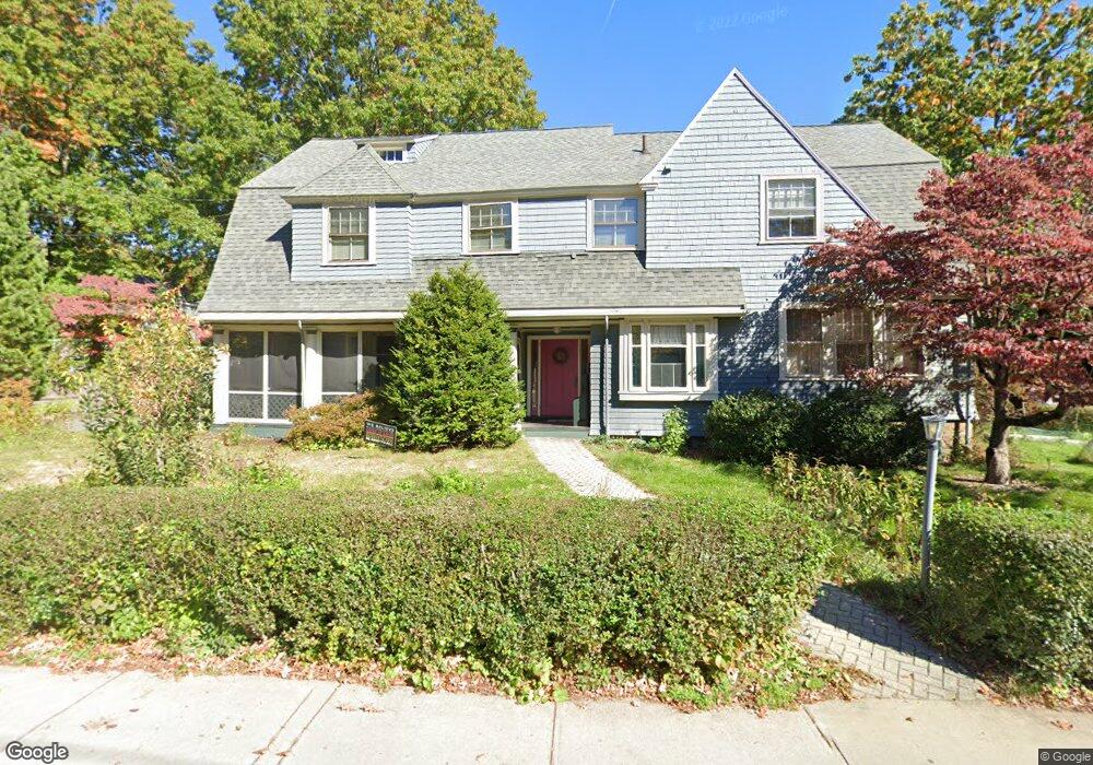
29 Williston Rd Brookline, MA 02445
Washington Square NeighborhoodEstimated Value: $2,720,581 - $3,079,000
7
Beds
3
Baths
3,787
Sq Ft
$772/Sq Ft
Est. Value
About This Home
This home is located at 29 Williston Rd, Brookline, MA 02445 and is currently estimated at $2,925,145, approximately $772 per square foot. 29 Williston Rd is a home located in Norfolk County with nearby schools including Michael Driscoll, Brookline High School, and Boston Green Academy Horace Mann Charter School.
Ownership History
Date
Name
Owned For
Owner Type
Purchase Details
Closed on
Apr 5, 1994
Sold by
Ge Capital Mtg Svc Inc
Bought by
Rabe Frank T
Current Estimated Value
Purchase Details
Closed on
Dec 6, 1993
Sold by
Lopoukhine Andre
Bought by
Ge Cap Mtg Svcs Inc
Purchase Details
Closed on
Sep 25, 1989
Sold by
Pitkin Wm
Bought by
Lopoukhine Andre
Create a Home Valuation Report for This Property
The Home Valuation Report is an in-depth analysis detailing your home's value as well as a comparison with similar homes in the area
Home Values in the Area
Average Home Value in this Area
Purchase History
| Date | Buyer | Sale Price | Title Company |
|---|---|---|---|
| Rabe Frank T | $520,000 | -- | |
| Ge Cap Mtg Svcs Inc | $374,000 | -- | |
| Lopoukhine Andre | $545,000 | -- |
Source: Public Records
Mortgage History
| Date | Status | Borrower | Loan Amount |
|---|---|---|---|
| Open | Lopoukhine Andre | $100,000 | |
| Open | Lopoukhine Andre | $181,000 | |
| Closed | Lopoukhine Andre | $220,000 |
Source: Public Records
Tax History
| Year | Tax Paid | Tax Assessment Tax Assessment Total Assessment is a certain percentage of the fair market value that is determined by local assessors to be the total taxable value of land and additions on the property. | Land | Improvement |
|---|---|---|---|---|
| 2025 | $25,162 | $2,549,300 | $1,575,800 | $973,500 |
| 2024 | $23,911 | $2,447,400 | $1,515,200 | $932,200 |
| 2023 | $23,770 | $2,384,200 | $1,402,100 | $982,100 |
| 2022 | $23,138 | $2,270,700 | $1,335,400 | $935,300 |
| 2021 | $21,396 | $2,183,300 | $1,284,000 | $899,300 |
| 2020 | $19,405 | $2,053,400 | $1,167,300 | $886,100 |
| 2019 | $18,324 | $1,955,600 | $1,111,700 | $843,900 |
| 2018 | $15,253 | $1,612,400 | $783,300 | $829,100 |
| 2017 | $15,028 | $1,521,100 | $738,900 | $782,200 |
| 2016 | $13,614 | $1,306,500 | $575,400 | $731,100 |
| 2015 | $12,898 | $1,207,700 | $537,800 | $669,900 |
| 2014 | $12,752 | $1,119,600 | $488,900 | $630,700 |
Source: Public Records
Map
Nearby Homes
- 9 Downing Rd
- 757 Washington St Unit 2
- 45 Bartlett Crescent Unit 402
- 45 Bartlett Crescent Unit 404
- 45 Bartlett Crescent Unit 302
- 45 Bartlett Crescent Unit 401
- 45 Bartlett Crescent Unit 101
- 45 Bartlett Crescent Unit 203
- 45 Bartlett Crescent Unit 105
- 33 Westbourne Terrace Unit 4
- 195 Winthrop Rd Unit 1
- 19 Westbourne Terrace Unit 2
- 1620 Beacon St
- 1618 Beacon St Unit 1
- 15 University Rd Unit C
- 1778 Beacon St Unit 302
- 315 Tappan St Unit 4
- 20 Claflin Rd Unit A
- 311 Allston St Unit 11
- 309 Allston St Unit 6
- 51 Salisbury Rd
- 30 Williston Rd
- 47 Salisbury Rd
- 60 Evans Rd
- 71 Salisbury Rd
- 52 Salisbury Rd
- 52 Salisbury Rd Unit Short Term
- 52 Salisbury Rd Unit House
- 52 Salisbury Rd Unit 52
- 72 Salisbury Rd
- 40 Evans Rd
- 77 Salisbury Rd
- 43 Salisbury Rd
- 18 Williston Rd
- 36 Evans Rd
- 66 Evans Rd
- 37 Evans Rd
- 37 Salisbury Rd
- 40 Salisbury Rd
- 74 Salisbury Rd
Your Personal Tour Guide
Ask me questions while you tour the home.