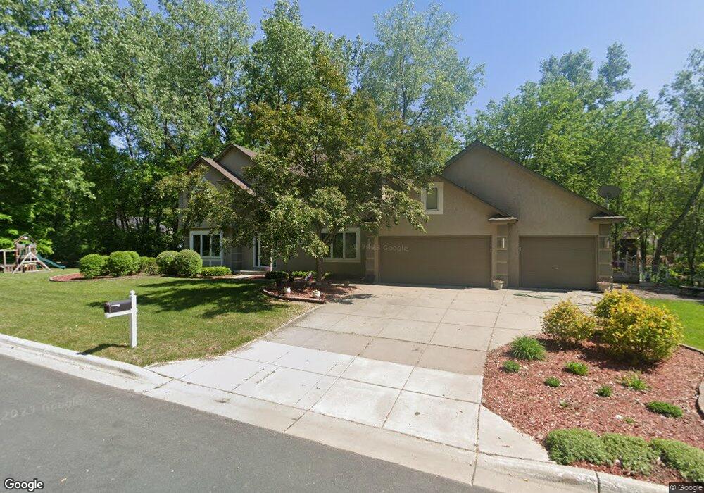
290 290 Sherwood Ct West St. Paul, MN 55118
Estimated Value: $725,000 - $807,000
3
Beds
3
Baths
2,680
Sq Ft
$283/Sq Ft
Est. Value
About This Home
This home is located at 290 290 Sherwood Ct, West St. Paul, MN 55118 and is currently estimated at $758,762, approximately $283 per square foot. 290 290 Sherwood Ct is a home located in Dakota County with nearby schools including Garlough Environmental Magnet, Friendly Hills Middle School, and Two Rivers High School.
Ownership History
Date
Name
Owned For
Owner Type
Purchase Details
Closed on
Aug 1, 2012
Sold by
Moran Emerson Megan B and Emerson Steven J
Bought by
Lang Jenna L Marfori and Lang Erik
Current Estimated Value
Home Financials for this Owner
Home Financials are based on the most recent Mortgage that was taken out on this home.
Original Mortgage
$341,000
Outstanding Balance
$236,007
Interest Rate
3.65%
Mortgage Type
New Conventional
Estimated Equity
$522,755
Purchase Details
Closed on
Jul 30, 2010
Sold by
John R Haugh Revocable Trust
Bought by
Moran Emerson Megan B and Emerson Steven J
Purchase Details
Closed on
Apr 22, 1996
Sold by
Spennewyn Keith
Bought by
Angela Haugh J Robert
Create a Home Valuation Report for This Property
The Home Valuation Report is an in-depth analysis detailing your home's value as well as a comparison with similar homes in the area
Home Values in the Area
Average Home Value in this Area
Purchase History
| Date | Buyer | Sale Price | Title Company |
|---|---|---|---|
| Lang Jenna L Marfori | $359,000 | Partners Title Of North Subu | |
| Moran Emerson Megan B | $350,000 | Burnet Title | |
| Angela Haugh J Robert | $279,000 | -- |
Source: Public Records
Mortgage History
| Date | Status | Borrower | Loan Amount |
|---|---|---|---|
| Open | Lang Jenna L Marfori | $341,000 |
Source: Public Records
Tax History Compared to Growth
Tax History
| Year | Tax Paid | Tax Assessment Tax Assessment Total Assessment is a certain percentage of the fair market value that is determined by local assessors to be the total taxable value of land and additions on the property. | Land | Improvement |
|---|---|---|---|---|
| 2024 | $10,070 | $666,400 | $172,300 | $494,100 |
| 2023 | $10,070 | $681,000 | $182,500 | $498,500 |
| 2022 | $9,014 | $609,900 | $181,800 | $428,100 |
| 2021 | $8,628 | $573,200 | $158,100 | $415,100 |
| 2020 | $8,560 | $543,000 | $150,600 | $392,400 |
| 2019 | $8,442 | $523,100 | $143,400 | $379,700 |
| 2018 | $7,063 | $490,800 | $134,100 | $356,700 |
| 2017 | $5,402 | $409,300 | $127,700 | $281,600 |
| 2016 | $5,426 | $376,400 | $116,100 | $260,300 |
| 2015 | $5,127 | $374,889 | $112,933 | $261,956 |
| 2014 | -- | $343,061 | $103,931 | $239,130 |
| 2013 | -- | $316,901 | $95,100 | $221,801 |
Source: Public Records
Map
Nearby Homes
- 2012 Pine Ridge Dr
- 492 Deer Run Trail
- 485 Preserve Path
- 2122 Delaware Ave
- 2148 Delaware Ave
- 2194 Charlton Rd
- 25 W Kraft Rd
- 8XX Humboldt Ave
- 600 Sibley Ct
- 180 Wentworth Ave W Unit E
- 1620 Charlton St Unit 109
- 170 Wentworth Ave W Unit F
- 357 Salem Church Rd
- 1912 South Ln
- 614 Hidden Creek Trail
- 1513 Smith Ave S
- 685 Hidden Creek Trail
- 255 Westview Dr Unit 305
- 260 Salem Church Rd
- 1774 Dodd Rd
- 290 290 Sherwood-Court-
- 290 Sherwood Ct
- 300 Edgewood Ln
- 269 269 Sherwood Ct
- 311 Sherwood Ct
- 280 Edgewood Ln
- 300 Sherwood Ct
- 1964 Charlton St
- 282 Sherwood Ct
- 300 Sherwood Ct
- 273 Sherwood Ct
- 312 Sherwood Ct
- 260 Edgewood Ln
- 269 Sherwood Ct
- 1974 Charlton St
- 270 Sherwood Ct
- 265 Sherwood Ct
- 1974 Charlton St
- 325 Sherwood Ct
- 1960 Charlton St