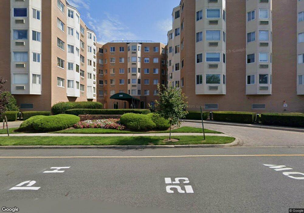
The Somerset 290 Anderson St Hackensack, NJ 07601
Estimated Value: $486,000
--
Bed
--
Bath
1,170
Sq Ft
$415/Sq Ft
Est. Value
About This Home
This home is located at 290 Anderson St, Hackensack, NJ 07601 and is currently estimated at $486,000, approximately $415 per square foot. 290 Anderson St is a home located in Bergen County with nearby schools including Hackensack High School and Bergen County Christian Academy.
Ownership History
Date
Name
Owned For
Owner Type
Purchase Details
Closed on
Apr 9, 2025
Sold by
Ferrer Marcus
Bought by
Hoffman Timothy John and Hoffman Casey Lynn
Current Estimated Value
Home Financials for this Owner
Home Financials are based on the most recent Mortgage that was taken out on this home.
Original Mortgage
$326,250
Outstanding Balance
$324,501
Interest Rate
6.63%
Mortgage Type
New Conventional
Estimated Equity
$161,499
Purchase Details
Closed on
Aug 6, 2019
Sold by
Callison Andrea
Bought by
Ferrer Marcus
Home Financials for this Owner
Home Financials are based on the most recent Mortgage that was taken out on this home.
Original Mortgage
$236,700
Interest Rate
3.7%
Mortgage Type
New Conventional
Purchase Details
Closed on
Jun 11, 2008
Sold by
Upadhyay Madhuja and Rawal Vikram C
Bought by
Callison Andrea
Purchase Details
Closed on
Oct 3, 2003
Sold by
Yakoob Mohamed
Bought by
Upadhay Madhuja and Rawal Vikram
Home Financials for this Owner
Home Financials are based on the most recent Mortgage that was taken out on this home.
Original Mortgage
$19,200
Interest Rate
5.98%
Purchase Details
Closed on
Aug 2, 2002
Sold by
Rodriguez Dorothy L
Bought by
Yakoob Mohamed S
Home Financials for this Owner
Home Financials are based on the most recent Mortgage that was taken out on this home.
Original Mortgage
$172,000
Interest Rate
6.58%
Purchase Details
Closed on
Aug 16, 2001
Sold by
Fisher Jack
Bought by
Rodriguez Dorothy L
Home Financials for this Owner
Home Financials are based on the most recent Mortgage that was taken out on this home.
Original Mortgage
$167,600
Interest Rate
6.99%
Purchase Details
Closed on
Aug 21, 2000
Bought by
Fisher Jack
Home Financials for this Owner
Home Financials are based on the most recent Mortgage that was taken out on this home.
Original Mortgage
$8,000
Interest Rate
7.83%
Create a Home Valuation Report for This Property
The Home Valuation Report is an in-depth analysis detailing your home's value as well as a comparison with similar homes in the area
Home Values in the Area
Average Home Value in this Area
Purchase History
| Date | Buyer | Sale Price | Title Company |
|---|---|---|---|
| Hoffman Timothy John | $435,000 | Stewart Title | |
| Hoffman Timothy John | $435,000 | Stewart Title | |
| Ferrer Marcus | $263,000 | -- | |
| Callison Andrea | $295,000 | -- | |
| Upadhay Madhuja | $240,000 | -- | |
| Yakoob Mohamed S | $215,000 | -- | |
| Rodriguez Dorothy L | $176,500 | -- | |
| Fisher Jack | -- | -- | |
| Fisher Jack | -- | -- |
Source: Public Records
Mortgage History
| Date | Status | Borrower | Loan Amount |
|---|---|---|---|
| Open | Hoffman Timothy John | $326,250 | |
| Closed | Hoffman Timothy John | $326,250 | |
| Previous Owner | Ferrer Marcus | $236,700 | |
| Previous Owner | Upadhay Madhuja | $19,200 | |
| Previous Owner | Yakoob Mohamed S | $172,000 | |
| Previous Owner | Rodriguez Dorothy L | $167,600 | |
| Previous Owner | Fisher Jack | $8,000 |
Source: Public Records
Tax History Compared to Growth
Tax History
| Year | Tax Paid | Tax Assessment Tax Assessment Total Assessment is a certain percentage of the fair market value that is determined by local assessors to be the total taxable value of land and additions on the property. | Land | Improvement |
|---|---|---|---|---|
| 2025 | $7,988 | $261,400 | $122,500 | $138,900 |
| 2024 | $7,526 | $261,400 | $122,500 | $138,900 |
| 2023 | $7,249 | $261,400 | $122,500 | $138,900 |
| 2022 | $7,249 | $258,700 | $120,000 | $138,700 |
| 2021 | $7,780 | $231,700 | $115,000 | $116,700 |
| 2020 | $7,667 | $231,700 | $115,000 | $116,700 |
| 2019 | $7,533 | $224,400 | $113,000 | $111,400 |
| 2018 | $7,618 | $223,200 | $112,000 | $111,200 |
| 2017 | $7,872 | $230,500 | $110,000 | $120,500 |
| 2016 | $7,405 | $219,200 | $100,000 | $119,200 |
| 2015 | $8,600 | $245,700 | $81,100 | $164,600 |
| 2014 | $8,162 | $245,700 | $81,100 | $164,600 |
Source: Public Records
About The Somerset
Map
Nearby Homes
- 309 Lookout Ave
- 245 Anderson St Unit 4I
- 245 Anderson St Unit 3A
- 303 Hamilton Place Unit D4
- 240 Hamilton Place
- 258 Clinton Place
- 131 Clinton Place Unit 314
- 25 Grand Ave Unit 7B
- 290 Clinton Place
- 395 2nd St
- 140 Euclid Ave Unit 1H
- 140 Euclid Ave Unit 2F
- 140 Euclid Ave Unit 4G
- 378 Lookout Ave
- 467 Summit Ave
- 403 Summit Ave
- 127 Poplar Ave
- 5 Linden St Unit 2C
- 5 Linden St Unit 3C
- 344 Prospect Ave Unit 4C
- 290 Anderson St Unit C005F
- 290 Anderson St
- 290 Anderson St Unit C006K
- 290 Anderson St
- 290 Anderson St
- 290 Anderson St Unit 5C
- 290 Anderson St Unit C004J
- 290 Anderson St
- 290 Anderson St
- 290 Anderson St
- 290 Anderson St
- 290 Anderson St
- 290 Anderson St
- 290 Anderson St
- 290 Anderson St
- 290 Anderson St
- 290 Anderson St
- 290 Anderson St
- 290 Anderson St
- 290 Anderson St