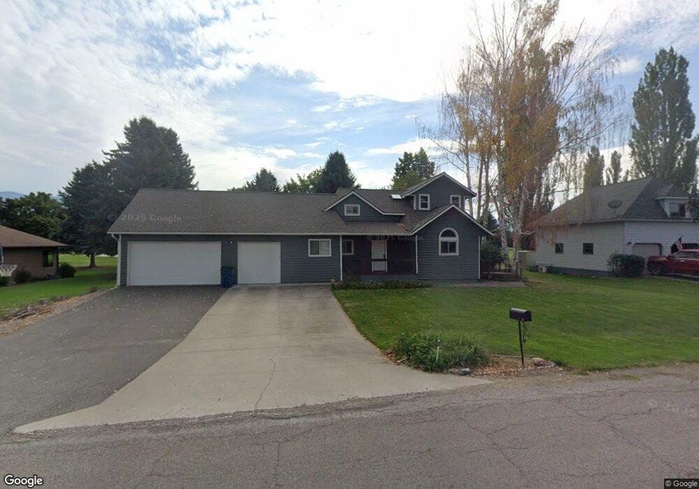
290 Bayview Dr Polson, MT 59860
Estimated Value: $550,000 - $593,000
3
Beds
3
Baths
1,853
Sq Ft
$308/Sq Ft
Est. Value
About This Home
This home is located at 290 Bayview Dr, Polson, MT 59860 and is currently estimated at $569,909, approximately $307 per square foot. 290 Bayview Dr is a home located in Lake County with nearby schools including Cherry Valley School, Linderman Elementary School, and Polson Middle School (7-8).
Ownership History
Date
Name
Owned For
Owner Type
Purchase Details
Closed on
Jul 11, 2018
Sold by
Bergren Terrance J and Bergren Bernice K
Bought by
Milton Cameron and Milton Brittany
Current Estimated Value
Home Financials for this Owner
Home Financials are based on the most recent Mortgage that was taken out on this home.
Original Mortgage
$242,400
Outstanding Balance
$210,076
Interest Rate
4.5%
Mortgage Type
New Conventional
Estimated Equity
$359,833
Purchase Details
Closed on
Feb 3, 2011
Sold by
Bergren Terrance J and Bergren Bernice K
Bought by
Bergren Terrance J and Bergren Bernice K
Create a Home Valuation Report for This Property
The Home Valuation Report is an in-depth analysis detailing your home's value as well as a comparison with similar homes in the area
Home Values in the Area
Average Home Value in this Area
Purchase History
| Date | Buyer | Sale Price | Title Company |
|---|---|---|---|
| Milton Cameron | -- | None Available | |
| Bergren Terrance J | -- | None Available |
Source: Public Records
Mortgage History
| Date | Status | Borrower | Loan Amount |
|---|---|---|---|
| Open | Milton Cameron | $242,400 |
Source: Public Records
Tax History
| Year | Tax Paid | Tax Assessment Tax Assessment Total Assessment is a certain percentage of the fair market value that is determined by local assessors to be the total taxable value of land and additions on the property. | Land | Improvement |
|---|---|---|---|---|
| 2025 | $3,049 | $574,400 | $0 | $0 |
| 2024 | $3,721 | $449,900 | $0 | $0 |
| 2023 | $3,464 | $449,900 | $0 | $0 |
| 2022 | $2,948 | $321,900 | $0 | $0 |
| 2021 | $3,064 | $321,900 | $0 | $0 |
| 2020 | $3,020 | $299,300 | $0 | $0 |
| 2019 | $3,059 | $299,300 | $0 | $0 |
| 2018 | $3,060 | $302,700 | $0 | $0 |
| 2017 | $3,096 | $302,700 | $0 | $0 |
| 2016 | $2,826 | $286,800 | $0 | $0 |
| 2015 | $2,721 | $286,800 | $0 | $0 |
| 2014 | $2,282 | $158,364 | $0 | $0 |
Source: Public Records
Map
Nearby Homes
- 113 Gwenda Ln Unit A
- 111 Gwenda Ln Unit B
- 109 Gwenda Ln Unit A
- 115 Gwenda Ln Unit B
- 412 White Fox Run
- 309 Timberwolf Dr
- 306 Timberwolf Dr
- Lot 23 Timberwolf Estates
- 107 Kari Ln
- nhn Hawk Dr
- 0000 Lavista Dr
- 100 Reliance Landing
- Nhn Montana Landing
- 108 Marias St
- 102 Marias St
- 372 Hawk Dr
- 212 Pheasant Ridge Ln
- Nhn (Lot 3) Us Hwy 93
- 213 Pheasant Ridge
- 113 Mission Bay Dr
- 292 Bayview Dr
- 288 Bayview Dr
- 294 Bayview Dr
- 101 Gwenda Ln Unit Aspen Unit
- 101 Gwenda Ln
- 103 Gwenda Ln
- 103 Gwenda Ln Unit Birch Unit
- 105 Gwenda Ln
- 105 Gwenda Ln Unit Cedar Unit
- 107 Gwenda Ln
- 107 Gwenda Ln Unit Cherry Unit
- 113 Gwenda Ln Unit A
- 113 Gwenda Ln
- 300 Bayview Dr
- 115 Gwenda Ln Unit B
- 109 Gwenda Ln Unit A
- 111 Gwenda Ln Unit B
- 0 Gwenda Ln Unit 20131700
- 0 Gwenda Ln Unit 318439
- 0 Gwenda Ln Unit 311164