Estimated Value: $333,122 - $381,000
Studio
3
Baths
2,239
Sq Ft
$161/Sq Ft
Est. Value
About This Home
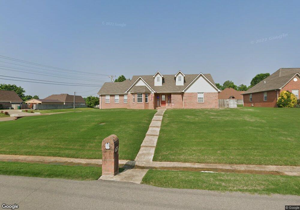
This home is located at 290 Beverly Dr, Atoka, TN 38004 and is currently estimated at $359,781, approximately $160 per square foot. 290 Beverly Dr is a home located in Tipton County with nearby schools including Atoka Elementary School, Brighton Middle School, and Brighton High School.
Ownership History
Date
Name
Owned For
Owner Type
Purchase Details
Closed on
Mar 31, 2009
Sold by
Tuck Bruce
Bought by
Tuck Rebecca
Current Estimated Value
Purchase Details
Closed on
Oct 27, 2005
Sold by
Stroud Willie B
Bought by
Bruce Tuck
Home Financials for this Owner
Home Financials are based on the most recent Mortgage that was taken out on this home.
Original Mortgage
$173,500
Interest Rate
7.05%
Purchase Details
Closed on
Dec 9, 2003
Sold by
Creative Development
Bought by
Stroud Willie B
Home Financials for this Owner
Home Financials are based on the most recent Mortgage that was taken out on this home.
Original Mortgage
$123,200
Interest Rate
3.13%
Purchase Details
Closed on
May 28, 2003
Bought by
Creative Development Inc
Purchase Details
Closed on
Oct 4, 1990
Bought by
Munford Development Co
Create a Home Valuation Report for This Property
The Home Valuation Report is an in-depth analysis detailing your home's value as well as a comparison with similar homes in the area
Purchase History
| Date | Buyer | Sale Price | Title Company |
|---|---|---|---|
| Tuck Rebecca | -- | -- | |
| Bruce Tuck | $173,500 | -- | |
| Stroud Willie B | $154,000 | -- | |
| Creative Development Inc | $54,000 | -- | |
| Munford Development Co | -- | -- |
Source: Public Records
Mortgage History
| Date | Status | Borrower | Loan Amount |
|---|---|---|---|
| Previous Owner | Munford Development Co | $173,500 | |
| Previous Owner | Munford Development Co | $123,200 |
Source: Public Records
Tax History
| Year | Tax Paid | Tax Assessment Tax Assessment Total Assessment is a certain percentage of the fair market value that is determined by local assessors to be the total taxable value of land and additions on the property. | Land | Improvement |
|---|---|---|---|---|
| 2025 | -- | $78,500 | $8,675 | $69,825 |
| 2024 | -- | $78,500 | $8,675 | $69,825 |
| 2023 | $1,771 | $78,500 | $8,675 | $69,825 |
| 2022 | $1,685 | $54,900 | $6,375 | $48,525 |
| 2021 | $1,658 | $54,900 | $6,375 | $48,525 |
| 2020 | $1,657 | $54,900 | $6,375 | $48,525 |
| 2019 | $1,688 | $47,025 | $6,375 | $40,650 |
| 2018 | $1,688 | $47,025 | $6,375 | $40,650 |
| 2017 | $1,514 | $47,025 | $6,375 | $40,650 |
| 2016 | $1,514 | $47,025 | $6,375 | $40,650 |
| 2015 | $1,513 | $47,025 | $6,375 | $40,650 |
| 2014 | $1,397 | $47,019 | $0 | $0 |
Source: Public Records
Map
Nearby Homes
- 1180 Williamsburg Dr
- 371 Beverly Dr
- 538 Rosemark Rd
- 189 Cotton Fall Dr
- 93 Sterling Farm Dr
- 128 Loch Haven Cove S
- 142 Clementine Dr
- 168 Clementine Rd
- 104 Lochmeade Dr
- 47 Clementine Rd
- 177 Como Ln
- 142 Como Ln
- 170 Como Ln
- 125 Columbia Way
- 19 Columbia Way
- 0 Smith Dr Unit 10202728
- 196 Como Ln
- 79 Columbia Way
- 159 Como Ln
- 61 Como Ln
- 310 Beverly Dr
- 167 Dogwood Trace
- 187 Dogwood Trace
- 256 Beverly Dr
- 281 Beverly Dr
- 320 Beverly Dr
- 301 Beverly Dr
- 261 Beverly Dr
- 133 Dogwood Trace
- 205 Dogwood Trace
- 319 Beverly Dr
- 243 Beverly Dr
- 234 Beverly Dr
- 338 Beverly Dr
- 101 Dogwood Trace
- 337 Beverly Dr
- 231 Dogwood Trace
- 188 Dogwood Trace
- 431 Rosemark Rd
- 411 Rosemark Rd
Your Personal Tour Guide
Ask me questions while you tour the home.