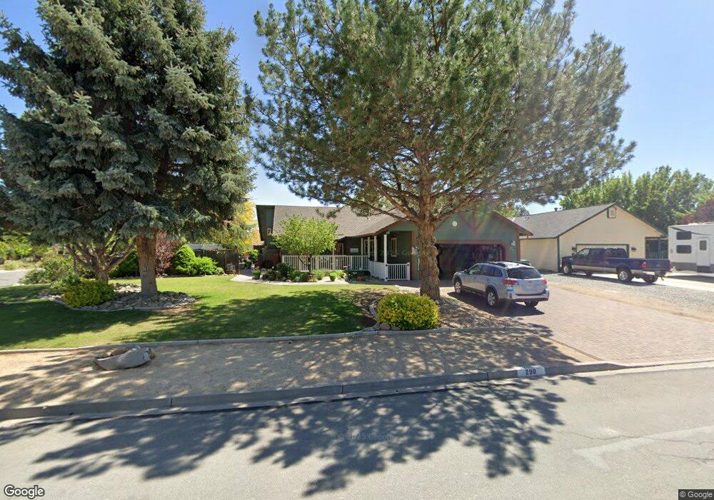
290 Date Palm Dr Sparks, NV 89441
Eagle Canyon-Pebble Creek NeighborhoodEstimated Value: $462,000 - $537,000
3
Beds
2
Baths
1,492
Sq Ft
$345/Sq Ft
Est. Value
About This Home
This home is located at 290 Date Palm Dr, Sparks, NV 89441 and is currently estimated at $514,463, approximately $344 per square foot. 290 Date Palm Dr is a home located in Washoe County with nearby schools including Alyce Savage Taylor Elementary School, Yvonne Shaw Middle School, and Spanish Springs High School.
Ownership History
Date
Name
Owned For
Owner Type
Purchase Details
Closed on
Apr 1, 2014
Sold by
Morris Michael J
Bought by
Morris Family Trust
Current Estimated Value
Purchase Details
Closed on
Mar 29, 2004
Sold by
Quarantiello Michael W and Quarantiello Linda K
Bought by
Morris Michael J
Home Financials for this Owner
Home Financials are based on the most recent Mortgage that was taken out on this home.
Original Mortgage
$199,000
Interest Rate
5.57%
Mortgage Type
Unknown
Purchase Details
Closed on
Nov 26, 2001
Sold by
Quarantiello Michael W and Quarantiello Linda K
Bought by
Quarantiello Michael W and Quarantiello Linda K
Home Financials for this Owner
Home Financials are based on the most recent Mortgage that was taken out on this home.
Original Mortgage
$101,300
Interest Rate
6.63%
Create a Home Valuation Report for This Property
The Home Valuation Report is an in-depth analysis detailing your home's value as well as a comparison with similar homes in the area
Home Values in the Area
Average Home Value in this Area
Purchase History
| Date | Buyer | Sale Price | Title Company |
|---|---|---|---|
| Morris Family Trust | -- | None Available | |
| Morris Michael J | $229,000 | First Centennial Title Co | |
| Quarantiello Michael W | -- | Founders Title Co |
Source: Public Records
Mortgage History
| Date | Status | Borrower | Loan Amount |
|---|---|---|---|
| Closed | Morris Michael J | $199,000 | |
| Previous Owner | Quarantiello Michael W | $101,300 |
Source: Public Records
Tax History
| Year | Tax Paid | Tax Assessment Tax Assessment Total Assessment is a certain percentage of the fair market value that is determined by local assessors to be the total taxable value of land and additions on the property. | Land | Improvement |
|---|---|---|---|---|
| 2026 | $1,562 | $88,395 | $40,495 | $47,900 |
| 2025 | $2,032 | $88,445 | $39,270 | $49,175 |
| 2024 | $2,032 | $86,610 | $36,610 | $50,000 |
| 2023 | $1,974 | $84,473 | $37,065 | $47,408 |
| 2022 | $1,917 | $72,063 | $32,340 | $39,723 |
| 2021 | $1,863 | $63,172 | $23,380 | $39,792 |
| 2020 | $1,764 | $61,609 | $23,135 | $38,474 |
| 2019 | $1,713 | $59,557 | $22,050 | $37,507 |
| 2018 | $1,666 | $52,670 | $15,750 | $36,920 |
| 2017 | $1,619 | $51,822 | $14,630 | $37,192 |
| 2016 | $1,574 | $51,602 | $13,615 | $37,987 |
| 2015 | $1,575 | $49,398 | $11,165 | $38,233 |
| 2014 | $1,529 | $47,442 | $10,395 | $37,047 |
| 2013 | -- | $44,010 | $6,230 | $37,780 |
Source: Public Records
Map
Nearby Homes
- 282 Arlis Place
- 284 Arlis Place
- 807 Lexington Arch Dr
- 718 Treasure City Dr
- 480 Aswan St
- 1981 Lanstar Dr
- 60 Rosetta Stone Ct
- 110 Josefina Ct Unit 1
- 250 Carlene Dr
- 65 Sheena Ct
- 260 Veronica Ave Unit 3
- 435 Kathy Terrace
- 85 E Sky Ranch Blvd
- 1055 Spoonbill Dr
- 952 Red Falcon Way
- 1038 Garden Pond Way
- 1030 Garden Pond Way
- 30 N Patterson Place
- 391 Taryn Dr
- 1302 Skyfire Ct
- 300 Date Palm Dr
- 10525 Palm Desert Dr
- 270 Date Palm Dr
- 310 Hyacinth St
- 10530 Palm Desert Dr
- 340 Hyacinth St
- 225 Regier Springs Dr
- 10560 Palm Desert Dr
- 235 Regier Springs Dr
- 215 Regier Springs Dr
- 335 Hyacinth St
- 345 Hyacinth St
- 320 Hyacinth St
- 10565 Palm Desert Dr
- 260 Date Palm Dr
- 205 Regier Springs Dr
- 360 Hyacinth St
- 255 Date Palm Dr
- 245 Regier Springs Dr
- 250 Date Palm Dr
Your Personal Tour Guide
Ask me questions while you tour the home.