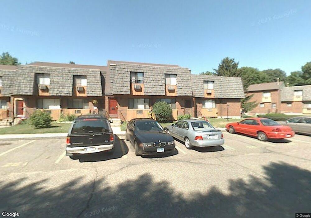
290 High Path Rd Windsor, CT 06095
West Windsor NeighborhoodEstimated Value: $169,000 - $192,000
2
Beds
3
Baths
1,020
Sq Ft
$173/Sq Ft
Est. Value
About This Home
This home is located at 290 High Path Rd, Windsor, CT 06095 and is currently estimated at $176,118, approximately $172 per square foot. 290 High Path Rd is a home located in Hartford County with nearby schools including Oliver Ellsworth School, John F. Kennedy School, and Sage Park Middle School.
Ownership History
Date
Name
Owned For
Owner Type
Purchase Details
Closed on
Aug 28, 2000
Sold by
Rivera Ernesto
Bought by
Thompson Camille
Current Estimated Value
Home Financials for this Owner
Home Financials are based on the most recent Mortgage that was taken out on this home.
Original Mortgage
$54,000
Outstanding Balance
$18,548
Interest Rate
8.06%
Mortgage Type
Purchase Money Mortgage
Estimated Equity
$157,570
Purchase Details
Closed on
Sep 29, 1994
Sold by
Swider John and Swider Lynn
Bought by
Williams Michael and Williams Lynette
Home Financials for this Owner
Home Financials are based on the most recent Mortgage that was taken out on this home.
Original Mortgage
$74,700
Interest Rate
8.5%
Mortgage Type
Purchase Money Mortgage
Create a Home Valuation Report for This Property
The Home Valuation Report is an in-depth analysis detailing your home's value as well as a comparison with similar homes in the area
Home Values in the Area
Average Home Value in this Area
Purchase History
| Date | Buyer | Sale Price | Title Company |
|---|---|---|---|
| Thompson Camille | $61,000 | -- | |
| Williams Michael | $76,500 | -- |
Source: Public Records
Mortgage History
| Date | Status | Borrower | Loan Amount |
|---|---|---|---|
| Open | Williams Michael | $54,000 | |
| Previous Owner | Williams Michael | $36,000 | |
| Previous Owner | Williams Michael | $74,700 |
Source: Public Records
Tax History
| Year | Tax Paid | Tax Assessment Tax Assessment Total Assessment is a certain percentage of the fair market value that is determined by local assessors to be the total taxable value of land and additions on the property. | Land | Improvement |
|---|---|---|---|---|
| 2025 | $2,553 | $89,740 | $0 | $89,740 |
| 2024 | $2,721 | $89,740 | $0 | $89,740 |
| 2023 | $1,957 | $58,240 | $0 | $58,240 |
| 2022 | $1,938 | $58,240 | $0 | $58,240 |
| 2021 | $1,938 | $58,240 | $0 | $58,240 |
| 2020 | $1,928 | $58,240 | $0 | $58,240 |
| 2019 | $1,886 | $58,240 | $0 | $58,240 |
| 2018 | $1,253 | $38,010 | $0 | $38,010 |
| 2017 | $1,227 | $37,800 | $0 | $37,800 |
| 2016 | $1,191 | $37,800 | $0 | $37,800 |
| 2015 | $1,169 | $37,800 | $0 | $37,800 |
| 2014 | $1,152 | $37,800 | $0 | $37,800 |
Source: Public Records
Map
Nearby Homes
- 268 High Path Rd Unit 268
- 943 High Path Rd Unit 943
- 136 High Path Rd
- 98 High Path Rd
- 118 High Path Rd Unit 118
- 58 High Path Rd Unit 58
- 22 Apple Tree Ln
- 9 Milo Peck Ln
- 22 Eastview Dr
- 16 Cornfield Rd
- 216 Hayden Station Rd
- 211 MacKtown Rd
- 1 Deanne Lynn Cir
- 490 Old Day Hill Rd
- 957 Palisado Ave
- 24 Mary Catherine Cir
- 94 Raymond Rd
- 19 Tiffany Dr
- 1333 Palisado Ave
- 109 Old Village Cir
- 292 High Path Rd
- 294 High Path Rd
- 294 High Path Rd Unit 294
- 294 High Path Rd Unit 294
- 288 High Path Rd
- 296 High Path Rd
- 298 High Path Rd
- 298 High Path Rd Unit 298
- 286 High Path Rd
- 302 High Path Rd
- 264 High Path Rd
- 264 High Path Rd Unit 264
- 262 High Path Rd
- 262 High Path Rd Unit 262
- 304 High Path Rd
- 268 High Path Rd
- 260 High Path Rd
- 260 High Path Rd Unit 260
- 306 High Path Rd
- 308 High Path Rd
Your Personal Tour Guide
Ask me questions while you tour the home.