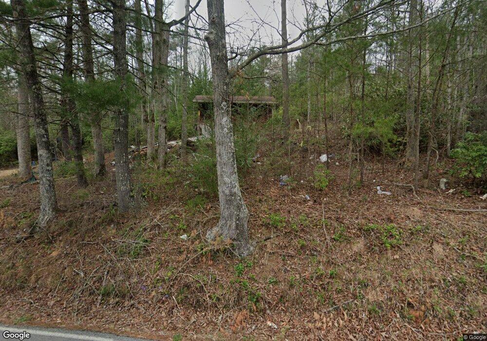
290 Pond Ridge Rd Tellico Plains, TN 37385
Estimated Value: $73,347 - $351,000
--
Bed
--
Bath
784
Sq Ft
$235/Sq Ft
Est. Value
About This Home
This home is located at 290 Pond Ridge Rd, Tellico Plains, TN 37385 and is currently estimated at $184,337, approximately $235 per square foot. 290 Pond Ridge Rd is a home with nearby schools including Coker Creek Elementary School and Tellico Plains High School.
Ownership History
Date
Name
Owned For
Owner Type
Purchase Details
Closed on
Sep 12, 2025
Sold by
Reed David C
Bought by
Havely Stephen B and Havely Tara G
Current Estimated Value
Home Financials for this Owner
Home Financials are based on the most recent Mortgage that was taken out on this home.
Original Mortgage
$131,250
Outstanding Balance
$131,250
Interest Rate
6.72%
Mortgage Type
New Conventional
Estimated Equity
$53,087
Purchase Details
Closed on
Aug 25, 2014
Sold by
Carper Laura Reed
Bought by
Reed David
Purchase Details
Closed on
Aug 21, 1998
Bought by
Carper Laura Reed
Create a Home Valuation Report for This Property
The Home Valuation Report is an in-depth analysis detailing your home's value as well as a comparison with similar homes in the area
Home Values in the Area
Average Home Value in this Area
Purchase History
| Date | Buyer | Sale Price | Title Company |
|---|---|---|---|
| Havely Stephen B | $175,000 | Skyway Title | |
| Reed David | $6,000 | -- | |
| Carper Laura Reed | $5,000 | -- |
Source: Public Records
Mortgage History
| Date | Status | Borrower | Loan Amount |
|---|---|---|---|
| Open | Havely Stephen B | $131,250 |
Source: Public Records
Tax History Compared to Growth
Tax History
| Year | Tax Paid | Tax Assessment Tax Assessment Total Assessment is a certain percentage of the fair market value that is determined by local assessors to be the total taxable value of land and additions on the property. | Land | Improvement |
|---|---|---|---|---|
| 2024 | $145 | $9,525 | $7,050 | $2,475 |
| 2023 | $145 | $9,525 | $7,050 | $2,475 |
| 2022 | $181 | $8,075 | $5,650 | $2,425 |
| 2021 | $217 | $9,675 | $5,650 | $4,025 |
| 2020 | $217 | $9,675 | $5,650 | $4,025 |
| 2019 | $192 | $9,675 | $5,650 | $4,025 |
| 2018 | $192 | $9,675 | $5,650 | $4,025 |
| 2017 | $196 | $9,375 | $5,650 | $3,725 |
| 2016 | $146 | $6,975 | $5,650 | $1,325 |
| 2015 | $146 | $6,975 | $5,650 | $1,325 |
| 2014 | $146 | $6,981 | $0 | $0 |
Source: Public Records
Map
Nearby Homes
- 00 Highway 68
- 163 Sourwood Lake Rd
- 208 Old Furnace Rd
- 323 McJunkin Rd
- 153 McJunkin Rd
- 500 Old Furnace Rd
- 630 Old Furnace Rd
- 688 Old Furnace Rd
- 0 Smithfield Rd Unit 1316596
- 0 Smithfield Rd Unit 1316589
- 205 Holder Cemetery Rd
- 486 Steer Creek Rd
- 480 Holder Cemetery Rd
- 514 Steer Creek Rd
- 450 Holder Cemetery Rd
- 550 Steer Creek Rd
- 102 Cherokee Path
- 0 Holder Cemetery Unit 1520296
- 101 Cherokee Path
- 206 Hot Water Rd
- 291 Pond Ridge Rd Unit 2098-L
- 291 Pond Ridge Rd
- 00 Pond Ridge Rd
- 4.82 ac Pond Ridge Rd
- 10 Ac Pond Ridge Rd
- 4.82 Pond Ridge Rd
- 5.36 Acres Pond Ridge Rd
- 256 Pond Ridge Rd
- 244 Pond Ridge Rd
- 240 Pond Ridge Rd
- 395 Pond Ridge Rd
- 4.82 Pond Ridge
- 400 Pond Ridge Rd
- 8 Ac Pond Ridge Rd
- 679 Pond Ridge Rd
- 420 Pond Ridge Rd
- 593 Pond Ridge Rd
- 581 Pond Ridge Rd
- 673 Pond Ridge Rd
- 167 Pond Ridge Rd
