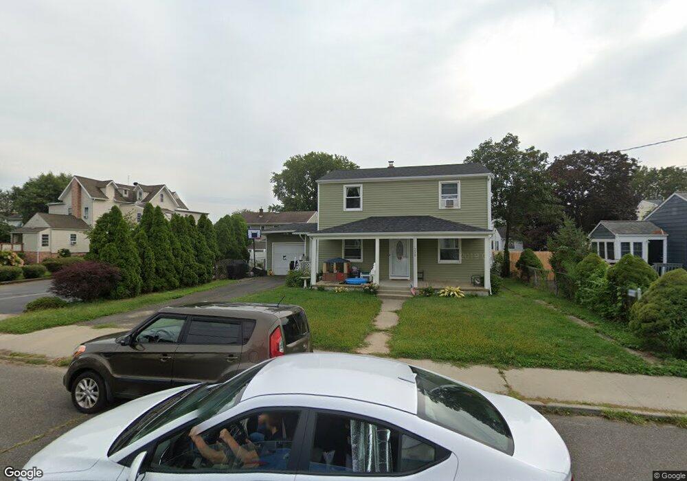
290 Poole Ave Long Branch, NJ 07740
Estimated Value: $564,000 - $745,000
5
Beds
2
Baths
1,836
Sq Ft
$344/Sq Ft
Est. Value
About This Home
This home is located at 290 Poole Ave, Long Branch, NJ 07740 and is currently estimated at $631,474, approximately $343 per square foot. 290 Poole Ave is a home located in Monmouth County with nearby schools including Long Branch High School, Holy Trinity School, and Bet Yaakov of the Jersey Shore.
Ownership History
Date
Name
Owned For
Owner Type
Purchase Details
Closed on
Aug 29, 2013
Sold by
Baxter Gregory S
Bought by
Morrell Andrew and Morrell Anthony
Current Estimated Value
Create a Home Valuation Report for This Property
The Home Valuation Report is an in-depth analysis detailing your home's value as well as a comparison with similar homes in the area
Home Values in the Area
Average Home Value in this Area
Purchase History
| Date | Buyer | Sale Price | Title Company |
|---|---|---|---|
| Morrell Andrew | -- | None Available |
Source: Public Records
Tax History Compared to Growth
Tax History
| Year | Tax Paid | Tax Assessment Tax Assessment Total Assessment is a certain percentage of the fair market value that is determined by local assessors to be the total taxable value of land and additions on the property. | Land | Improvement |
|---|---|---|---|---|
| 2025 | $8,331 | $586,400 | $256,600 | $329,800 |
| 2024 | $7,419 | $542,000 | $226,600 | $315,400 |
| 2023 | $7,419 | $477,700 | $176,600 | $301,100 |
| 2022 | $6,943 | $384,200 | $118,900 | $265,300 |
| 2021 | $6,813 | $347,000 | $98,900 | $248,100 |
| 2020 | $6,991 | $334,500 | $87,900 | $246,600 |
| 2019 | $6,813 | $324,100 | $88,900 | $235,200 |
| 2018 | $7,908 | $374,100 | $88,900 | $285,200 |
| 2017 | $7,599 | $368,700 | $88,900 | $279,800 |
| 2016 | $7,405 | $366,400 | $93,900 | $272,500 |
| 2015 | $5,447 | $244,600 | $79,700 | $164,900 |
| 2014 | $5,253 | $248,600 | $89,100 | $159,500 |
Source: Public Records
Map
Nearby Homes
- 298 Poole Ave
- 277 Poole Ave
- 303 Westwood Ave
- 215 Cleveland Ave
- 364 Westwood Ave Unit 39
- 364 Westwood Ave Unit 71
- 364 Westwood Ave Unit 21
- 377 Westwood Ave
- 237 3rd Ave Unit 1-4
- 399 Willow Ave
- 434 Westwood Ave
- 170 Franklin Ave
- 168 Franklin Ave
- 153 Vanderbilt Ave
- 430 Broadway
- 158 Franklin Ave
- 152 Franklin Ave
- 150 Franklin Ave Unit 5
- 23 Woolley Ave
- 12 Seashore Dr
- 294 Poole Ave
- 281 Cleveland Ave
- 279A Cleveland Ave
- 285 Cleveland Ave
- 289 Cleveland Ave
- 279 Xcleveland A E
- 279 Cleveland Ave
- 287 Poole Ave
- 283 Poole Ave
- 291 Poole Ave
- 300 Poole Ave
- 279 Poole Ave
- 292 Poole Ave
- 277 Cleveland Ave
- 293 Cleveland Ave
- 293 Poole Ave
- 268 Poole Ave
- 297 Poole Ave
- 304 Poole Ave
- 304 Poole Ave Unit 2