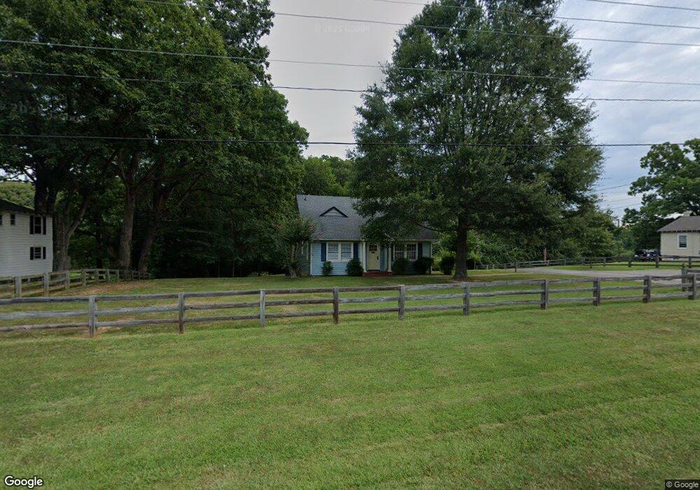
290 River Rd W Manakin Sabot, VA 23103
Manakin-Sabot NeighborhoodEstimated Value: $324,622
--
Bed
1
Bath
2,142
Sq Ft
$152/Sq Ft
Est. Value
About This Home
This home is located at 290 River Rd W, Manakin Sabot, VA 23103 and is currently estimated at $324,622, approximately $151 per square foot. 290 River Rd W is a home located in Goochland County with nearby schools including Goochland Middle School, Goochland High School, and Hunter Classical Christian School.
Ownership History
Date
Name
Owned For
Owner Type
Purchase Details
Closed on
Feb 24, 2023
Sold by
Sabot Partners
Bought by
Sabot Office Works Llc
Current Estimated Value
Home Financials for this Owner
Home Financials are based on the most recent Mortgage that was taken out on this home.
Original Mortgage
$190,000
Outstanding Balance
$182,721
Interest Rate
5%
Mortgage Type
New Conventional
Estimated Equity
$141,901
Create a Home Valuation Report for This Property
The Home Valuation Report is an in-depth analysis detailing your home's value as well as a comparison with similar homes in the area
Home Values in the Area
Average Home Value in this Area
Purchase History
| Date | Buyer | Sale Price | Title Company |
|---|---|---|---|
| Sabot Office Works Llc | $290,000 | -- |
Source: Public Records
Mortgage History
| Date | Status | Borrower | Loan Amount |
|---|---|---|---|
| Open | Sabot Office Works Llc | $190,000 |
Source: Public Records
Tax History Compared to Growth
Tax History
| Year | Tax Paid | Tax Assessment Tax Assessment Total Assessment is a certain percentage of the fair market value that is determined by local assessors to be the total taxable value of land and additions on the property. | Land | Improvement |
|---|---|---|---|---|
| 2025 | $1,922 | $362,700 | $142,100 | $220,600 |
| 2024 | $1,740 | $328,300 | $137,900 | $190,400 |
| 2023 | $1,685 | $317,900 | $135,300 | $182,600 |
| 2022 | $1,562 | $294,700 | $131,300 | $163,400 |
| 2021 | $1,467 | $276,700 | $119,300 | $157,400 |
| 2020 | $1,403 | $267,800 | $116,300 | $151,500 |
| 2019 | $1,403 | $264,800 | $110,700 | $154,100 |
| 2018 | $1,381 | $256,600 | $107,500 | $149,100 |
| 2017 | $1,381 | $260,500 | $107,500 | $153,000 |
| 2016 | $690 | $260,500 | $107,500 | $153,000 |
| 2015 | $1,368 | $258,100 | $106,500 | $151,600 |
| 2014 | -- | $250,100 | $106,500 | $143,600 |
Source: Public Records
Map
Nearby Homes
- 109 Willway Dr
- 602 Red Maple Dr
- 320 Willway Dr
- 610 Canoe Run Place
- 513 Hickory Dr
- 406 Powhatan Hill Place
- 547 River Rd W
- 714 Big Woods Place
- 306 Victoria Way
- 9270 Cerulean Place
- 321 First Flite Ln
- Meadow Plan at Mosaic at West Creek
- Elm Plan at Mosaic at West Creek
- Indigo Plan at Mosaic at West Creek
- Cove Plan at Mosaic at West Creek
- 9334 Citrine Run
- 9454 Tesserae Way
- 9008 Mirage Mews Unit 7-6
- 0000 Hockett Rd
- 1475 Huguenot Trail
- 294 River Road West
- 300 River Rd W
- 300 River Road West
- 304 River Road West
- 314 River Rd W
- 285 River Rd W
- 307 River Road West
- 260 River Road West
- 318 River Rd W
- 334 River Rd W
- 313 River Rd W
- 320 River Road West
- 320 River Rd W
- 521 Lois Ln
- 343 River Rd W
- 527 Lois Ln
- 342 River Rd W
- 112 Hickory Dr
- 110 Hickory Dr
- 200 Hickory Dr