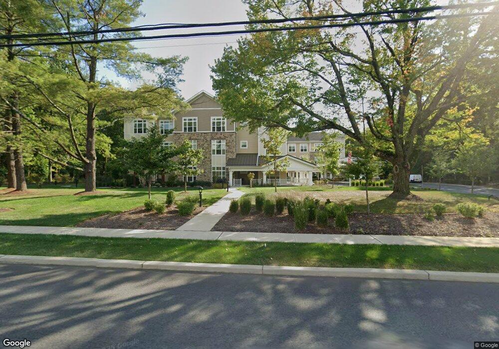
290 S Orange Ave Livingston, NJ 07039
Estimated Value: $5,581,806
--
Bed
--
Bath
1,889
Sq Ft
$2,955/Sq Ft
Est. Value
About This Home
This home is located at 290 S Orange Ave, Livingston, NJ 07039 and is currently priced at $5,581,806, approximately $2,954 per square foot. 290 S Orange Ave is a home located in Essex County with nearby schools including Livingston Sr High School, Joseph Kushner Hebrew Academy, and Sinai Schools Maor.
Ownership History
Date
Name
Owned For
Owner Type
Purchase Details
Closed on
Dec 16, 2019
Sold by
Remspens Llc
Bought by
Sunrise Of Livingston Propco Llc
Current Estimated Value
Purchase Details
Closed on
Jan 4, 2016
Sold by
Remspens Llc
Bought by
Sunrise Development Inc
Purchase Details
Closed on
May 6, 2015
Sold by
Heller Cary B
Bought by
Remspens Llc
Purchase Details
Closed on
Dec 18, 2012
Sold by
Cruse Arlene
Bought by
Heller Cary B
Home Financials for this Owner
Home Financials are based on the most recent Mortgage that was taken out on this home.
Original Mortgage
$417,000
Interest Rate
3.35%
Mortgage Type
New Conventional
Create a Home Valuation Report for This Property
The Home Valuation Report is an in-depth analysis detailing your home's value as well as a comparison with similar homes in the area
Home Values in the Area
Average Home Value in this Area
Purchase History
| Date | Buyer | Sale Price | Title Company |
|---|---|---|---|
| Sunrise Of Livingston Propco Llc | $4,000,000 | First American Title Ins Co | |
| Sunrise Development Inc | -- | None Available | |
| Remspens Llc | $417,000 | None Listed On Document | |
| Heller Cary B | $750,000 | None Available |
Source: Public Records
Mortgage History
| Date | Status | Borrower | Loan Amount |
|---|---|---|---|
| Previous Owner | Heller Cary B | $417,000 |
Source: Public Records
Tax History Compared to Growth
Tax History
| Year | Tax Paid | Tax Assessment Tax Assessment Total Assessment is a certain percentage of the fair market value that is determined by local assessors to be the total taxable value of land and additions on the property. | Land | Improvement |
|---|---|---|---|---|
| 2025 | $616,056 | $25,972,000 | $6,990,000 | $18,982,000 |
| 2024 | $616,056 | $25,972,000 | $6,990,000 | $18,982,000 |
| 2022 | $163,310 | $7,000,000 | $6,990,000 | $10,000 |
| 2021 | $161,980 | $7,000,000 | $6,990,000 | $10,000 |
| 2020 | $158,970 | $7,000,000 | $6,990,000 | $10,000 |
| 2019 | $14,145 | $540,700 | $365,000 | $175,700 |
| 2018 | $13,955 | $540,700 | $365,000 | $175,700 |
| 2017 | $13,772 | $540,700 | $365,000 | $175,700 |
| 2016 | $13,518 | $540,700 | $365,000 | $175,700 |
| 2015 | $13,317 | $540,700 | $365,000 | $175,700 |
| 2014 | $12,885 | $540,700 | $365,000 | $175,700 |
Source: Public Records
Map
Nearby Homes
- 305 Binghampton Ln
- 301 Edmonton Ct Unit 6301
- 36 Cortland Ct
- 7 Coventry Rd
- 11 Ambrosia Ct
- 15 East Dr
- 15 North Dr
- 6 Arrow Dr
- 40 Byron Place
- 20 Crescent Rd
- 16 Crossbrook Place
- 95 W Northfield Rd
- 14 Burnet Hill Rd
- 24 E Harrison Place
- 5 Foxcroft Dr
- 7 Concord Dr
- 1 Relkin Rd
- 25 Midway Dr
- 4 Trevino Ct Unit 30D
- 60 Baker Rd
- 0 Cr 510 & Cr 520
- 287 S Orange Ave
- 283 S Orange Ave
- 279 S Orange Ave
- 37 Passaic Ave
- 26 Camelot Dr Unit 26
- 33 Passaic Ave
- 29 Passaic Ave
- 31 Passaic Ave
- 41 Passaic Ave
- 273 S Orange Ave
- 2 Goodhart Dr
- 8 Winston Dr
- 10 Winston Dr
- 24 Passaic Ave
- 6 Winston Dr
- 267 S Orange Ave
- 28 Passaic Ave
- 4 Winston Dr
- 30 Passaic Ave