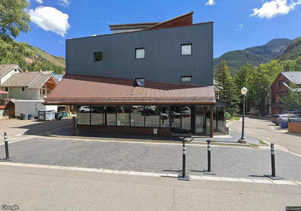
290 S Townsend St Telluride, CO 81435
Estimated Value: $8,439,288
--
Bed
--
Bath
1,936
Sq Ft
$4,359/Sq Ft
Est. Value
About This Home
This home is located at 290 S Townsend St, Telluride, CO 81435 and is currently estimated at $8,439,288, approximately $4,359 per square foot. 290 S Townsend St is a home located in San Miguel County with nearby schools including Telluride Intermediate School, Telluride Middle School, and Telluride High School.
Ownership History
Date
Name
Owned For
Owner Type
Purchase Details
Closed on
Dec 27, 2021
Sold by
Herrick Edward D
Bought by
Edward D Herrick Jr 2016 Lifetime Trust
Current Estimated Value
Purchase Details
Closed on
Jul 1, 2021
Sold by
Herrick Jan A
Bought by
Business In The Front Llc
Purchase Details
Closed on
Jul 1, 2020
Sold by
Asyouwish Llc
Bought by
Herrick Jan
Home Financials for this Owner
Home Financials are based on the most recent Mortgage that was taken out on this home.
Original Mortgage
$200,000
Interest Rate
3.1%
Mortgage Type
Future Advance Clause Open End Mortgage
Purchase Details
Closed on
Feb 26, 2019
Sold by
Plunge Landing Llc
Bought by
Asyouwish Llc
Home Financials for this Owner
Home Financials are based on the most recent Mortgage that was taken out on this home.
Original Mortgage
$4,200,000
Interest Rate
4.4%
Mortgage Type
Unknown
Create a Home Valuation Report for This Property
The Home Valuation Report is an in-depth analysis detailing your home's value as well as a comparison with similar homes in the area
Home Values in the Area
Average Home Value in this Area
Purchase History
| Date | Buyer | Sale Price | Title Company |
|---|---|---|---|
| Edward D Herrick Jr 2016 Lifetime Trust | -- | None Available | |
| Business In The Front Llc | -- | None Available | |
| Herrick Jan | -- | None Available | |
| Asyouwish Llc | $5,700,000 | Land Title Guarantee Co |
Source: Public Records
Mortgage History
| Date | Status | Borrower | Loan Amount |
|---|---|---|---|
| Previous Owner | Herrick Jan | $200,000 | |
| Previous Owner | Asyouwish Llc | $4,200,000 |
Source: Public Records
Tax History Compared to Growth
Tax History
| Year | Tax Paid | Tax Assessment Tax Assessment Total Assessment is a certain percentage of the fair market value that is determined by local assessors to be the total taxable value of land and additions on the property. | Land | Improvement |
|---|---|---|---|---|
| 2024 | $19,893 | $392,150 | $0 | $392,150 |
| 2023 | $18,638 | $392,150 | $0 | $392,150 |
| 2022 | $16,560 | $357,180 | $0 | $357,180 |
| 2021 | $18,918 | $427,660 | $0 | $427,660 |
| 2020 | $10,494 | $237,590 | $0 | $237,590 |
| 2019 | $10,388 | $237,590 | $0 | $237,590 |
| 2018 | $5,830 | $135,770 | $0 | $0 |
| 2017 | $4,882 | $135,770 | $0 | $135,770 |
| 2016 | $4,870 | $132,970 | $0 | $132,970 |
| 2015 | $4,763 | $132,970 | $0 | $132,970 |
| 2014 | $4,822 | $0 | $0 | $0 |
Source: Public Records
Map
Nearby Homes
- 515 W Depot Ave Unit A
- 515 W Depot Ave Unit B
- 475 W Depot Ave
- 368 S Davis St Unit A7
- 542 B W Pacific Ave Unit B
- 122 S Townsend St Unit 3
- 546 W Pacific Ave
- 398 S Davis St Unit SW201
- 398 S Davis St Unit C302
- 398 S Davis St Unit SW302
- 548 W Pacific Ave Unit B
- 413 W Depot Ave
- 431 W Pacific Ave Unit D
- 333 S Davis St Unit 315 & 317
- 567 W Pacific Ave Unit B
- 260 S Aspen St Unit 3
- 651 W Pacific Ave Unit 315B
- 445 W Colorado Ave
- 394 W Colorado Ave Unit D
- 438 W Columbia Ave
- 290 S Townsend St Unit 1,2,3
- 485 Depot Ave
- Lot 1 Depot Alley Unit 1
- 475 Depot Ave
- 300 S Townsend St Unit 1,2,3
- 271 S Townsend St Unit A4
- 271 S Townsend St Unit A5
- 465 Depot Ave
- 480 Depot Ave
- A1 W Depot Ave Unit A1
- 515 W Depot Ave
- 474 W Depot Ave
- 455 W Depot Ave
- 401 W Depot Ave Unit 8E
- 409 W Depot Ave Unit 8C
- 406 W Depot Ave Unit 3
- 0 W Depot Ave Unit 5 29950
- 419 W Depot Ave Unit 5
- 0 W Depot Ave Unit 8C
- 464 W Pacific Ave