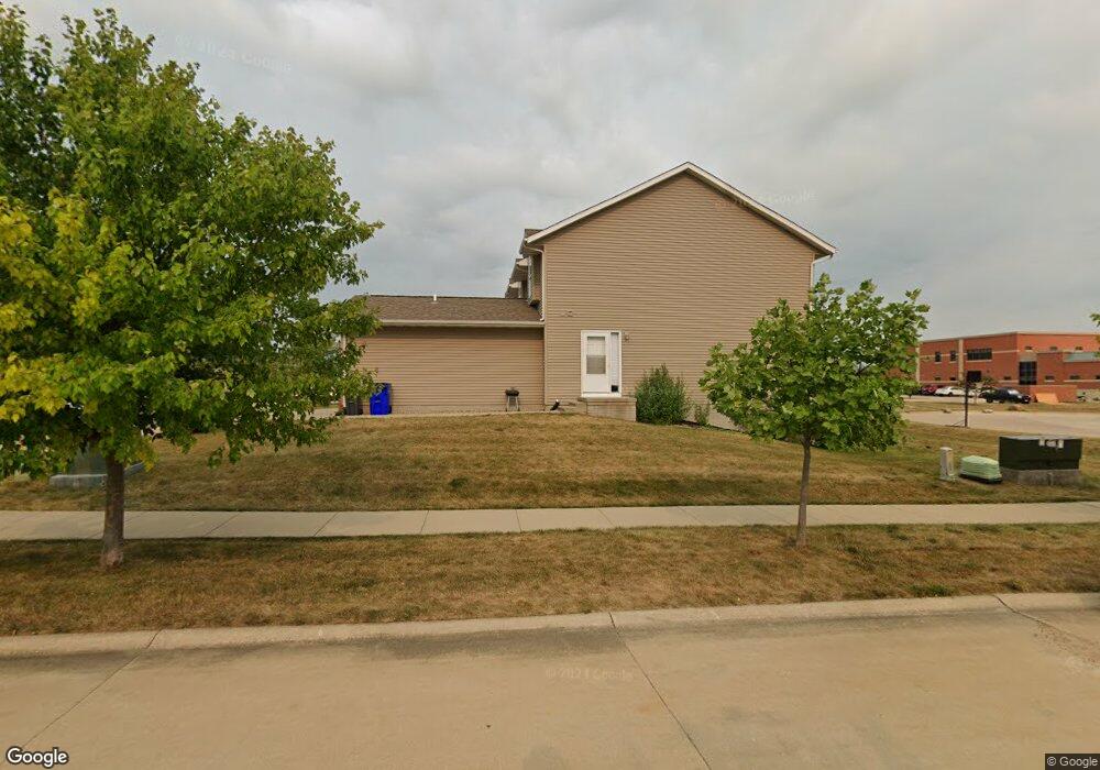
2900 Samuel Ct SW Cedar Rapids, IA 52404
Estimated Value: $156,000 - $176,000
2
Beds
1
Bath
1,048
Sq Ft
$155/Sq Ft
Est. Value
About This Home
This home is located at 2900 Samuel Ct SW, Cedar Rapids, IA 52404 and is currently estimated at $162,766, approximately $155 per square foot. 2900 Samuel Ct SW is a home located in Linn County with nearby schools including Prairie Crest Elementary School, Prairie View Elementary School, and Prairie Ridge Elementary School.
Ownership History
Date
Name
Owned For
Owner Type
Purchase Details
Closed on
Aug 31, 2020
Sold by
Carmichael Kelly Anne and Theusch Kelly Anne
Bought by
Williams Spencer J
Current Estimated Value
Purchase Details
Closed on
Jul 28, 2015
Sold by
Henderson Adam and Henderson Gwen R
Bought by
Theusch Kelly Anne
Home Financials for this Owner
Home Financials are based on the most recent Mortgage that was taken out on this home.
Original Mortgage
$99,655
Interest Rate
4.01%
Mortgage Type
Farmers Home Administration
Purchase Details
Closed on
May 28, 2009
Sold by
Morris Wood Enterprises Llc
Bought by
Lange Gwen R
Home Financials for this Owner
Home Financials are based on the most recent Mortgage that was taken out on this home.
Original Mortgage
$100,859
Interest Rate
4.85%
Mortgage Type
FHA
Create a Home Valuation Report for This Property
The Home Valuation Report is an in-depth analysis detailing your home's value as well as a comparison with similar homes in the area
Home Values in the Area
Average Home Value in this Area
Purchase History
| Date | Buyer | Sale Price | Title Company |
|---|---|---|---|
| Williams Spencer J | $125,000 | None Available | |
| Theusch Kelly Anne | $105,000 | Security First Title Co | |
| Lange Gwen R | $102,000 | None Available |
Source: Public Records
Mortgage History
| Date | Status | Borrower | Loan Amount |
|---|---|---|---|
| Previous Owner | Theusch Kelly Anne | $99,655 | |
| Previous Owner | Lange Gwen R | $100,859 | |
| Closed | Williams Spencer J | $0 |
Source: Public Records
Tax History Compared to Growth
Tax History
| Year | Tax Paid | Tax Assessment Tax Assessment Total Assessment is a certain percentage of the fair market value that is determined by local assessors to be the total taxable value of land and additions on the property. | Land | Improvement |
|---|---|---|---|---|
| 2025 | $2,602 | $153,000 | $23,000 | $130,000 |
| 2024 | $2,860 | $148,500 | $23,000 | $125,500 |
| 2023 | $2,860 | $137,300 | $23,000 | $114,300 |
| 2022 | $2,712 | $129,100 | $21,000 | $108,100 |
| 2021 | $2,408 | $124,800 | $17,000 | $107,800 |
| 2020 | $2,408 | $114,400 | $17,000 | $97,400 |
| 2019 | $2,238 | $108,300 | $17,000 | $91,300 |
| 2018 | $2,054 | $108,300 | $17,000 | $91,300 |
| 2017 | $2,122 | $102,800 | $12,000 | $90,800 |
| 2016 | $2,159 | $99,800 | $12,000 | $87,800 |
| 2015 | $2,107 | $97,891 | $12,000 | $85,891 |
| 2014 | $1,920 | $109,139 | $12,000 | $97,139 |
| 2013 | $2,232 | $109,139 | $12,000 | $97,139 |
Source: Public Records
Map
Nearby Homes
- 0 Williams Blvd Sw 6 47 Ac Unit 202506004
- 3045 Samuel Ct SW Unit C
- 3045 Samuel Ct SW
- 2908 Riviera St SW Unit C
- 3107 Riviera Ct SW Unit B
- 3011 Sequoia Dr SW
- 3112 Sequoia Dr SW
- 3024 Teton St SW
- 3026 Teton St SW
- 3032 Teton St SW
- 3110 Teton St SW
- 3421 Banar Dr SW Unit B
- 4310 Banar Ave SW
- 3620 Banar Dr SW Unit E
- 3720 Bluebird Dr SW
- 3606 Bluebird Dr SW
- 3715 33rd Ave Sw #5 8 Ac
- 3715 33rd Ave Sw #4 8 Ac
- 3711 Bluebird Dr SW
- 2335 Wiley Blvd SW
- 2910 Samuel Ct SW
- 2910 Samuel Ct SW
- 2910 Samuel Ct SW
- 2910 Samuel Ct SW
- 2900 Samuel Ct SW
- 2900 Samuel Ct SW
- 2900 Samuel Ct SW
- 2900 Samuel Ct SW Unit C
- 2900 Samuel Ct SW Unit B
- 2910 Samuel Ct SW Unit C
- 2910 Samuel Ct SW Unit D
- 2900 Samuel Ct SW Unit A
- 2910 Samuel Ct SW Unit A
- 2910 Samuel Ct SW Unit B
- 2900 Samuel Ct SW Unit A
- 2930 Samuel Ct SW
- 2930 Samuel Ct SW
- 2930 Samuel Ct SW
- 2930 Samuel Ct SW
- 2930 Samuel Ct SW Unit C