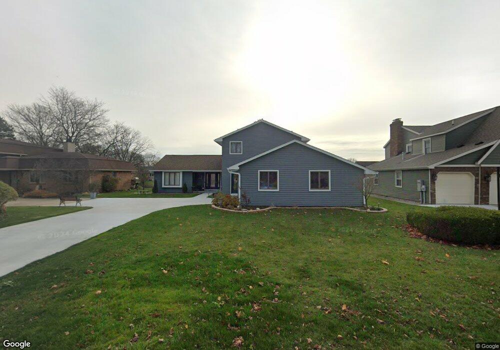
2900 Woodstock Cir Port Huron, MI 48060
Estimated Value: $517,000 - $574,000
4
Beds
3
Baths
2,806
Sq Ft
$194/Sq Ft
Est. Value
About This Home
This home is located at 2900 Woodstock Cir, Port Huron, MI 48060 and is currently estimated at $544,607, approximately $194 per square foot. 2900 Woodstock Cir is a home located in St. Clair County with nearby schools including H.D. Crull Elementary School, Holland Woods Middle School, and Port Huron Northern High School.
Ownership History
Date
Name
Owned For
Owner Type
Purchase Details
Closed on
Jun 30, 2021
Sold by
Kolcz Trista and Hill Trista
Bought by
2012 Cindy Marie Benedict Revocable Tr
Current Estimated Value
Create a Home Valuation Report for This Property
The Home Valuation Report is an in-depth analysis detailing your home's value as well as a comparison with similar homes in the area
Home Values in the Area
Average Home Value in this Area
Purchase History
| Date | Buyer | Sale Price | Title Company |
|---|---|---|---|
| 2012 Cindy Marie Benedict Revocable Tr | $450,000 | Ata National Title |
Source: Public Records
Tax History Compared to Growth
Tax History
| Year | Tax Paid | Tax Assessment Tax Assessment Total Assessment is a certain percentage of the fair market value that is determined by local assessors to be the total taxable value of land and additions on the property. | Land | Improvement |
|---|---|---|---|---|
| 2025 | $12,700 | $231,900 | $0 | $0 |
| 2024 | $11,736 | $222,500 | $0 | $0 |
| 2023 | $11,114 | $227,000 | $0 | $0 |
| 2022 | $11,763 | $186,900 | $0 | $0 |
| 2021 | $5,394 | $136,000 | $0 | $0 |
| 2020 | $5,455 | $135,200 | $135,200 | $0 |
| 2019 | $5,357 | $142,000 | $0 | $0 |
| 2018 | $5,237 | $142,000 | $0 | $0 |
| 2017 | $4,671 | $129,600 | $0 | $0 |
| 2016 | $4,039 | $129,600 | $0 | $0 |
| 2015 | $3,963 | $118,600 | $118,600 | $0 |
| 2014 | $3,963 | $112,600 | $112,600 | $0 |
| 2013 | -- | $108,800 | $0 | $0 |
Source: Public Records
Map
Nearby Homes
- 2806 Woodstock Dr
- 2549 Riverwood Dr
- 2838 Elmwood St
- 2610 Strawberry Ln
- 2857 Riverside Dr
- 2215 Hancock St
- 2475 Sharon Ln
- 2812 19th Ave
- 3196 Oakwood Dr
- 0000 Water St
- 3228 Turnberry
- V/L #4 Water St
- V/L #6 Water St
- V/L #5 Water St
- V/L #8 Water St
- V/L #3 Water St
- 3335 W Water St
- 1907 Riverside Dr
- 1819 Riverside Dr
- 3409 Ancient Dr
- 2900 Woodstock Cir
- 2838 Woodstock Cir
- 2908 Woodstock Cir
- 2901 Woodstock Cir Unit Bldg-Unit
- 2901 Woodstock Cir
- 2909 Woodstock Cir
- 2841 Woodstock Dr
- 2917 Woodstock Cir
- 2835 Woodstock Dr
- 2924 Woodstock Cir
- 2613 Riverwood Dr
- 2857 Canal Dr
- 2911 Canal Dr
- 2932 Woodstock Cir
- 2925 Woodstock Cir
- 2903 Canal Dr
- 2555 Riverwood Dr
- 2919 Canal Dr
- 2841 Canal Dr
- 2720 Woodstock Dr