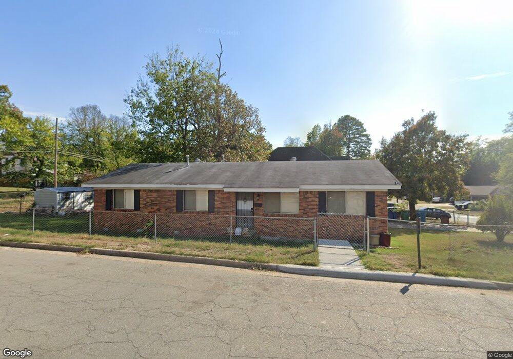
2901 S Battery St Little Rock, AR 72206
South End NeighborhoodEstimated Value: $47,000 - $93,000
--
Bed
3
Baths
1,350
Sq Ft
$56/Sq Ft
Est. Value
About This Home
This home is located at 2901 S Battery St, Little Rock, AR 72206 and is currently estimated at $75,916, approximately $56 per square foot. 2901 S Battery St is a home located in Pulaski County with nearby schools including Washington Magnet Elementary School, Dunbar Magnet Middle School, and Little Rock Southwest High School.
Ownership History
Date
Name
Owned For
Owner Type
Purchase Details
Closed on
Apr 4, 2018
Sold by
Mcclendon Dorothy
Bought by
Williams Margoret and Flemings Georse
Current Estimated Value
Purchase Details
Closed on
Nov 15, 2000
Sold by
Morgan Will
Bought by
Mcclendon Dorothy M
Home Financials for this Owner
Home Financials are based on the most recent Mortgage that was taken out on this home.
Original Mortgage
$35,166
Interest Rate
7.84%
Mortgage Type
FHA
Create a Home Valuation Report for This Property
The Home Valuation Report is an in-depth analysis detailing your home's value as well as a comparison with similar homes in the area
Home Values in the Area
Average Home Value in this Area
Purchase History
| Date | Buyer | Sale Price | Title Company |
|---|---|---|---|
| Williams Margoret | $22,108 | None Available | |
| Mcclendon Dorothy M | $35,000 | Stewart Title |
Source: Public Records
Mortgage History
| Date | Status | Borrower | Loan Amount |
|---|---|---|---|
| Previous Owner | Mcclendon Dorothy M | $35,166 | |
| Closed | Mcclendon Dorothy M | $3,000 |
Source: Public Records
Tax History Compared to Growth
Tax History
| Year | Tax Paid | Tax Assessment Tax Assessment Total Assessment is a certain percentage of the fair market value that is determined by local assessors to be the total taxable value of land and additions on the property. | Land | Improvement |
|---|---|---|---|---|
| 2025 | $767 | $12,671 | $1,000 | $11,671 |
| 2024 | $708 | $12,671 | $1,000 | $11,671 |
| 2023 | $708 | $12,671 | $1,000 | $11,671 |
| 2022 | $649 | $12,671 | $1,000 | $11,671 |
| 2021 | $594 | $8,430 | $600 | $7,830 |
| 2020 | $590 | $8,430 | $600 | $7,830 |
| 2019 | $590 | $8,430 | $600 | $7,830 |
| 2018 | $156 | $8,430 | $600 | $7,830 |
| 2017 | $156 | $8,430 | $600 | $7,830 |
| 2016 | $156 | $12,090 | $1,150 | $10,940 |
| 2015 | $507 | $7,230 | $1,150 | $6,080 |
| 2014 | $507 | $7,230 | $1,150 | $6,080 |
Source: Public Records
Map
Nearby Homes
- 3101 S Battery St
- 2719 S Battery St
- 2600 Wolfe St
- 2600 S Battery St
- 2700 Doctor Martin Luther King Junior Dr
- 3214 Bishop St
- 2417 Wolfe St
- 1513 W 33rd St
- 2913 S Cross St
- 2405 S Battery St
- 1623 W 24th St
- 3109 S Ringo St
- 2320 S Pulaski St
- 2811 S Chester St
- 2415 S Chester St
- 1118 W 35th St
- 1515 W 22nd St
- 3010 S Izard St
- 0 W 36th St
- 1524 W 22nd St
- 2905 S Battery St
- 2823 S Battery St
- 2909 S Battery St
- 2819 S Battery St
- 2900 Wolfe St
- 2824 Wolfe St
- 2908 Wolfe St
- 1901 W 29th St
- 2904 S Battery St
- 2917 S Battery St
- 2815 S Battery St
- 2908 S Battery St
- 2816 Wolfe St
- 2914 Wolfe St
- 2918 S Battery St
- 2811 S Battery St
- 2812 Wolfe St
- 2916 Wolfe St
- 2923 S Battery St
- 2808 Wolfe St