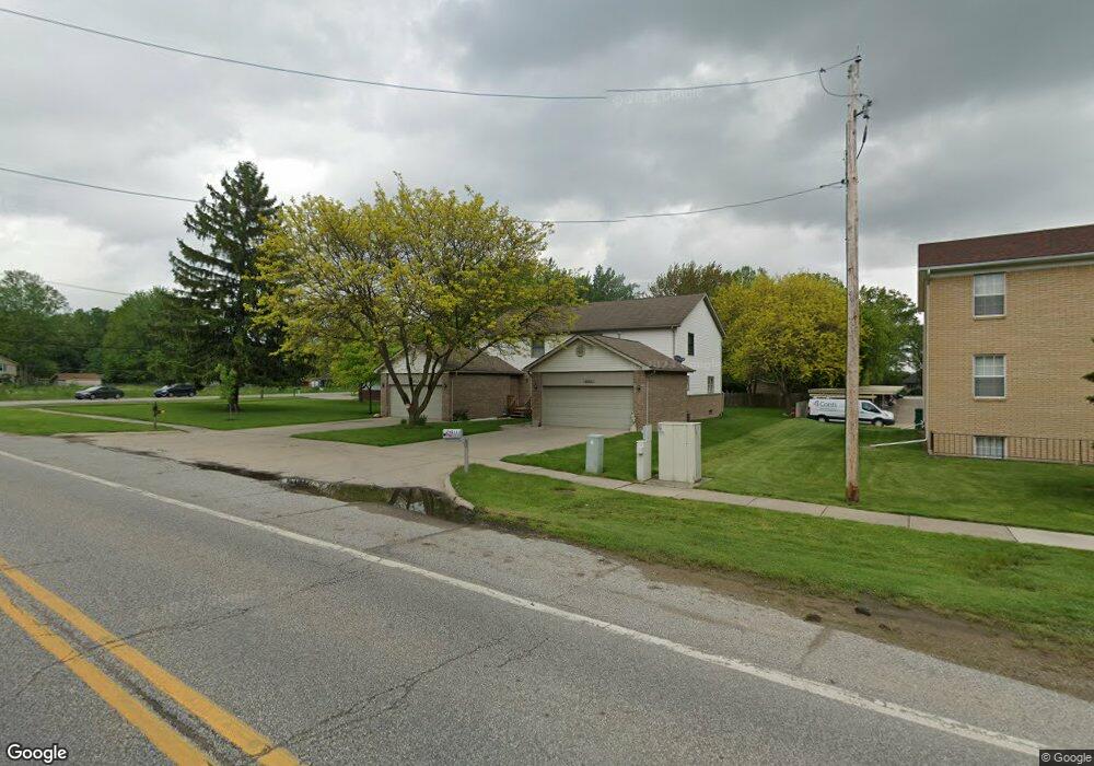
29011 Cotton Rd Unit 1 Chesterfield, MI 48047
Estimated Value: $242,000 - $312,000
3
Beds
3
Baths
1,778
Sq Ft
$159/Sq Ft
Est. Value
About This Home
This home is located at 29011 Cotton Rd Unit 1, Chesterfield, MI 48047 and is currently estimated at $282,433, approximately $158 per square foot. 29011 Cotton Rd Unit 1 is a home located in Macomb County with nearby schools including Dean A. Naldrett School, Anchor Bay Middle School South, and Anchor Bay High School.
Ownership History
Date
Name
Owned For
Owner Type
Purchase Details
Closed on
Jan 31, 2018
Sold by
Patterson Janis and Wills Janis
Bought by
Frank David G and Frank Anne Marie
Current Estimated Value
Home Financials for this Owner
Home Financials are based on the most recent Mortgage that was taken out on this home.
Original Mortgage
$60,000
Outstanding Balance
$50,763
Interest Rate
3.95%
Mortgage Type
New Conventional
Estimated Equity
$231,670
Purchase Details
Closed on
Oct 30, 2012
Sold by
First Choice Investment Group Llc
Bought by
Willis Janis
Purchase Details
Closed on
May 11, 2012
Sold by
The Estate Of Anthony J Matway
Bought by
First Choice Investment Group Llc
Purchase Details
Closed on
Nov 15, 2011
Sold by
Fannie Mae
Bought by
Matway Anthony J
Create a Home Valuation Report for This Property
The Home Valuation Report is an in-depth analysis detailing your home's value as well as a comparison with similar homes in the area
Home Values in the Area
Average Home Value in this Area
Purchase History
| Date | Buyer | Sale Price | Title Company |
|---|---|---|---|
| Frank David G | $157,000 | Partners Title Agency Llc | |
| Willis Janis | $85,000 | Visionary Title Agency Llc | |
| First Choice Investment Group Llc | $50,000 | Fidelity Natl Title Ins Co | |
| Matway Anthony J | $52,500 | None Available |
Source: Public Records
Mortgage History
| Date | Status | Borrower | Loan Amount |
|---|---|---|---|
| Open | Frank David G | $60,000 |
Source: Public Records
Tax History Compared to Growth
Tax History
| Year | Tax Paid | Tax Assessment Tax Assessment Total Assessment is a certain percentage of the fair market value that is determined by local assessors to be the total taxable value of land and additions on the property. | Land | Improvement |
|---|---|---|---|---|
| 2025 | $3,586 | $107,000 | $0 | $0 |
| 2024 | $1,916 | $104,900 | $0 | $0 |
| 2023 | $1,816 | $91,700 | $0 | $0 |
| 2022 | $3,011 | $82,100 | $0 | $0 |
| 2021 | $2,983 | $78,400 | $0 | $0 |
| 2020 | $1,671 | $77,400 | $0 | $0 |
| 2019 | $2,734 | $76,600 | $0 | $0 |
| 2018 | $1,942 | $72,100 | $5,000 | $67,100 |
| 2017 | $1,797 | $63,200 | $3,500 | $59,700 |
| 2016 | $1,794 | $63,200 | $0 | $0 |
| 2015 | $834 | $54,850 | $0 | $0 |
| 2014 | $834 | $48,800 | $3,500 | $45,300 |
| 2012 | -- | $0 | $0 | $0 |
Source: Public Records
Map
Nearby Homes
- 47460 Sugarbush Rd
- 29126 Brooke Meadows Ct
- 29371 Bayside Cir N
- 29213 Rachid Ln
- 28490 Cotton Rd Unit 3
- 47812 Forbes Dr
- 47685 Jefferson Ave
- 47031 Jefferson Ave
- 29705 Alexandra Ln Unit 13
- 28715 Portsmouth Ct Unit 32
- 29401 Wand Dr
- 28734 Yarmouth Ct Unit 18
- 48345 Whittington Dr
- 00000 21 Mile Rd
- 47935 Remington Ct
- 000 Farwell St
- 29050 Farwell St
- 48832 Birmingham Dr
- 48713 Chelmsford Ct Unit 127
- 46835 Putnam Ct
- 29011 Cotton Rd Unit 1, 1
- 29011 Cotton Rd Unit 1
- 29011 Cotton Rd
- 29015 Cotton Rd
- 0 Cotton Rd Unit 28155249
- 0 Cotton Rd Unit 28155244
- 0 Cotton Rd Unit 29142345
- 0 Cotton Rd Unit 211031130
- 0 Cotton Rd Unit 211031132
- 0 Cotton Rd Unit 212036891
- 0 Cotton Rd Unit 213070924
- 0 Cotton Rd Unit 31346527
- 0 Cotton Rd Unit 4345604
- 0 Cotton Rd Unit 4345605
- 0 Cotton Rd Unit 4972012
- 0 Cotton Rd Unit 4445180
- 0 Cotton Rd Unit 4924251
- 0 Cotton Rd Unit 4529135
- 0 Cotton Rd Unit 912395
- 0 Cotton Rd Unit 912844