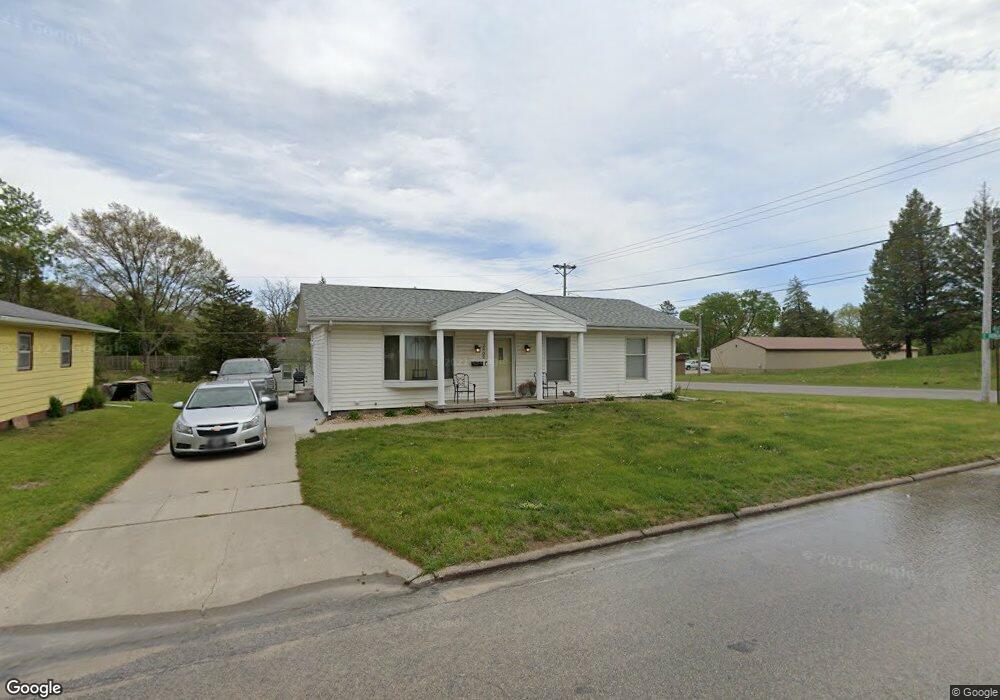
2902 Niles St Waterloo, IA 50703
Good Shepherd NeighborhoodEstimated Value: $127,203 - $140,000
About This Home
This home is located at 2902 Niles St, Waterloo, IA 50703 and is currently estimated at $133,801, approximately $126 per square foot. 2902 Niles St is a home located in Black Hawk County with nearby schools including Cunningham School, George Washington Carver Academy, and East High School.
Ownership History
We collect this data history from publicly available records. To have your information removed, we recommend requesting removal directly through your county’s website.
Purchase Details
Purchase Details
Home Financials for this Owner
Home Financials are based on the most recent Mortgage that was taken out on this home.Home Values in the Area
Average Home Value in this Area
Purchase History
We collect this data history from publicly available records. To have your information removed, we recommend requesting removal directly through your county’s website.
| Date | Buyer | Sale Price | Title Company |
|---|---|---|---|
| -- | None Available | ||
| $79,500 | None Available |
Mortgage History
We collect this data history from publicly available records. To have your information removed, we recommend requesting removal directly through your county’s website.
| Date | Status | Borrower | Loan Amount |
|---|---|---|---|
| Open | $63,529 |
Tax History
We collect this data history from publicly available records. To have your information removed, we recommend requesting removal directly through your county’s website.
| Year | Tax Paid | Tax Assessment Tax Assessment Total Assessment is a certain percentage of the fair market value that is determined by local assessors to be the total taxable value of land and additions on the property. | Land | Improvement |
|---|---|---|---|---|
| 2025 | $1,674 | $115,030 | $12,880 | $102,150 |
| 2024 | $1,674 | $87,400 | $12,880 | $74,520 |
| 2023 | $1,510 | $87,400 | $12,880 | $74,520 |
| 2022 | $1,470 | $68,770 | $12,880 | $55,890 |
| 2021 | $1,558 | $68,770 | $12,880 | $55,890 |
| 2020 | $1,336 | $68,770 | $12,880 | $55,890 |
| 2019 | $1,336 | $68,770 | $12,880 | $55,890 |
| 2018 | $1,072 | $64,120 | $12,880 | $51,240 |
| 2017 | $764 | $63,770 | $12,880 | $50,890 |
| 2016 | $1,248 | $63,770 | $12,880 | $50,890 |
| 2015 | $1,248 | $63,770 | $12,880 | $50,890 |
| 2014 | $1,274 | $63,770 | $12,880 | $50,890 |
Map
- Lots Lakeside St
- 736 Sherman Ave
- 626 Boston Ave
- 617 Boston Ave
- 2227 E 4th St
- 2207 E 4th St
- 314 Lester St
- 419 Charles St
- 303 E Arlington St
- 1317 Logan Ave
- 1134 N Barclay St
- 516 Cutler St
- 117 Sherman Ave
- 523 Cutler St
- 406 Litchfield Ave
- Lot 13, 14, 15 Gable St
- 230 Gable St
- 415 Cutler St
- 101 Ricker St
- 20+ Acres Corner of Airline and Logan
- 2908 Niles St
- 3002 Niles St
- 3004 Niles St
- 2904 Niles St
- 626 Keystone St
- 2907 Bedard Dr
- 627 Keystone St
- 3006 Niles St
- 833 E Donald St
- 2903 Niles St
- 625 Keystone St
- 3008 Niles St
- 2911 Bedard Dr
- 624 Keystone St
- 626 Lakeside St
- 2901 Niles St
- 843 E Donald St
- Lots Bedard Dr
- 623 Keystone St
- 624 Lakeside St
Ask me questions while you tour the home.