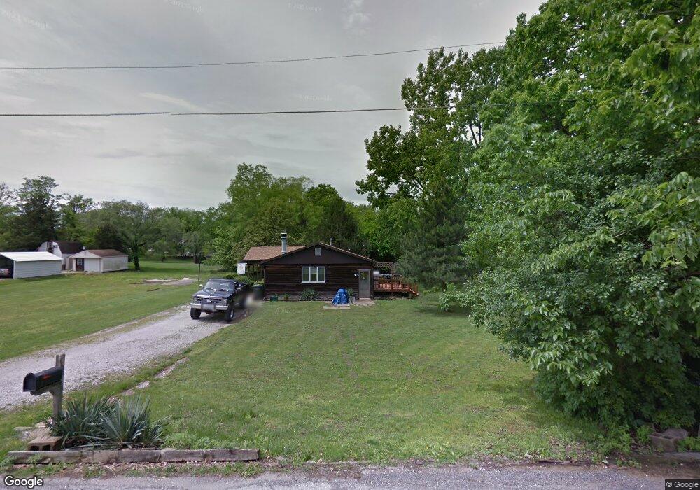
2902 West Ave Keokuk, IA 52632
Estimated Value: $136,000 - $148,520
2
Beds
2
Baths
1,231
Sq Ft
$117/Sq Ft
Est. Value
About This Home
This home is located at 2902 West Ave, Keokuk, IA 52632 and is currently estimated at $143,880, approximately $116 per square foot. 2902 West Ave is a home located in Lee County with nearby schools including Hawthorne Elementary School, George Washington Elementary School, and Keokuk Middle School.
Ownership History
Date
Name
Owned For
Owner Type
Purchase Details
Closed on
Oct 31, 2011
Sold by
Peevler Patricia K
Bought by
Arrowood Anthony G and Arrowood Misty J
Current Estimated Value
Home Financials for this Owner
Home Financials are based on the most recent Mortgage that was taken out on this home.
Original Mortgage
$47,855
Interest Rate
4.09%
Mortgage Type
New Conventional
Create a Home Valuation Report for This Property
The Home Valuation Report is an in-depth analysis detailing your home's value as well as a comparison with similar homes in the area
Home Values in the Area
Average Home Value in this Area
Purchase History
| Date | Buyer | Sale Price | Title Company |
|---|---|---|---|
| Arrowood Anthony G | $70,000 | -- | |
| Arrowood Anthony G | $70,000 | -- | |
| Arrowood Anthony G | $69,875 | None Available |
Source: Public Records
Mortgage History
| Date | Status | Borrower | Loan Amount |
|---|---|---|---|
| Closed | Arrowood Anthony G | $47,855 |
Source: Public Records
Tax History Compared to Growth
Tax History
| Year | Tax Paid | Tax Assessment Tax Assessment Total Assessment is a certain percentage of the fair market value that is determined by local assessors to be the total taxable value of land and additions on the property. | Land | Improvement |
|---|---|---|---|---|
| 2025 | $3,024 | $142,550 | $17,470 | $125,080 |
| 2024 | $3,024 | $127,950 | $17,470 | $110,480 |
| 2023 | $2,626 | $127,950 | $17,470 | $110,480 |
| 2022 | $2,236 | $102,670 | $17,470 | $85,200 |
| 2021 | $2,236 | $102,670 | $17,470 | $85,200 |
| 2020 | $2,308 | $105,310 | $18,520 | $86,790 |
| 2019 | $2,420 | $105,310 | $18,520 | $86,790 |
| 2018 | $2,330 | $99,350 | $0 | $0 |
| 2017 | $2,386 | $99,350 | $0 | $0 |
| 2016 | $2,028 | $89,100 | $0 | $0 |
| 2015 | $2,028 | $89,100 | $0 | $0 |
| 2014 | $2,010 | $89,100 | $0 | $0 |
Source: Public Records
Map
Nearby Homes
- 402 Hawthorne Place
- 503 Hawthorne Place
- 306 Hickory Terrace
- 28 Melody Ct
- 2928 Middle Rd
- 716 Boulevard Rd
- 2nd Main St
- 3252 Brookshire Dr
- 723 Hazelhurst Cir
- 11 Sun Crest Terrace
- 2305 Mckinley Ave
- 1901 Plank Rd
- 3295 Middle Rd
- 1829 Main St
- 16 S 19th St
- 1707 Parkview Heights
- 1922 Exchange St
- 1821 Johnson St
- 3359 Middle Rd
- 1 Navaho Dr
- 2902 West Ave
- 2808 West Ave
- 304 Hawthorne Place
- 2806 West Ave
- 303 Hawthorne Place
- 2935 West Ave
- 2728 West Ave
- 312 Hawthorne Place
- 311 Hawthorne Place
- 2809 Plank Rd
- 2809 Plank Rd
- 318 Hawthorne Place
- 2718 West Ave
- 324 Hawthorne Place
- 323 Hawthorne Place
- 2725 West Ave
- 2721 West Ave
- 2708 West Ave
- 2737 Plank Rd
- 215 Summit Ave