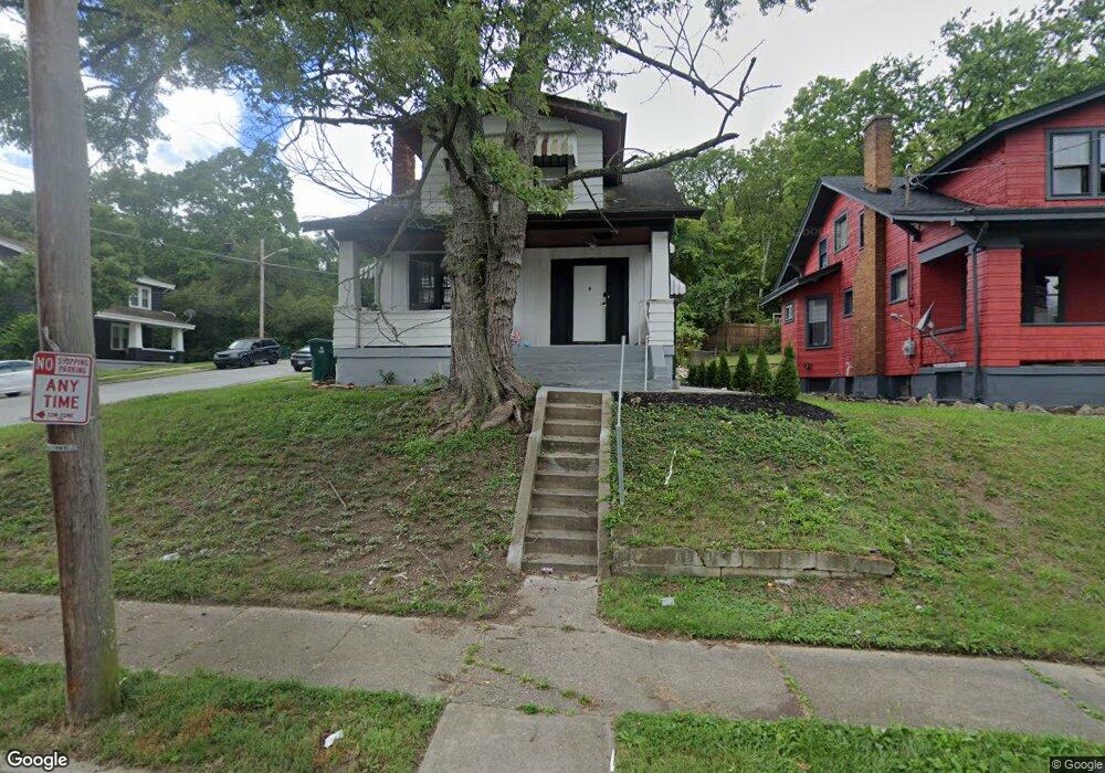
2903 Moosewood Ct Cincinnati, OH 45225
North Fairmount NeighborhoodEstimated Value: $98,645 - $168,000
2
Beds
1
Bath
1,527
Sq Ft
$78/Sq Ft
Est. Value
About This Home
This home is located at 2903 Moosewood Ct, Cincinnati, OH 45225 and is currently estimated at $119,161, approximately $78 per square foot. 2903 Moosewood Ct is a home located in Hamilton County with nearby schools including Oyler School, Robert A. Taft Information Technology High School, and Western Hills High School.
Ownership History
Date
Name
Owned For
Owner Type
Purchase Details
Closed on
Mar 2, 2023
Sold by
Kfj Realty Group Llc
Bought by
Gomez Orlin Josue Ortiz and Serrano Yenny Yaricza
Current Estimated Value
Purchase Details
Closed on
Feb 21, 2023
Sold by
Thabit Shakir
Bought by
Kfj Realty Group Llc
Create a Home Valuation Report for This Property
The Home Valuation Report is an in-depth analysis detailing your home's value as well as a comparison with similar homes in the area
Home Values in the Area
Average Home Value in this Area
Purchase History
| Date | Buyer | Sale Price | Title Company |
|---|---|---|---|
| Gomez Orlin Josue Ortiz | $72,000 | None Listed On Document | |
| Gomez Orlin Josue Ortiz | $72,000 | None Listed On Document | |
| Kfj Realty Group Llc | $42,500 | -- | |
| Kfj Realty Group Llc | $42,500 | None Listed On Document |
Source: Public Records
Tax History
| Year | Tax Paid | Tax Assessment Tax Assessment Total Assessment is a certain percentage of the fair market value that is determined by local assessors to be the total taxable value of land and additions on the property. | Land | Improvement |
|---|---|---|---|---|
| 2025 | $1,600 | $25,200 | $1,757 | $23,443 |
| 2024 | $1,553 | $25,200 | $1,757 | $23,443 |
| 2023 | $1,646 | $25,200 | $1,757 | $23,443 |
| 2022 | $685 | $9,009 | $2,527 | $6,482 |
| 2021 | $658 | $9,009 | $2,527 | $6,482 |
| 2020 | $660 | $9,009 | $2,527 | $6,482 |
| 2019 | $751 | $9,384 | $2,632 | $6,752 |
| 2018 | $751 | $9,384 | $2,632 | $6,752 |
| 2017 | $722 | $9,384 | $2,632 | $6,752 |
| 2016 | $808 | $10,287 | $3,101 | $7,186 |
| 2015 | $725 | $10,287 | $3,101 | $7,186 |
| 2014 | $729 | $10,287 | $3,101 | $7,186 |
| 2013 | $776 | $10,830 | $3,266 | $7,564 |
Source: Public Records
Map
Nearby Homes
- 2911 Moosewood Ct
- 1642 Sutter Ave
- 1646 Pulte St
- 1613 Pulte St
- 1607 Pulte St
- 1674 Baltimore Ave
- 2658 Linden St
- 2656 Linden St
- 2654 Linden St
- 2652 Linden St
- 2650 Linden St
- 1797 Denham St
- 1781 Baltimore Ave
- 2594 Seegar Ave
- 1808 Carll St
- 1793 Baltimore Ave
- 2568 Trevor Place
- 2572 Liddell St
- 2564 Linden St
- 1859 Baltimore Ave
- 2907 Moosewood Ct
- 1640 Sutter Ave
- 1633 Sutter Ave
- 1631 Sutter Ave
- 1630 Sutter Ave
- 1627 Sutter Ave
- 1625 Sutter Ave
- 1703 Sutter Ave
- 1621 Hopple Ct
- 1624 Sutter Ave
- 1621 Sutter Ave
- 1617 Hopple Ct
- 1619 Sutter Ave
- 1640 Pulte St
- 1620 Sutter Ave
- 1638 Pulte St
- 1615 Hopple Ct
- 1700 Pulte St
- 1636 Pulte St
- 1617 Sutter Ave
Your Personal Tour Guide
Ask me questions while you tour the home.