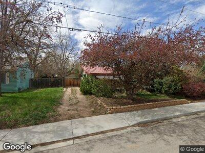
2903 N Overland Trail Laporte, CO 80535
Laporte NeighborhoodEstimated Value: $371,000 - $412,000
2
Beds
1
Bath
720
Sq Ft
$535/Sq Ft
Est. Value
About This Home
This home is located at 2903 N Overland Trail, Laporte, CO 80535 and is currently estimated at $385,220, approximately $535 per square foot. 2903 N Overland Trail is a home located in Larimer County with nearby schools including Cache La Poudre Elementary School, Cache La Poudre Middle School, and Poudre High School.
Ownership History
Date
Name
Owned For
Owner Type
Purchase Details
Closed on
Mar 15, 2005
Sold by
Deutsche Bank National Trust Co
Bought by
Bebow Christine M
Current Estimated Value
Home Financials for this Owner
Home Financials are based on the most recent Mortgage that was taken out on this home.
Original Mortgage
$105,800
Interest Rate
5.67%
Mortgage Type
Fannie Mae Freddie Mac
Purchase Details
Closed on
Nov 12, 2004
Sold by
Dillon Robert M
Bought by
Deutsche Bank National Trust Co
Purchase Details
Closed on
Dec 5, 2000
Sold by
Dillon Michelle P
Bought by
Dillon Robert M
Home Financials for this Owner
Home Financials are based on the most recent Mortgage that was taken out on this home.
Original Mortgage
$90,000
Interest Rate
7.78%
Purchase Details
Closed on
Dec 1, 1975
Bought by
Dillon Robert M
Create a Home Valuation Report for This Property
The Home Valuation Report is an in-depth analysis detailing your home's value as well as a comparison with similar homes in the area
Home Values in the Area
Average Home Value in this Area
Purchase History
| Date | Buyer | Sale Price | Title Company |
|---|---|---|---|
| Bebow Christine M | $135,800 | -- | |
| Deutsche Bank National Trust Co | -- | -- | |
| Dillon Robert M | -- | -- | |
| Dillon Robert M | $23,000 | -- |
Source: Public Records
Mortgage History
| Date | Status | Borrower | Loan Amount |
|---|---|---|---|
| Open | Bebow Christine M | $99,800 | |
| Closed | Bebow Christine M | $105,800 | |
| Previous Owner | Dillon Robert M | $111,200 | |
| Previous Owner | Dillon Robert M | $90,000 | |
| Previous Owner | Dillon Robert M | $15,322 |
Source: Public Records
Tax History Compared to Growth
Tax History
| Year | Tax Paid | Tax Assessment Tax Assessment Total Assessment is a certain percentage of the fair market value that is determined by local assessors to be the total taxable value of land and additions on the property. | Land | Improvement |
|---|---|---|---|---|
| 2025 | $2,042 | $24,690 | $2,345 | $22,345 |
| 2024 | $1,944 | $24,690 | $2,345 | $22,345 |
| 2022 | $1,830 | $19,176 | $2,433 | $16,743 |
| 2021 | $1,846 | $19,727 | $2,503 | $17,224 |
| 2020 | $1,549 | $16,403 | $2,503 | $13,900 |
| 2019 | $1,556 | $16,403 | $2,503 | $13,900 |
| 2018 | $1,192 | $12,960 | $2,520 | $10,440 |
| 2017 | $1,187 | $12,960 | $2,520 | $10,440 |
| 2016 | $1,100 | $11,948 | $2,786 | $9,162 |
| 2015 | $1,092 | $11,950 | $2,790 | $9,160 |
| 2014 | $985 | $10,700 | $2,790 | $7,910 |
Source: Public Records
Map
Nearby Homes
- 3210 W County Road 52 E Unit 3
- 3210 W County Road 52 Unit 2
- 3328 Mcconnell Dr
- 3409 Buckskin Trail
- 4516 Bingham Hill Rd
- 4417 Lawrence Ln
- 2825 Buckboard Ct
- 3005 Swing Station Way
- 4442 Del Colina Way
- 3915 N County Road 19
- 4528 Del Colina Way
- 2720 N County Road 23
- 924 Teal Dr
- 804 Theo Ave
- 2804 N County Road 25 E
- 2921 N Shields St
- 2704 N Shields St Unit 10
- 2704 N Shields St Unit 7
- 4205 W County Road 56e
- 333 N U S Highway 287