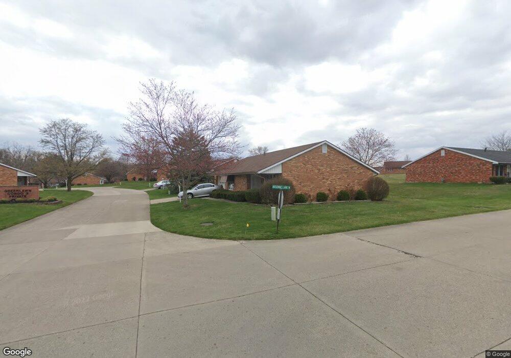
2904 Avery Cir Springfield, OH 45503
Estimated Value: $158,000 - $179,000
2
Beds
2
Baths
1,176
Sq Ft
$143/Sq Ft
Est. Value
About This Home
This home is located at 2904 Avery Cir, Springfield, OH 45503 and is currently estimated at $167,979, approximately $142 per square foot. 2904 Avery Cir is a home located in Clark County with nearby schools including Kenton Elementary School, Roosevelt Middle School, and Springfield High School.
Ownership History
Date
Name
Owned For
Owner Type
Purchase Details
Closed on
Dec 3, 2013
Sold by
Setterfield Patrice L and Severs Pamela L
Bought by
Patton Judy A Oldham
Current Estimated Value
Home Financials for this Owner
Home Financials are based on the most recent Mortgage that was taken out on this home.
Original Mortgage
$74,100
Outstanding Balance
$55,297
Interest Rate
4.17%
Mortgage Type
New Conventional
Estimated Equity
$112,682
Purchase Details
Closed on
Feb 12, 1993
Sold by
Smith Doris D
Bought by
Rizer Mary Jo
Purchase Details
Closed on
Feb 10, 1993
Create a Home Valuation Report for This Property
The Home Valuation Report is an in-depth analysis detailing your home's value as well as a comparison with similar homes in the area
Home Values in the Area
Average Home Value in this Area
Purchase History
| Date | Buyer | Sale Price | Title Company |
|---|---|---|---|
| Patton Judy A Oldham | $78,000 | Team Title & Closing Svcs Ll | |
| Rizer Mary Jo | $69,000 | -- | |
| -- | $69,000 | -- |
Source: Public Records
Mortgage History
| Date | Status | Borrower | Loan Amount |
|---|---|---|---|
| Open | Patton Judy A Oldham | $74,100 |
Source: Public Records
Tax History Compared to Growth
Tax History
| Year | Tax Paid | Tax Assessment Tax Assessment Total Assessment is a certain percentage of the fair market value that is determined by local assessors to be the total taxable value of land and additions on the property. | Land | Improvement |
|---|---|---|---|---|
| 2024 | $1,138 | $32,780 | $5,380 | $27,400 |
| 2023 | $1,138 | $32,780 | $5,380 | $27,400 |
| 2022 | $1,186 | $32,780 | $5,380 | $27,400 |
| 2021 | $1,076 | $28,870 | $4,380 | $24,490 |
| 2020 | $1,078 | $28,870 | $4,380 | $24,490 |
| 2019 | $1,551 | $28,870 | $4,380 | $24,490 |
| 2018 | $1,457 | $26,030 | $3,820 | $22,210 |
| 2017 | $1,456 | $25,421 | $3,815 | $21,606 |
| 2016 | $1,458 | $25,421 | $3,815 | $21,606 |
| 2015 | $1,352 | $25,106 | $3,500 | $21,606 |
| 2014 | $1,346 | $25,106 | $3,500 | $21,606 |
| 2013 | $840 | $25,106 | $3,500 | $21,606 |
Source: Public Records
Map
Nearby Homes
- 732 Grandview Dr Unit 732
- 542 Villa Rd
- 647 Villa Rd Unit A
- 537 Rensselaer St
- 2933 Stonehaven Dr
- 2813 Wellsford Dr
- 2677 Carousel Dr
- 2933 Bahia Dr
- 1225 Vester Ave
- 2540 Rebecca Dr
- 2683 Home Orchard Dr
- 2516 Balsam Dr
- 2524 Home Orchard Dr
- 2642 Kilkenny Ct
- 2408 Balsam Dr
- 385 Secretariat Dr
- 417 Braytonburne Dr
- 3032 Armsgate Rd Unit 25
- 3029 Bradford Dr Unit 46
- 26 Thomaston Trail
- 2908 Avery Cir Unit 2908
- 2900 Avery Cir
- 2901 Avery Cir Unit 2901
- 2905 Avery Cir
- 548 Argonne Ave Unit 548
- 548 Argonne Ave
- 2912 Avery Cir Unit 2912
- 2912 Avery Cir
- 2909 Avery Cir
- 2916 Avery Cir
- 540 Argonne Ave Unit 540
- 550 Argonne Ave
- 545 Argonne Ave Unit 545
- 2913 Avery Cir
- 3021 Argonne Ln N
- 2920 Avery Cir Unit 2920
- 3027 Argonne Ln N Unit 3027
- 538 Argonne Ave
- 536 Argonne Ave
- 534 Argonne Ave