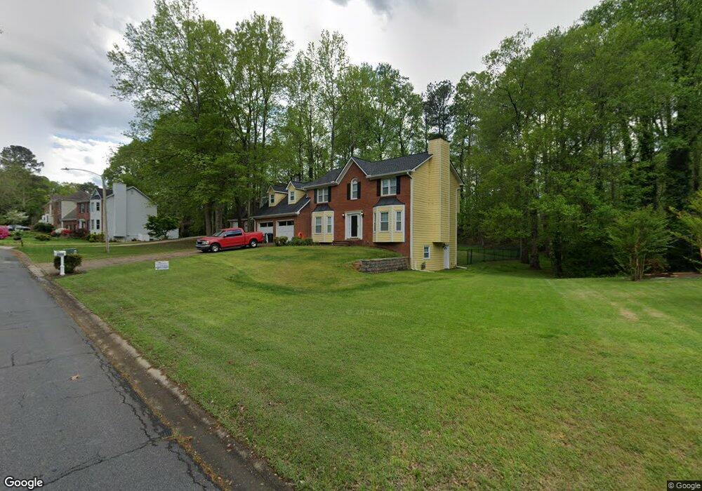
2904 Katy Ln SW Unit II Marietta, GA 30064
West Cobb NeighborhoodEstimated Value: $402,000 - $487,000
4
Beds
3
Baths
2,322
Sq Ft
$194/Sq Ft
Est. Value
About This Home
This home is located at 2904 Katy Ln SW Unit II, Marietta, GA 30064 and is currently estimated at $451,026, approximately $194 per square foot. 2904 Katy Ln SW Unit II is a home located in Cobb County with nearby schools including Dowell Elementary School, Lovinggood Middle School, and Hillgrove High School.
Ownership History
Date
Name
Owned For
Owner Type
Purchase Details
Closed on
Dec 17, 1997
Sold by
Peluso Arnold and Peluso Donna M
Bought by
Sengbusch Wayne P and Sengbusch Amy L
Current Estimated Value
Home Financials for this Owner
Home Financials are based on the most recent Mortgage that was taken out on this home.
Original Mortgage
$143,050
Outstanding Balance
$24,094
Interest Rate
7.18%
Mortgage Type
New Conventional
Estimated Equity
$426,932
Create a Home Valuation Report for This Property
The Home Valuation Report is an in-depth analysis detailing your home's value as well as a comparison with similar homes in the area
Home Values in the Area
Average Home Value in this Area
Purchase History
| Date | Buyer | Sale Price | Title Company |
|---|---|---|---|
| Sengbusch Wayne P | $147,500 | -- |
Source: Public Records
Mortgage History
| Date | Status | Borrower | Loan Amount |
|---|---|---|---|
| Open | Sengbusch Wayne P | $143,050 |
Source: Public Records
Tax History Compared to Growth
Tax History
| Year | Tax Paid | Tax Assessment Tax Assessment Total Assessment is a certain percentage of the fair market value that is determined by local assessors to be the total taxable value of land and additions on the property. | Land | Improvement |
|---|---|---|---|---|
| 2024 | $999 | $188,364 | $36,000 | $152,364 |
| 2023 | $730 | $167,472 | $18,000 | $149,472 |
| 2022 | $877 | $147,788 | $18,000 | $129,788 |
| 2021 | $773 | $112,892 | $18,000 | $94,892 |
| 2020 | $766 | $110,424 | $8,000 | $102,424 |
| 2019 | $728 | $97,924 | $8,000 | $89,924 |
| 2018 | $2,390 | $97,924 | $8,000 | $89,924 |
| 2017 | $1,720 | $71,012 | $8,000 | $63,012 |
| 2016 | $1,722 | $71,012 | $8,000 | $63,012 |
| 2015 | $1,764 | $71,012 | $8,000 | $63,012 |
| 2014 | $1,946 | $78,532 | $0 | $0 |
Source: Public Records
Map
Nearby Homes
- 1209 Wilkes Way SW Unit 1
- 1311 Bustling Ln SW
- 1234 Wynford Colony SW
- 1313 Bustling Ln SW
- 1518 Sage Ridge Dr
- 2418 Southern Oak Dr SW
- 2866 Wynford Dr SW Unit 2
- 1237 Wynford Woods SW
- 2673 Altony Dr SW
- 3006 Coffman Ct SW
- 1214 Bonshaw Trail
- 1004 Villa Rica Rd SW
- 1884 Dovonshire Rd SW
- 2375 Westport Cir SW Unit 2
- 2341 Habersham Dr SW
- 1853 Edington Rd SW
- 2353 Habersham Dr SW
- 3001 Ashland Ct SW
- 1567 Vine Leaf Dr
- 2906 Katy Ln SW
- 0 Brookwest Ln SW Unit 8589739
- 0 Brookwest Ln SW Unit 8093218
- 0 Brookwest Ln SW Unit 7257175
- 0 Brookwest Ln SW Unit 8545959
- 0 Brookwest Ln SW Unit 8405237
- 0 Brookwest Ln SW Unit 3155825
- 0 Brookwest Ln SW Unit 8063860
- 2902 Katy Ln SW
- 2908 Katy Ln SW Unit II
- 0 Katy Ln SW Unit 3277456
- 0 Katy Ln SW Unit 7564426
- 0 Katy Ln SW
- 1470 Benjamin Ct SW Unit 2
- 2903 Katy Ln SW
- 2810 Brookwest Dr SW
- 2810 Brookwest Dr SW Unit 1
- 2808 Brookwest Dr SW
- 2910 Katy Ln SW
- 2905 Katy Ln SW